Satelytics solves the most pressing industrial challenges.
Satelytics is a software company, producing geospatial analytics for early detection, location, and — in many instances — quantification of our customers’ most pressing challenges.
Why? Finding any event in its infancy, locating the source, even the extent of the risks are all critical steps in avoiding or minimizing costly consequences, including loss of product or services. Almost all corrective and remediation costs involve large sums of money and escalate dramatically. Each of our customers is committed to reducing environmental impacts.
Many of your operations are regulated by local, state, or federal agencies — and in today's climate, the court of public opinion. Both can add enormous cost implications to any event.
How our skills, services and software benefit your organization
Early detection and alerts with specifics to location and severity minimizes risk, avoids escalating costs and impacts on the environment, and lessens the toll of public exposure. Satelytics directs you to the source with specificity, saving time, money, and ensuring valuable resources go where they are needed the most.
Solving the World's Most Pressing Industrial Challenges
What We Do
Satelytics is a software company that uses artificial intelligence to keep vigilant watch over your assets, alerting you to conditions outside of your operating integrity window. Pressing industrial challenges could include liquid leaks, land movement, methane emissions and flows, chemical contamination, risk-inducing changes due to wildfires, and many more.
Why We Do It
Finding any event in its infancy, locating the source, and determining the extent of the risk are all critical steps in avoiding or minimizing costly consequences — including loss of product or service affecting your bottom line. Most corrective and remediation costs involve large sums of money that escalate dramatically — especially environmental impacts. Many of your operations are regulated by local, state, or federal agencies — and in todays’ climate, the court of public opinion. All have enormous cost implications to any event.
How Our Services Benefit Your Organization
Early detection and alerts with specifics about location and severity minimizes risk, avoids escalating costs and impacts on the environment, and lessens the toll of public exposure. Satelytics directs you to the source with specificity, saving time and money, then directs valuable resources to where their expertise is critical to resolution.
Need a solution? Let’s talk.
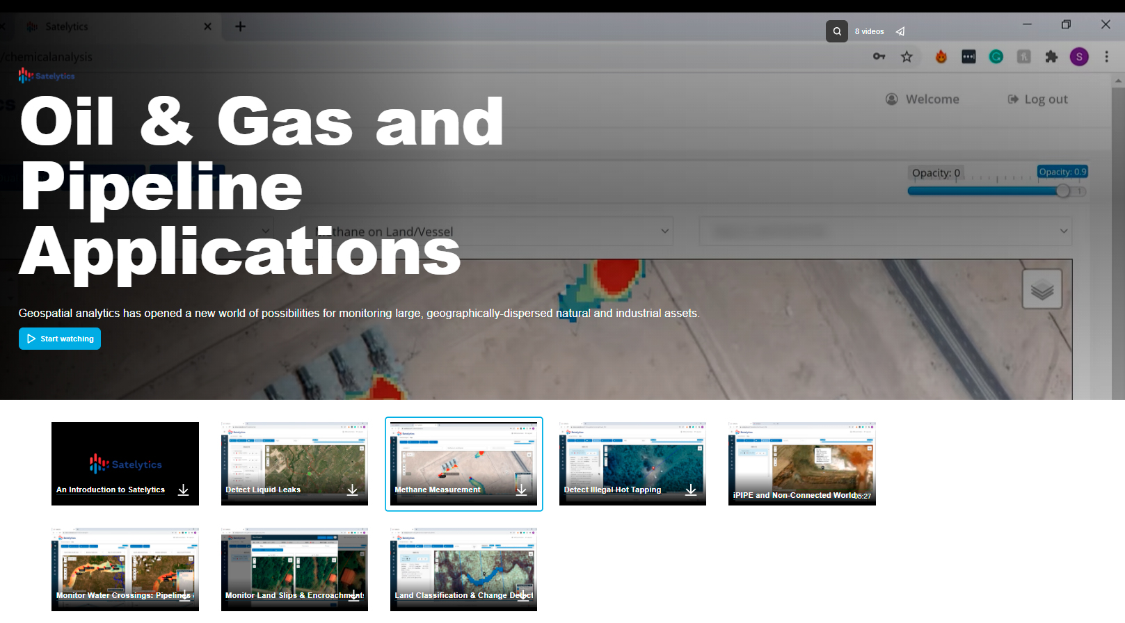
Oil & Gas
Monitor methane emissions, monitor remediation programs for regulatory compliance, and identify contamination risks.
Pipeline
Monitor thousands of miles of right-of-way for signs of trouble. Spot pipeline leaks early, measure land movement, and identify encroachments.
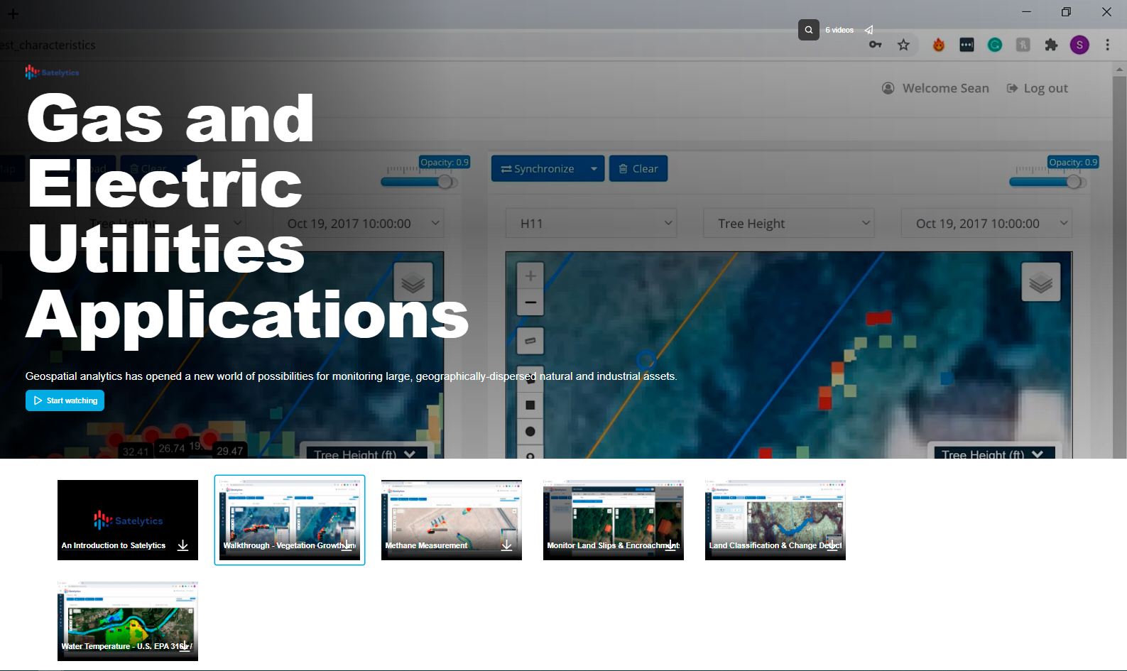
Power Utilities
Monitor thousands of miles of transmission corridor for vegetation management, monitor post-combustion waste sites, and visualize thermal plumes near power stations.
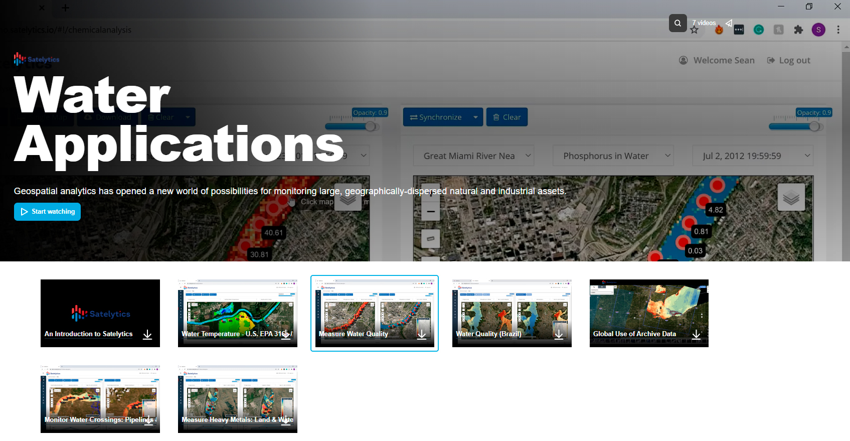
Water & Wastewater
Sample entire bodies of water at once for a variety of chemical and biological species, monitor green infrastructure, and see point sources on land that threaten water resources.
Forestry
Assess tree speciation, tree height, and overall tree health to optimize harvest and afforestation.
Mining
Monitor tailings ponds and piles for acid rock drainage, dam condition, and land movement. Assess seasonal and process-related pond chemistry changes.
Specialty Chemicals
Monitor processes for environmental impacts and measure water chemistry for regulatory compliance.
Interested in what Satelytics has to offer your industry? Check out the corresponding showcases below.
Take a Look at How Satelytics Works.
Our Process
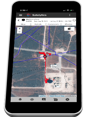
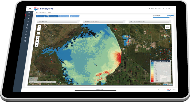
Satelytics is agnostic to the data source and sensor platform used, analyzing petabytes of multispectral and hyperspectral data from a variety of sources, illustrated below, using complex artificial intelligence (AI) algorithms to isolate spectral signatures within the pixels of the imagery. The use of AI means that with more data, our algorithms continue to increase in intelligence and accuracy. Detection algorithms then render this data into interactive displays, alerts, and visualizations for our customers, via our AWS cloud-based platform, satelytics.io. There are no user license fees, data is never deleted, and each customer may utilize satelytics.io on any form factor — desktop, tablet, and smartphone.
Request a Demonstration.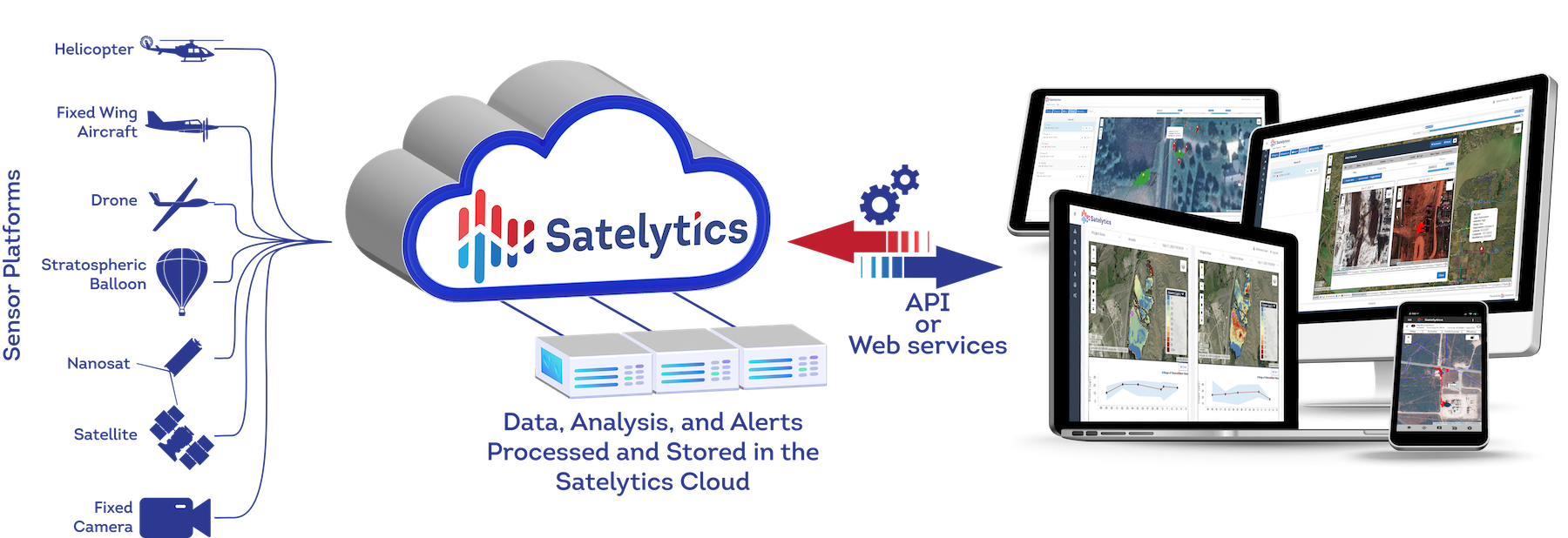
Our Valued Clients.
Don't just take our word for it.
Satelytics stands by our products and services — and our clients do too. See who’s implementing the innovation of Satelytics and what we offer.
See what our Clients are saying
bp
Marathon Pipe Line
Ramboll
Black & Veatch
Southern Company
Alabama Power
American Electric Power
Chevron
ConocoPhilips
Duke Energy
Aquarion
California Resource Corporation
Dynegy
Energy Transfer Partners
Equitrans
ExxonMobil
Georgia Power

Hess
Husky Oil
ACRT Services
Tecna Perú
Nortech
Tecna I.C.E.
Accenture
