• General

• General
How do you focus your essential personnel only to those areas that need their expertise, to resolve and minimize consequences? Look at the Satelytics “How.”
Coronavirus is putting our country in lock down. The vast majority of corporate America is working “virtual.” Who is watching over your infrastructure? Widespread changes across the American landscape has caused severe restrictions on movement, all in the name of keeping our most precious asset, people, safe.
The Satelytics “How”
The results are simple. Adopting this proven technology alleviates the need for your precious assets — personnel — being put in harm's way. Expert first responders are directed to areas which need attention, and ONLY those areas!
This pandemic will change how the American economy functions, not just now, but into the future. Employees are precious assets, there is no need for overexposure when Satelytics can be more precise. Your teams can monitor threats, measure them, and ensure any corrective action has been effective, all from the friendly confines of the home office.
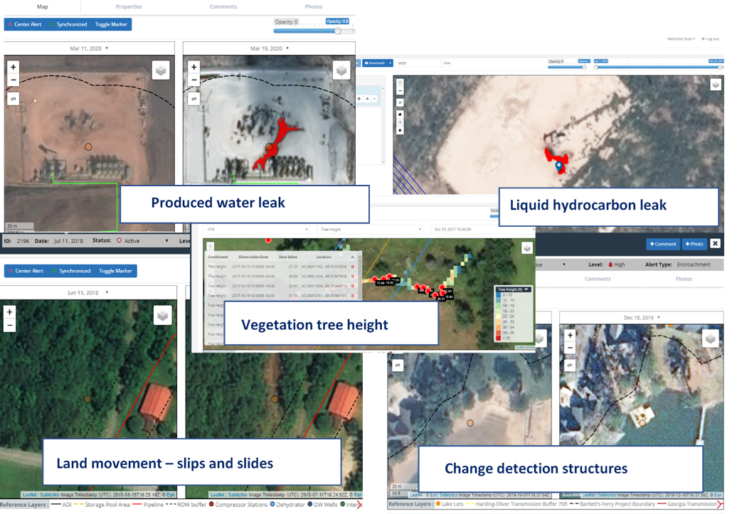
Look at these real-life examples in the power, oil & gas, pipeline, water, and mining industries of the Satelytics “How!”

Satelytics Inc., www.satelytics.com, is a cloud-based geospatial analytics software suite. Multispectral and hyperspectral imagery is gathered from satellites, UAV, planes, and fixed cameras, and processed to provide both alerts and qualitative results for our customers. Data can be gathered up to a daily basis, and results are sent to customers within hours. This includes the specific problem, location, magnitude, and even qualitative information, which minimizes cost, impact, and operational disruption for our clients.
Toledo, OH – March 24, 2020. For more information, contact David Dunham, ddunham@satelytics.com, (o) (419) 728 0060 extension #101, (c) (701) 213 0294.