
• General
• General
Multiple news and information outlets are reporting on the value of satellite monitoring and data analytics for everything from Coronavirus food supply chain stress, plastic wastes in the ocean, the Chinese economy, oil storage capacity, or even the location of a despot! Geospatial analytics is a non-invasive way of providing information to minimize or get out ahead of threats to infrastructure or business activities. Of course, in today’s world, non-invasive means keeping your people out of harm almost entirely! What common problems exist in your business that could be solved with a fresh look from above?

Need new data for vegetation management?
Satelytics' forward-thinking customers include the following market segments:
The list goes on! All these tools are available to be run simultaneously on the same set of data to solve multiple business problems. Results are sent via text and email (and are cloud-accessible) directly to our customers in a matter of hours after imagery is acquired. Or perhaps your company already has regular drone or fixed-wing monitoring? Satelytics can process any type of aerial data to ensure you are getting the most out of every monitoring opportunity.
Need another information source for leak detection?
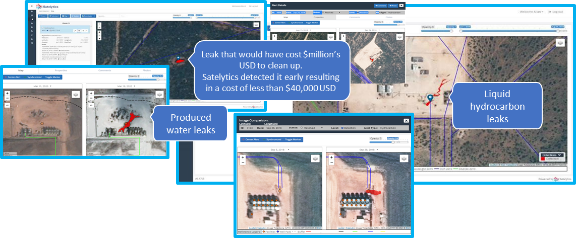
Satelytics Inc., www.satelytics.com, is a cloud-based geospatial analytics software suite. Multispectral and hyperspectral imagery is gathered from satellites, UAV, planes, and fixed cameras, and processed to provide both alerts and qualitative results for our customers. Data can be gathered up to a daily basis, and results are sent to customers within hours. This includes the specific problem, location, magnitude, and even qualitative information, which minimizes cost, impact, and operational disruption for our clients.
For more information, contact David Dunham, ddunham@satelytics.com, (o) (419) 728 0060 extension #101, (c) (701) 213 0294.
We use cookies to analyze our web traffic and to enhance your experience. By continuing to view this website, you agree to our use of cookies.
Our Privacy Policy