
• General
• General

The Satelytics team has grown five-fold in the last three years. The main reason for that growth has been our professionals who create, craft, and deliver solutions to our customers' most challenging tasks. The treasure in any company is its personnel.
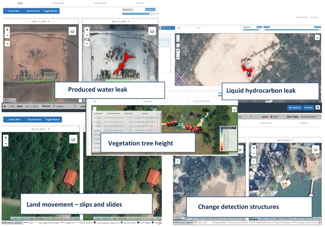
Our customers have also played a huge role in our growth, with helpful insight, access to their infrastructure, knowledge, and patience as we develop some of world’s first geospatial analytics solutions for not only detection of hydrocarbons, encroachments, changes, etc., but often QUANTIFICATION of constituents. Our arsenal of 30+ algorithms include quantification for: methane leak rates, water quality parameters in parts per billion (PPB) concentrations, and even heavy metals analyses.
Today, Satelytics serves our customers in the oil & gas, pipeline, water and wastewater, and power industries. With rapid expansion in our current markets and new solutions for mining, rail, risk insurance, and PFAS, we are looking for professionals to join our team. We are a software company, with AI-powered algorithms that apply spectral emission principles to high-resolution infrared aerial data. Our solutions are agnostic to the data source, whether from satellites, UAVs, fixed-wing aircrafts, cameras, and now even stratospheric balloons.
The disciplines we are seeking include:
Please visit satelytics.com/careers or reach out with the contact information below.
Satelytics' real world analytics.

Satelytics for the non-connected world real world analytics.
Satelytics Inc., www.satelytics.com, is a cloud-based geospatial analytics software suite. Multispectral and hyperspectral imagery is gathered from satellites, UAV, planes, and fixed cameras, and processed to provide both alerts and qualitative results for our customers. Data can be gathered up to a daily basis, and results are sent to customers within hours. This includes the specific problem, location, magnitude, and even qualitative information, which minimizes cost, impact, and operational disruption for our clients.
Toledo, OH – September 24, 2020. For more information, contact David Dunham, ddunham@satelytics.com, (o) (419) 728 0060 extension #101, (c) (701) 213 0294.
We use cookies to analyze our web traffic and to enhance your experience. By continuing to view this website, you agree to our use of cookies.
Our Privacy Policy