
• General
• General
Hurricanes in the south, fires in the west, and who knows what else in the middle — but life must go on, even when critical infrastructure is affected. A disaster’s march on human safety, as well as vital geo-dispersed energy delivery assets, is met with an unbiased appetite as it bares down. Satelytics offers response tools to assess damaged infrastructure without putting personnel in harm's way. Our remote sensing reaches areas even before the final affects of an incident may be realized, or before it is safe for human response teams to venture out. Flooded streets, downed trees, mountainous and fire-damaged lands: let our data analytics go to work before you put boots on the ground!
Real life examples.
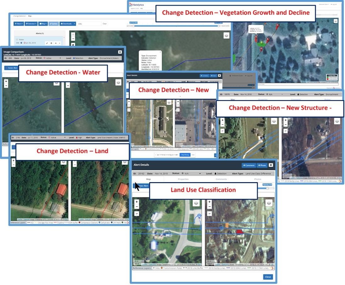
At its very core, disaster response is change detection. What has the incident affected and to what extent? Satelytics' algorithms are specifically tuned to assess:
Satelytics offers a solution to safely asses all of your infrastructure in the aftermath of a major disaster. Begin sourcing materials and filling out work orders at the earliest opportunity with our assessment — without ever leaving the comfort of your home or office. And, when teams are sent out to commence repairs, use Satelytics for the non-connected world to access all of your data and alerts — even if communications infrastructure is still offline.

Satelytics for the non-connected world.
Satelytics Inc., www.satelytics.com, is a cloud-based geospatial analytics software suite. Multispectral and hyperspectral imagery is gathered from satellites, UAV, planes, and fixed cameras, and processed to provide both alerts and qualitative results for our customers. Data can be gathered up to a daily basis, and results are sent to customers within hours. This includes the specific problem, location, magnitude, and even qualitative information, which minimizes cost, impact, and operational disruption for our clients.
Toledo, OH – September 18, 2020. For more information, contact David Dunham, ddunham@satelytics.com, (o) (419) 728 0060 extension #101, (c) (701) 213 0294.
We use cookies to analyze our web traffic and to enhance your experience. By continuing to view this website, you agree to our use of cookies.
Our Privacy Policy