
• General
• General
A lesser-known effect of wildfires is the permanent changes that they can cause watershed areas. This can include land movements, loss of sediment filtering vegetation, and ash production. Ash swept into tributaries and reservoirs can feed algae responsible for the production of cyanobacteria. Officials in Oregon expect this year’s unprecedented wildfires to cause turbidity problems for local utilities, as well as increased source water temperature, both of which are known causes for harmful algal blooms.
Satelytics’ utility and watershed customers gather aerial imagery after fires to quantify infrastructure and environmental damage. Our AI-powered algorithms process in the infrared wavelengths to provide alerts, alarms, detections, and measurements to immediate threats and challenges — without putting employees in harm’s way.
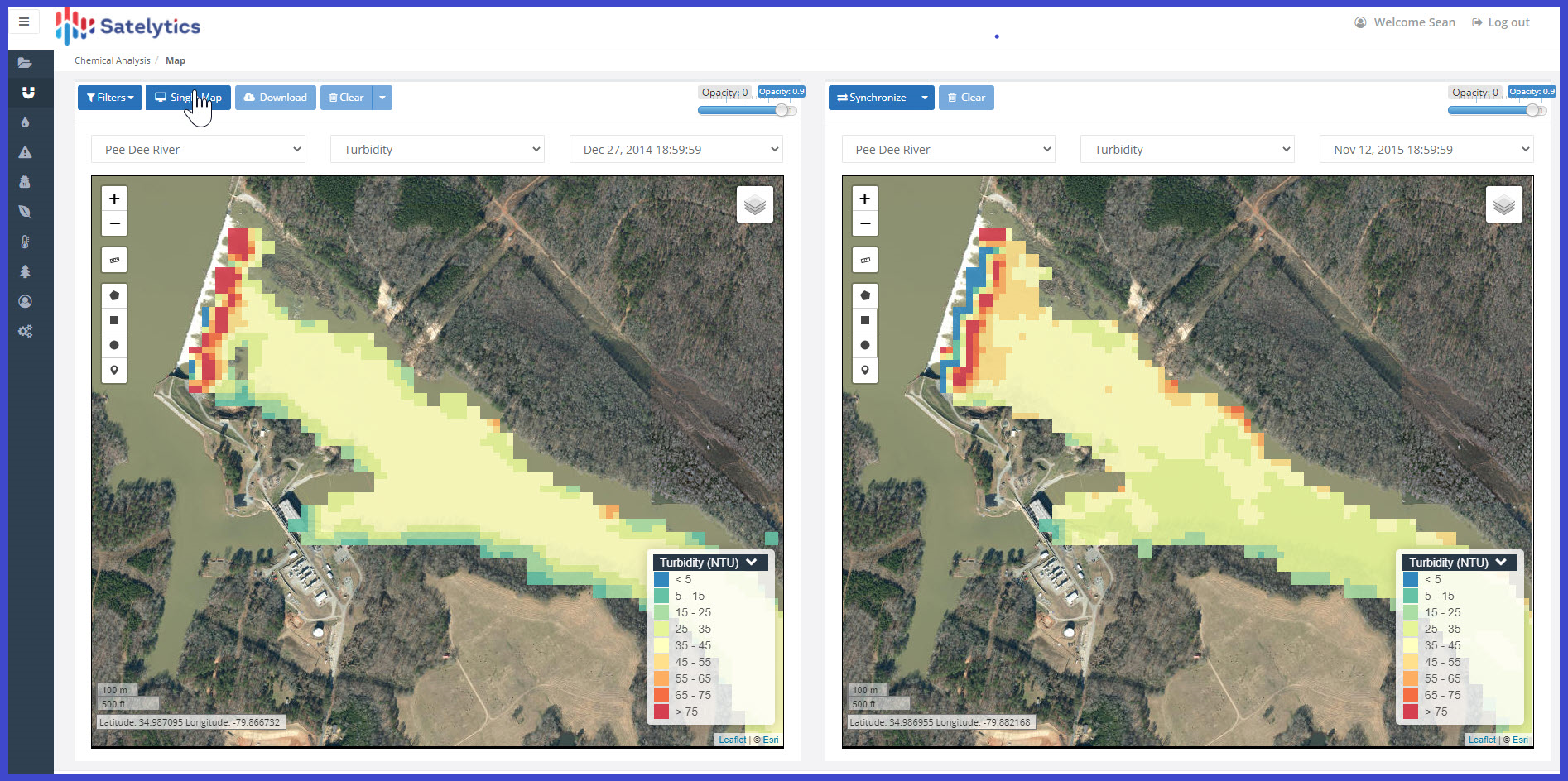
Satelytics’ turbidity measurement (NTU).
These outputs can be sourced from one set of data where assets overlap and include:
Electric Utilities
Water/Wastewater

Satelytics’ vegetation management algorithms.
As the seasons change, wildfire disaster response will fade away and the focus will shift to the rebuilding of infrastructure. However, for our watershed customers, the response is only just beginning. Contact us today to see how our tools can help you provide the highest quality product to your constituents!
Satelytics Inc., www.satelytics.com, is a cloud-based geospatial analytics software suite. Multispectral and hyperspectral imagery is gathered from satellites, UAV, planes, and fixed cameras, and processed to provide both alerts and qualitative results for our customers. Data can be gathered up to a daily basis, and results are sent to customers within hours. This includes the specific problem, location, magnitude, and even qualitative information, which minimizes cost, impact, and operational disruption for our clients.
Toledo, OH – October 14, 2020. For more information, contact David Dunham, ddunham@satelytics.com, (o) (419) 728 0060 extension #101, (c) (701) 213 0294.
We use cookies to analyze our web traffic and to enhance your experience. By continuing to view this website, you agree to our use of cookies.
Our Privacy Policy