• Electric & Gas Utilities,Mining & Extraction

• Electric & Gas Utilities,Mining & Extraction
Coal usage in the United States has decreased in the past 10 years, but coal is expected to remain a significant energy source, supplying a substantial portion of our electric generation portfolio for at least another 20 years. However, the legal liability and remediation burdens associated with coal mining and storage of combustion residuals will be present for many years after that.
Satelytics’ utility and mining customers are employing our geospatial analytics algorithms to reduce risk, monitor environmental impacts, and even generate additional revenue from waste stores. Satelytics offers a suite of proven algorithms that measure meaningful parameters on land, in water, and in the air — and provide actionable alerts, all from a single set of data. As an example, our coal-fired power utility customers use our software to monitor the physical condition of ash ponds. The algorithms measure soil moisture, vegetation growth and decline, land movement, and soil and water chemistry.
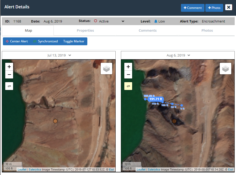
Slope subsidence and lateral ground movements can be discretely measured over sites, including ash pits and mined lands that are being reclaimed. Our software as a service (SaaS) can be contracted for cyclical seasonal monitoring or in response to large rain events. In many instances, our customers will use Satelytics to verify that revegetation has been completed, which may enable the release of the financial bond associated with the work.

Subsidence measurements on a generated alert.
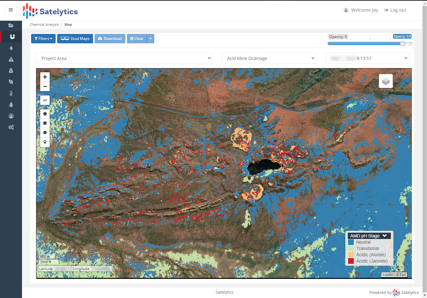
Another Satelytics tool analyzes leaching and acid rock drainage associated with ash storage and mine sites. The ability to see surface pH and even mineral identification has drawn interest from environmental users who hold liability — even as degradation reactions may continue years after a site’s closure. In unlined storage ponds, heavy metals can affect nearby waterways and groundwater flows. Satelytics monitors for that leaching activity, and prevents significant costs incurred when it gets beyond secondary barriers.

Identifying acid mine drainage.
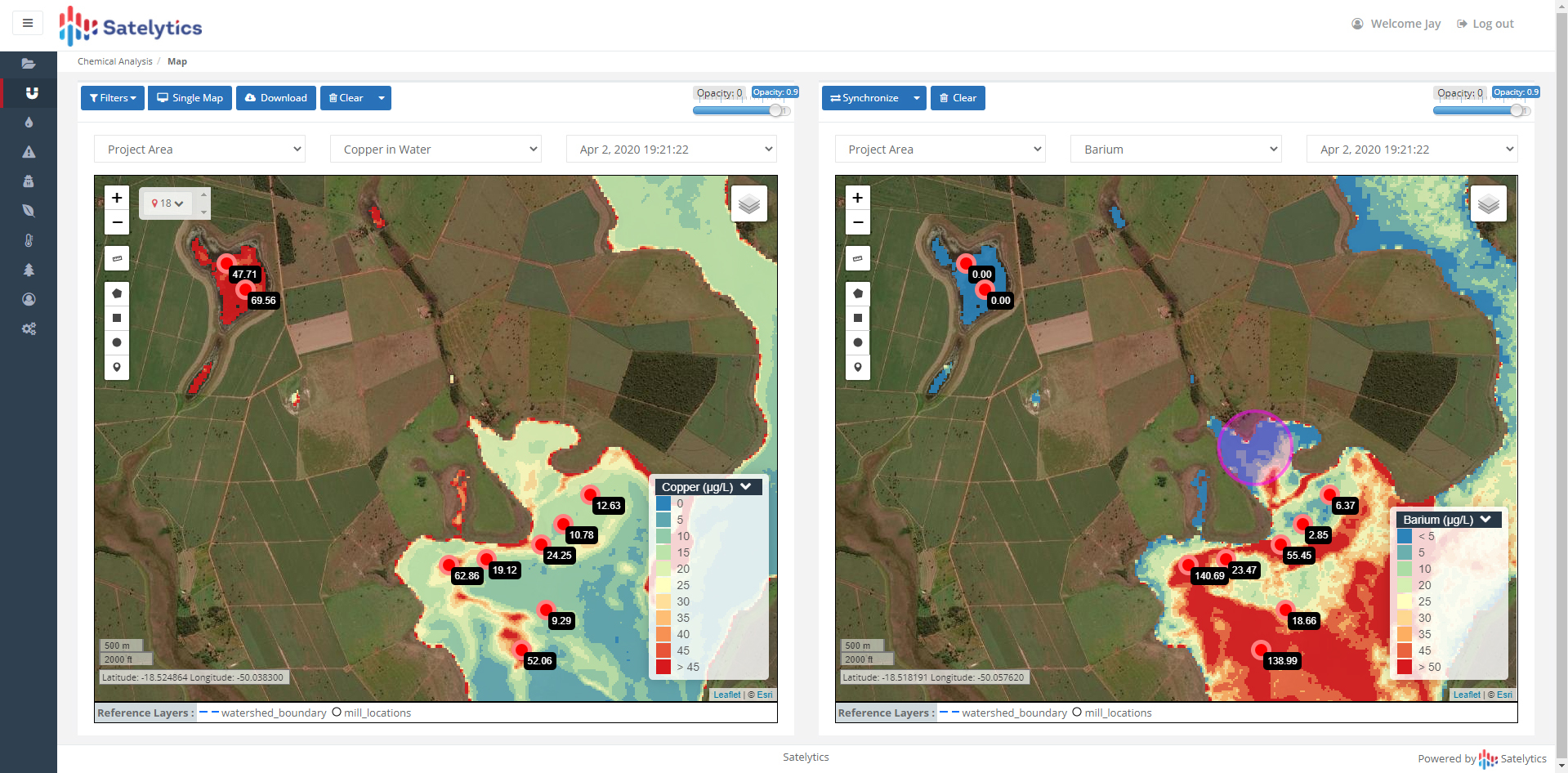
Heavy metals — including arsenic, barium, iron, copper, and manganese — are measured accurately to parts per billion (PPB) concentrations on land and in water. With surrogates like vegetation health, affected areas under the ground can be mapped and tracked. Automated alerts can notify you when action is required. We even have algorithms to detect salinity and the spread of surface dust from mines and storage sites!

Measuring heavy metals concentration in water.
Employ Satelytics' SaaS now to prevent future costs. Make Satelytics a part of your long-term stewardship strategy and simultaneously ensure minimum future costs for your shareholders.
For demonstrations of how Satelytics harnesses the power of geospatial analytics to solve problems like the above and more, explore our YouTube channel. Learn more about our services and how they can benefit your organization on our website. If you have specific questions about our technology or would like to request a demonstration, contact us.