Is Real-Time Monitoring Possible?

• General

Is Real-Time Monitoring Possible?

Making remote sensing data useful.

Précis
  • Problem: Data transfer and analytics take time.
  • Solution: Satellite data transfer, cloud computing, and AI shorten that time to hours.
  • Benefit: Actionable alerts, directing your resources only to where they are needed.

I have spent a good portion of several recent conversations with potential customers setting the record straight on “real-time monitoring.” This is a claim made by some remote sensing companies who are more concerned with hype than delivery on promises. Can the generic family of remote sensing capabilities really provide real-time monitoring for large infrastructure areas? Spoiler alert: NO they cannot, not even Satelytics.

Real-time monitoring is instantaneous. An example is an advanced SCADA system that acquires equipment conditions multiple times per second and calculates conditions outside of the norm for an entire asset. Other examples include internal pipeline leak detection systems and digital twins for offshore platforms with the fastest fiber connections. The response time for these systems is often counted in seconds.

Geospatial analytics offered by Satelytics are not “real-time.” We instead focus on the delivery of actionable alerts within hours of satellite data capture — a feat unmatched by most and still results in timely notification of problems. After the satellite image is captured, how does that dataset become useful and actionable? There are several keys to making remote sensing actionable and timely:
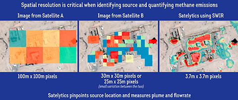
  1. High spatial resolution. Only objects larger than the spatial resolution offered by the sensor can be identified. Satelytics uses the highest-resolution satellite imagery available. In most cases, this is 30 to 46 centimeters. That is detailed enough to see something the size of a dinner plate. In the case of methane, we use 3.7-meter resolution imagery, the best available commercially. In either case, this allows us to specify the location and magnitude of a problem with great precision.


  2. Time to capture data. A drone can capture a few square miles per day. A fixed-wing aircraft can capture a few hundred square miles per day. A satellite can capture thousands of square miles in a matter of minutes. Many companies today are exploring the use of drones to accomplish remote sensing functions, but this may not be viable to cover large asset fleets spread over large geographic areas (think: pipelines, electrical transmission lines, oil field assets).
  3. Data transfer speed. High-resolution data results in more pixels and larger data sets. It takes time to move large data sets to the cloud for processing. Satellites overcome this by streaming the data constantly via a vast network of downlink stations connected to the cloud by fiberoptic data cables that enable terabytes of data to be transferred in a matter of minutes. Conversely, drones and fixed-wing aircraft platforms often require the physical transfer of a hard drive, then the intermediate transfer of the data off that hard drive, before uploading the data to the cloud after the hard drive finally arrives at a location with suitable internet infrastructure.
  4. Analyzing large data sets. A potential customer told me recently that they had a team of engineers review thousands of images for planning a new electric transmission line right-of-way. This process took their team 2 months! Another group told me they typically wait 3-4 months for lidar results to be returned to them! What is the utility of that data that long after an unwanted event or condition?

Satelytics’ algorithms analyze spectral signatures in the infrared portion of the spectrum. They do so in the cloud, enabling us to analyze large data sets, measuring every pixel every time. With cloud computing power and proven AI-powered analytics, the time from satellite overpass to analytical results can be as little as a couple of hours. We don’t claim this is real-time, but we deliver actionable alerts in time to direct action to resolve problems.
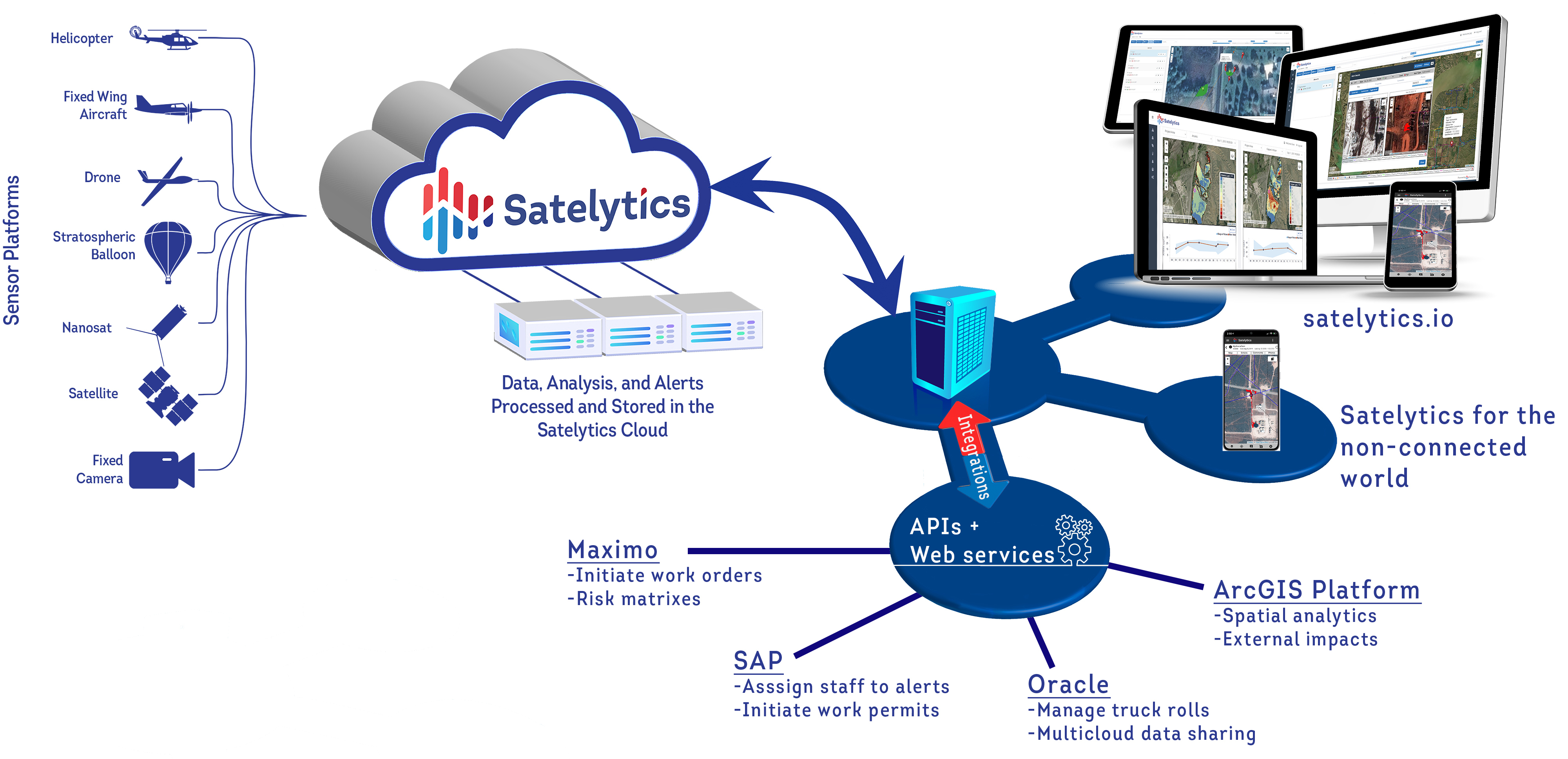

Satelytics uses cloud computing and AI to deliver results in hours.

Satelytics uses cloud computing and AI to deliver results in hours.


The lesson is this: dig past the hype, seek the truth from experts, ask the questions implied above. Industry is just beginning to learn the value of geospatial analytics. That learning process only advances with accurate information.


Let Satelytics help you solve multiple business challenges in as close to real-time as possible.

Interested in our newsletter?