
• Water & Wastewater
• Water & Wastewater
We frequently talk about monitoring large areas of land, bodies of water, and geographically dispersed assets. But our algorithms also have application in urban settings, promoting better management of natural resources, environment, and infrastructure.
This field is referred to as green infrastructure management. Satelytics offers numerous tools that allow city managers to promote natural environments that assist in managing water, heat stress, air quality, and even biodiversity. Incorporating various types of gardens, green spaces, and ponds benefits not only the environment but the lifestyle of citizens — and therefore the aesthetic appeal of the city as well.

Monitoring the vegetation health of green roofs in Portland, OR.
With algorithms originally developed for our utility vegetation management customers and the water/wastewater industry, Satelytics offers the regular monitoring of:
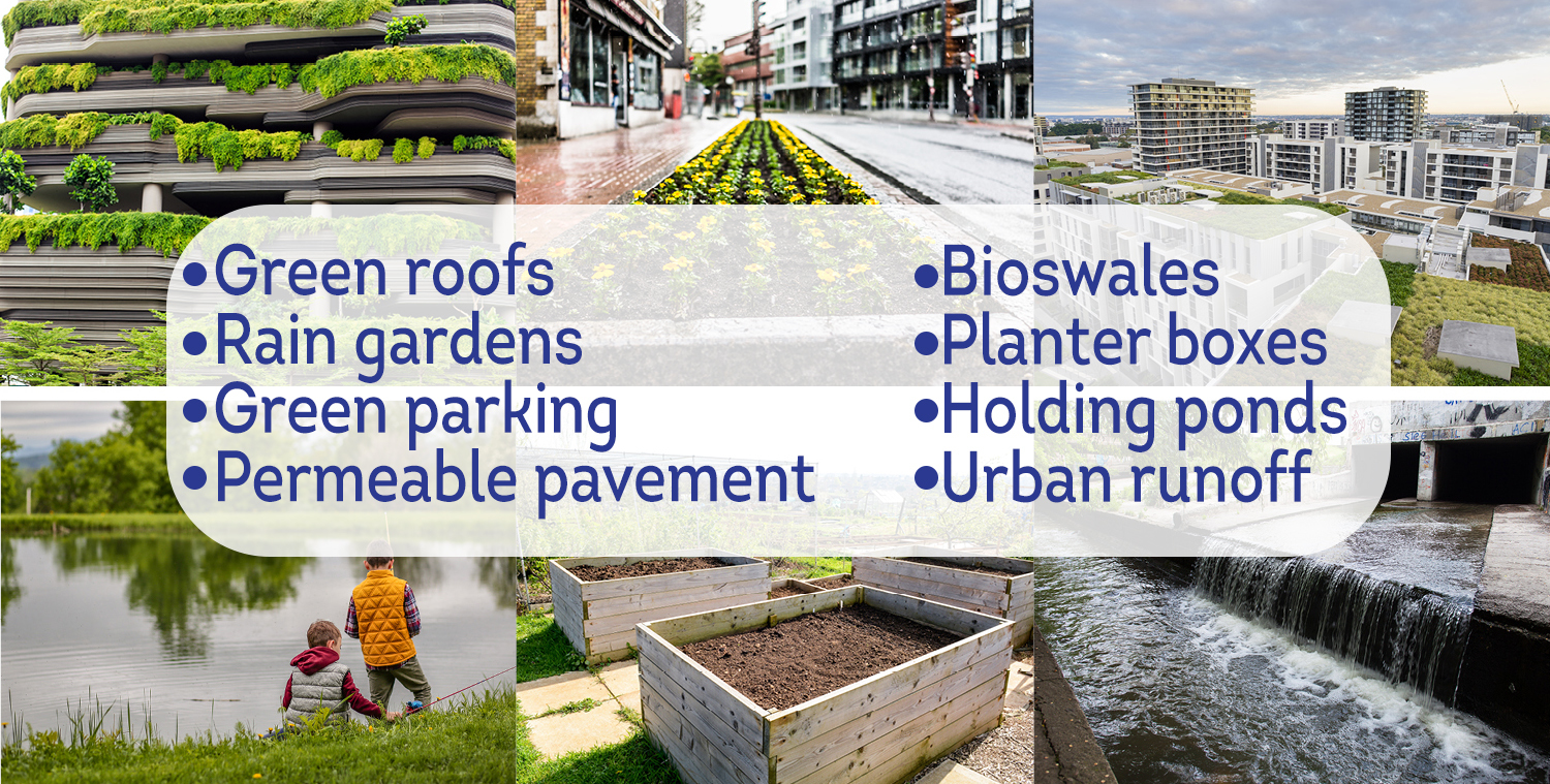
Satelytics analyzes high-resolution imagery to monitor vegetation health, including metrics for growth/decline and verification of cover over manmade and natural surfaces like those shown above.
Gardens and the soils underneath serve to filter stormwater that might otherwise travel directly to rivers through concrete storm drains. Our customers have attached the results of our metrics to financial incentives for residents and business owners to build and maintain gardens and vegetative cover. Municipalities have even used Satelytics to identify copper dust from vehicle brakes to plan street cleaning patterns. Our algorithms for heavy metals can support remediation efforts in industrial areas and affected waterways.
Municipal leaders can also use the results of our water quality analyses performed on lakes, rivers, and ponds — often centerpieces of our nation’s cities — to locate additional green installations. Analyses include measurements of sediment, suspended solids, phosphorous, and harmful bacteria from algal blooms. For holding ponds, we can also provide an assessment of what capacity remains prior to and during rainy seasons.

Measuring phosphorus and chlorophyll-a in a body of water.
Private/public partnerships between municipalities and utilities can even share the cost of the data, with each entity receiving benefit. Utility interests might include natural gas detection and quantification from distribution networks for tiered leak response or vegetation management near overhead utility lines. Satelytics' outputs are ready for consumption in a matter of hours after imagery is captured. One set of data and a suite of algorithms addresses threats and minimizes consequences for the entirety of your city.

Satelytics, Inc. is a cloud-based geospatial analytics software suite. Multispectral and hyperspectral imagery is gathered from satellites, UAV, planes, stratospheric balloons, and fixed cameras, and is analyzed to provide both alerts and qualitative results for our customers. Data can be gathered daily, and results can be sent to customers within hours. This includes the specific problem, location, magnitude, and even qualitative information, which minimizes cost, impact, and operational disruption for our clients.
For more information, contact
Dave Dunham
(o) (419) 728-0060 ext.101
(c) (701) 213-0294
We use cookies to analyze our web traffic and to enhance your experience. By continuing to view this website, you agree to our use of cookies.
Our Privacy Policy