
• Electric & Gas Utilities
• Electric & Gas Utilities
We have said that anti-energy forces are gathering, ready to point the finger at the energy industry over methane emissions. This storm front is upon us.
In each of these cases, the data produced by these anti-energy organizations is inferior to commercially available data. Industry can combat vague assertions with superior data.

Don’t sit idly by while anti-energy activists shoot their arrows. Trump their inferior data with superior data, demonstrating your proactive stance on ESG and methane emissions. In the process, arm yourself with actionable alerts that drive your LDAR program with specificity and immediacy, thus achieving cost savings and safety gains.
Existing gas utility customers have achieved the greatest gains by cooperatively educating regulators on what is possible with geospatial analytics. We are happy to share examples of these successes and, in some cases, can even connect you with companies that have experienced success in this approach.
Our customers have verified methane flow rates at sites all over the world in both upstream oil & gas (as low as 9 kg/hr) and urban natural gas distribution infrastructure (as low as 1 kg/hr). Satelytics’ methane algorithm analyzes 3.7-m spatial resolution commercial satellite data, allowing us to specify the leak source within 4 meters. No other solution comes close to this level of specificity. If a gas riser or meter is leaking, it is identifiable. When a distribution pipe is leaking, it can be seen.
Gas Distribution KPIs:

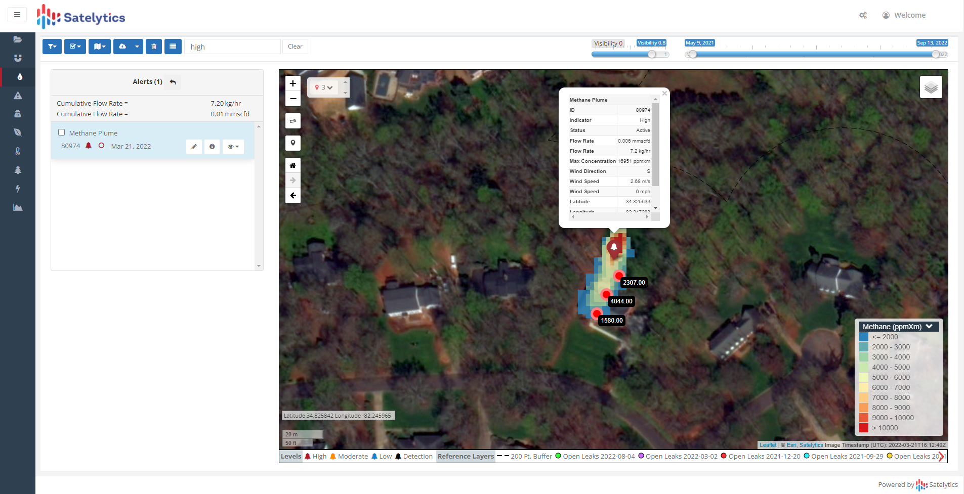
Spotting gas distribution system methane leaks
Make your methane data work for you by directing response personnel to the source needing attention most. Use this data again for reporting volumes reduced through operational efficiencies! Then, maximize your ROI by employing 40 other measurements that can all be obtained from the same set of satellite imagery, including liquid hydrocarbon leaks, brine leaks, vegetation management, encroachments, geohazards, and more. All our data processing occurs on the cloud and analytical results are delivered in a matter of hours after satellite overpass.
Are you prepared for the storm? Contact us today about a solution stronger than a flimsy umbrella.
We use cookies to analyze our web traffic and to enhance your experience. By continuing to view this website, you agree to our use of cookies.
Our Privacy Policy