• Water & Wastewater

• Water & Wastewater
We started this series with Satelytics’ quantification of phosphorus and nitrogen, two chemical drivers of cyanobacteria that, in sufficient quantities, cause harmful algal blooms (HABs). In this installment, we focus on biological contaminants and their indicators.
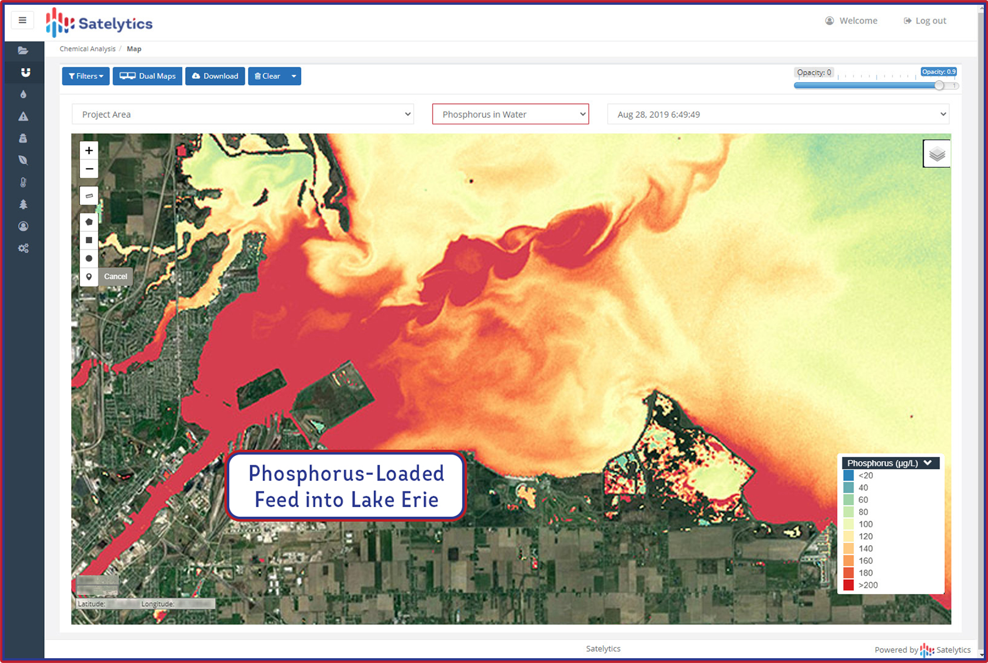
Geospatial analytics is a logical solution for water protection, especially because Satelytics is headquartered in northwest Ohio, right on the nutrient-overburdened western portion of Lake Erie. The shallowest of the Great Lakes, Lake Erie has long been plagued by algal blooms, encouraged by adjacent agricultural land, industrial activity, and a dense population. At the inception of Satelytics, we looked to satellite imagery to analyze large areas for nutrient loading and algae growth in Lake Erie.

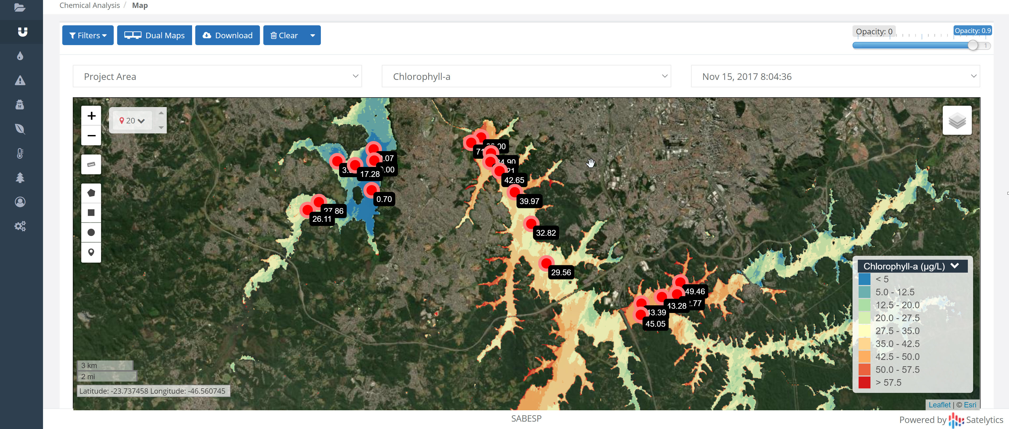
Together, phycocyanin and chlorophyll-a are the most common biological indicators of cyanobacteria. Satelytics measures both indicators in parts-per-billion concentrations.
Chlorophyll-a is a pigment that aids photosynthesis in cyanobacteria. Knowing the light wavelengths reflected and absorbed by chlorophyll-a, Satelytics accurately quantifies the substance in waterbodies to a depth of 18 inches. If chlorophyll-a is present in high concentrations, cyanobacteria and HABs may also be present.


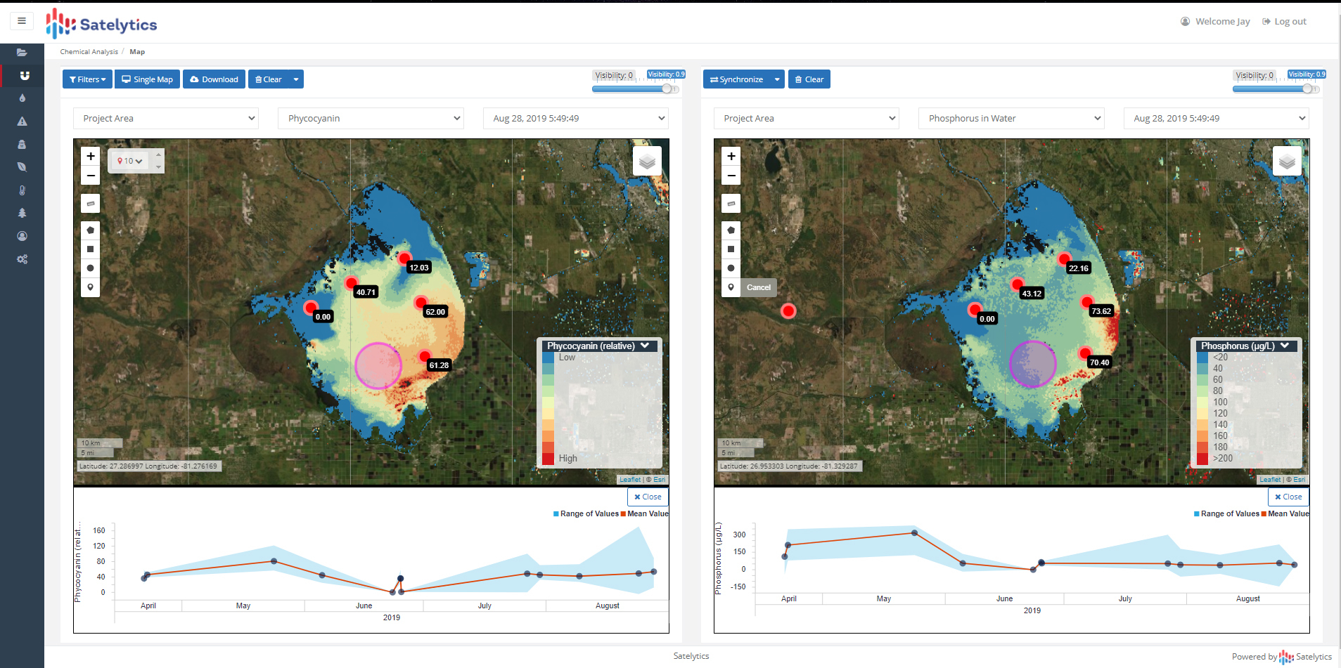
Phycocyanin measurement often accompanies chlorophyll-a to provide another metric of unwanted biological activity. Phycocyanin is a pigment-protein that also aids the photosynthetic process. Satelytics can measure chlorophyll-a and phycocyanin independently, providing an accurate measurement of algae concentrations.

Geospatial analytics goes beyond point source sampling, with every pixel being a measurement, allowing watershed managers a holistic view of their assets — no sample bottles or laboratories needed.
Satelytics provides our customers with near real-time alerts to prevent negative consequences and fix problems in their infancy before disaster strikes. We have worked on water bodies worldwide and will guide you every step of the way as you ingest this measurement capability. Call us to inquire how we can help you manage your watershed more effectively.