• General

• General
On the business development team, part of our job is to educate customers about the difference between satellite data and imagery. Imagery refers to the picture seen by the human eye, while satellite data is so much more.
Increasingly, satellite images accompany various news articles, such as surveillance photos from Ukraine and Russia. The clarity of these images is incredible, showing details of damage and vehicles or identifying troop movements. As impressive as they are, images also have a limiting factor — reliance on the human eye to assign value.
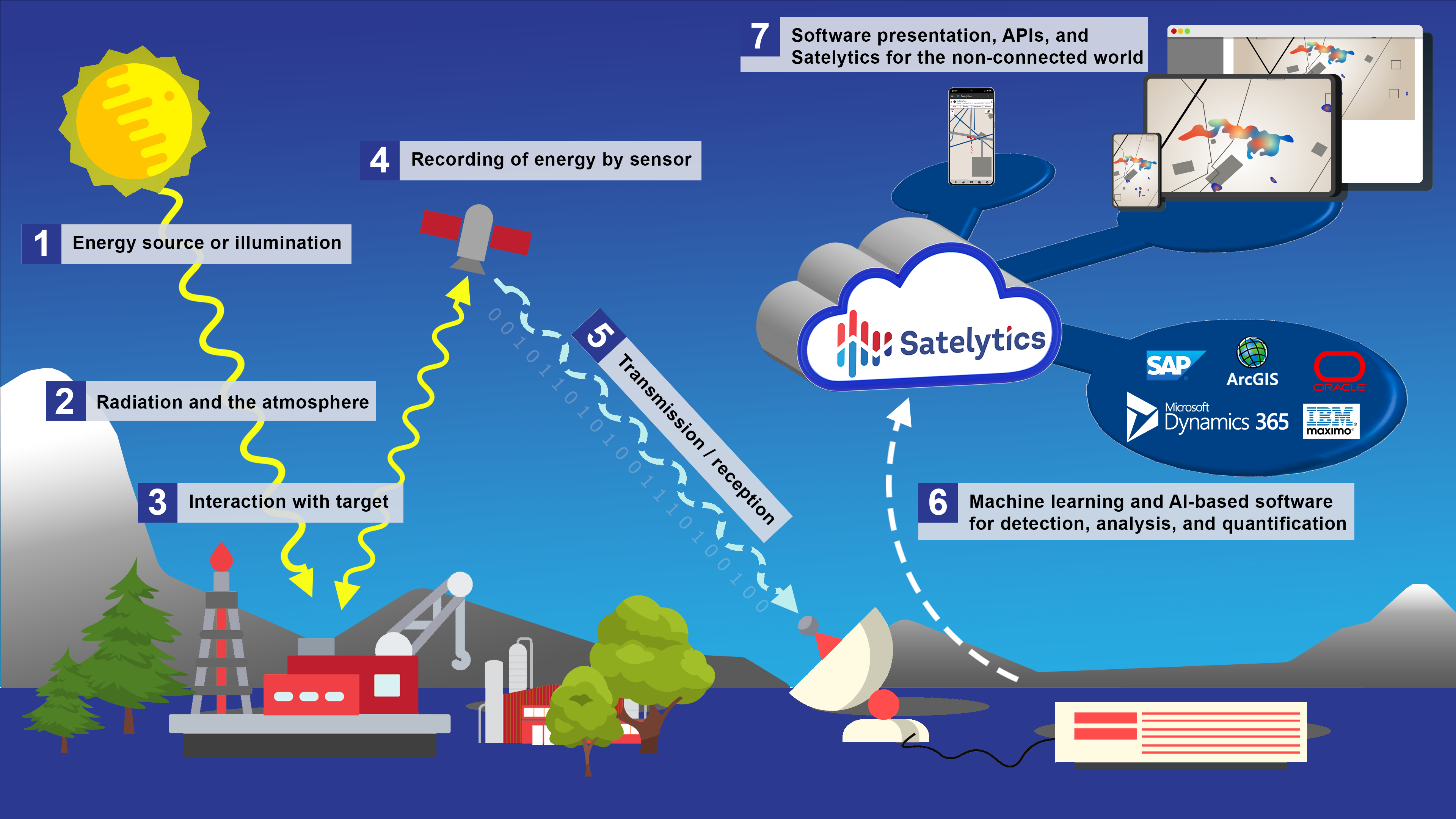
Satelytics looks at big pictures, literally — tens of thousands of square miles. The human eye and mind cannot gather all the details and detect changes from imagery of this enormity. This is where our algorithms and geospatial analytics come into play.

Geospatial analytics make sense of enormous data sets.
Our algorithms identify spectral signatures — combinations of wavelength bands representing various chemicals and physical phenomena — and measure their intensity. The human eye can see visible wavelengths (red, green, blue, etc.), but more information can be found outside the visible spectrum. This data is in ultraviolet, infrared, and radio wavelengths.
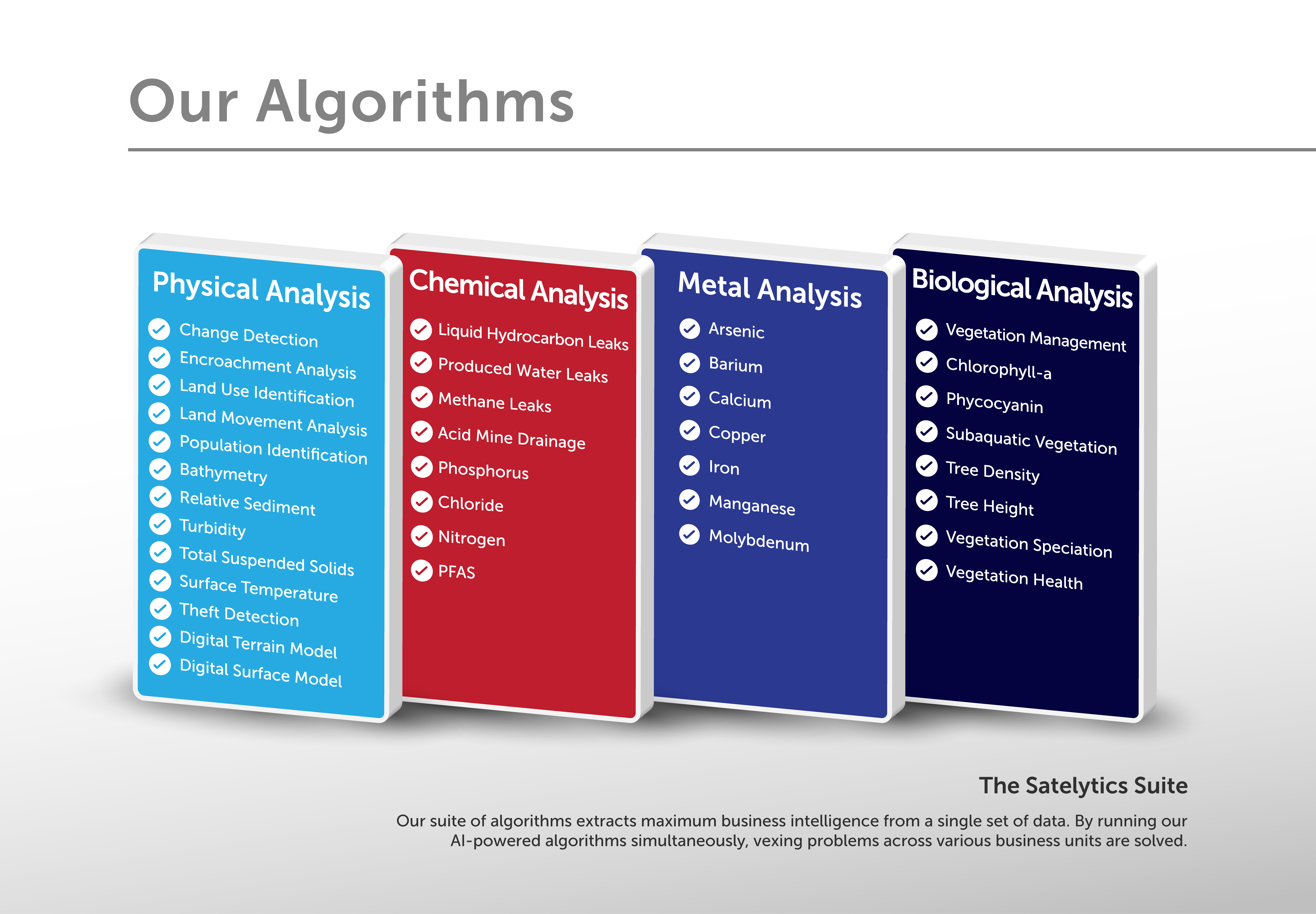
By looking beyond what’s visible and analyzing geospatial data, Satelytics can detect and measure the presence of chemicals and metals, liquid leaks above and below grade, methane leaks, phosphorus runoff, and so much more. Our algorithms also pick up on minute changes in land movements, erosion, and vegetation cover before they trigger costly consequences. These capabilities allow us to provide our customers with actionable alerts within hours of satellite overpass.

More than 40 algorithms can analyze a single set of data.
There’s no denying the wonderful pictures captured by satellites, but the details are in the data, not the imagery. Contact us to arrange a demonstration.