• General

• General
CERAWeek just wrapped up in Houston. This year's theme was "Pace of Change: Energy, Climate, and Innovation." Much of the discussion in presentations and hallways centered on the tug-of-war between creating affordable energy and adhering to ESG principles, with a glaring preoccupation with methane emissions. Innovation is the only solution.
Call it the Age of Remote Sensing. Many innovative methane measurement solutions rising to the top seem to leverage remote sensing platforms to monitor assets spread across vast geographical areas. Three general approaches have emerged:

Why is Spatial Resolution Important?
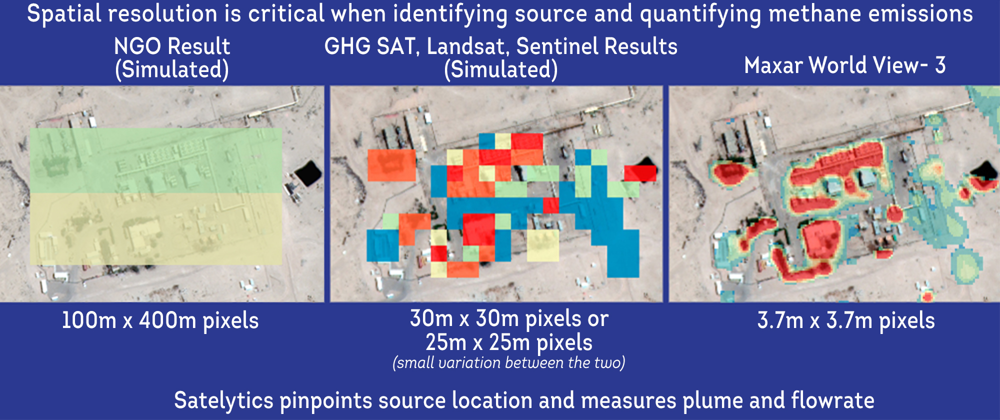
Satelytics has long had the capability to measure methane, and we know that our customers need specificity and low detection thresholds. We can only attain these goals with high-resolution imagery. Landsat (15-m to 100-m resolution), Sentinel (10-m to 60-m resolution), and GHGSat (25-m to 30-m resolution) data can be analyzed to identify enormous methane plumes from super-emitter sites, but that doesn't help our customers address the problems at their onset. A methane leak large enough to be registered by these coarse-resolution sensors is an unmitigated disaster on your hands! Instead, we must use truly high-resolution (3.7-m) shortwave infrared data, currently only available from Maxar's WorldView-3 satellite.

Why is Revisit Time Important?
Methane leaks are notoriously transient. On Tuesday, your field teams may not see them with OGI instruments, but a regulator with an identical instrument may see them on Wednesday. So, by extension, your confidence grows exponentially with an increased frequency of revisits. You can also address large leaks as quickly as possible before safe operations are affected. Satelytics uses a commercial satellite that delivers data to be analyzed by Satelytics for methane up to 5 times weekly.
Why Invest in a One-Trick Pony?
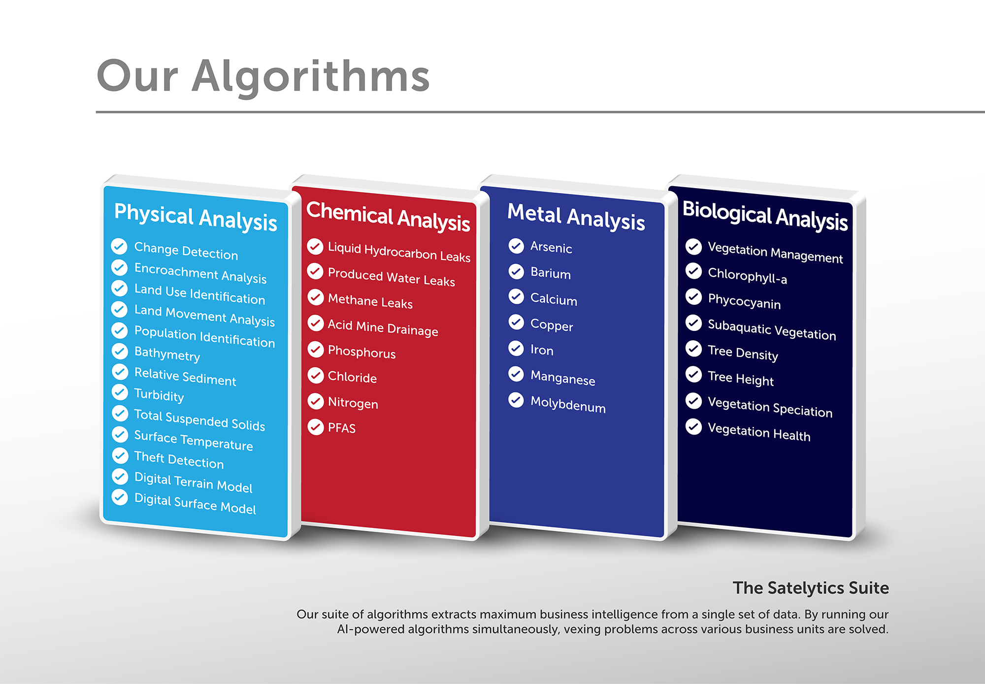
A point we make repeatedly: Satelytics can run 40+ algorithms to address myriad business challenges on a single set of data. Why buy multiple one-off solutions when Satelytics can help you solve it all?

Key Questions When Comparing Methane Monitoring Solutions