
• Water & Wastewater
• Water & Wastewater
Satelytics started as a company focused solely on solving the challenge of measuring nutrient loading into rivers and water bodies that cause harmful algae blooms. This was a problem close to home for the company all those years ago. Lake Erie has suffered for years from pollution and nutrient runoff, causing algae blooms that impair recreation and drinking water sources. Our scientists knew that remote sensing could address these challenges by looking at large land areas for sources of pollution.
Satelytics’ first algorithm was phosphorous on land and water. The results produced both detection and quantification alerts.
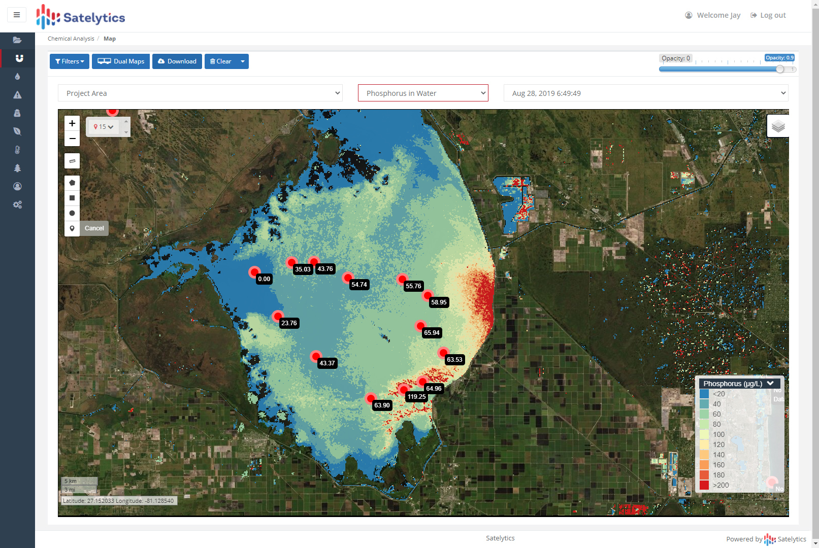
Satelytics measuring phosphorus in water.
How accurate can a measurement be when made by a sensor hurtling through space? That was the question on which our science team obsessed during the early days of Satelytics. Using spectral science, they isolated the unique signature of phosphorous on land and water in satellite images. The next step was to calibrate the models, which required grabbing innumerable ground and water samples close to the moment of satellite overpass. These samples were sent to an independent laboratory for analysis and results were fed back into the models to increase accuracy.
The key to our water quality measurement capability is using AI to learn from past data sets. In those early years, Lake Erie was our petri dish. Phosphorous was measured across a variety of seasons, locations, and backgrounds. As Satelytics analyzes more data, AI compares phosphorous concentrations for new watershed areas with past results. Today, our phosphorous measurement is accurate to single digits parts-per-billion (ppb)!
Phosphorous was Satelytics’ first algorithm and has now analyzed billions of pixels, but it is just one of 40 other measurements obtained from a single set of data.
Other water quality measurements include nitrogen, chlorophyll-a, phycocyanin, and total suspended solids. We provide a confidence level for each of these measurements from the first time each analyzes a customer’s watershed area. In addition to these more traditional water quality measurements, Satelytics has algorithms to determine the concentration of metals and detection and speciation of emerging and subaquatic vegetation.

Measuring phosphorus and phycocyanin simultaneously with one set of data.

Solve many business problems simultaneously with one set of data.
Call today to see what remote sensing data can provide to help you get out ahead of negative consequences for your managed areas.
We use cookies to analyze our web traffic and to enhance your experience. By continuing to view this website, you agree to our use of cookies.
Our Privacy Policy