
• General
• General
Within a 48-hour period in the eastern North Dakota/northern Minnesota region where I live, many communities found themselves in emergency response and flood protection mode when snow, rain, ice, and wind interrupted April’s spring melt. The Red River, which divides the two states, began rising rapidly as tributaries dumped runoff from the still-frozen ground into the system. Hatton, North Dakota experienced a violent washout in a once unassuming ditch.
Events like these have prospective customers asking us: Can satellite monitoring be used to respond to natural disasters quicker and more effectively? The short answer is yes — but let’s dig a little deeper.
Surveillance data captured a week after an environmental event isn’t that useful. In that amount of time, the damage could have been assessed by ground crews or from alerts sent in by customers. Today, high-resolution satellite imagery is available daily for almost any location on Earth. Imagery of these vast areas is captured in minutes, not days or weeks, allowing for swift action.
With Satelytics’ Constant Vigilance™, disaster response crews have all the data they need to direct remediation efforts and resources, as well as prevent further damages. Below are examples of how our services aid our industry customers.

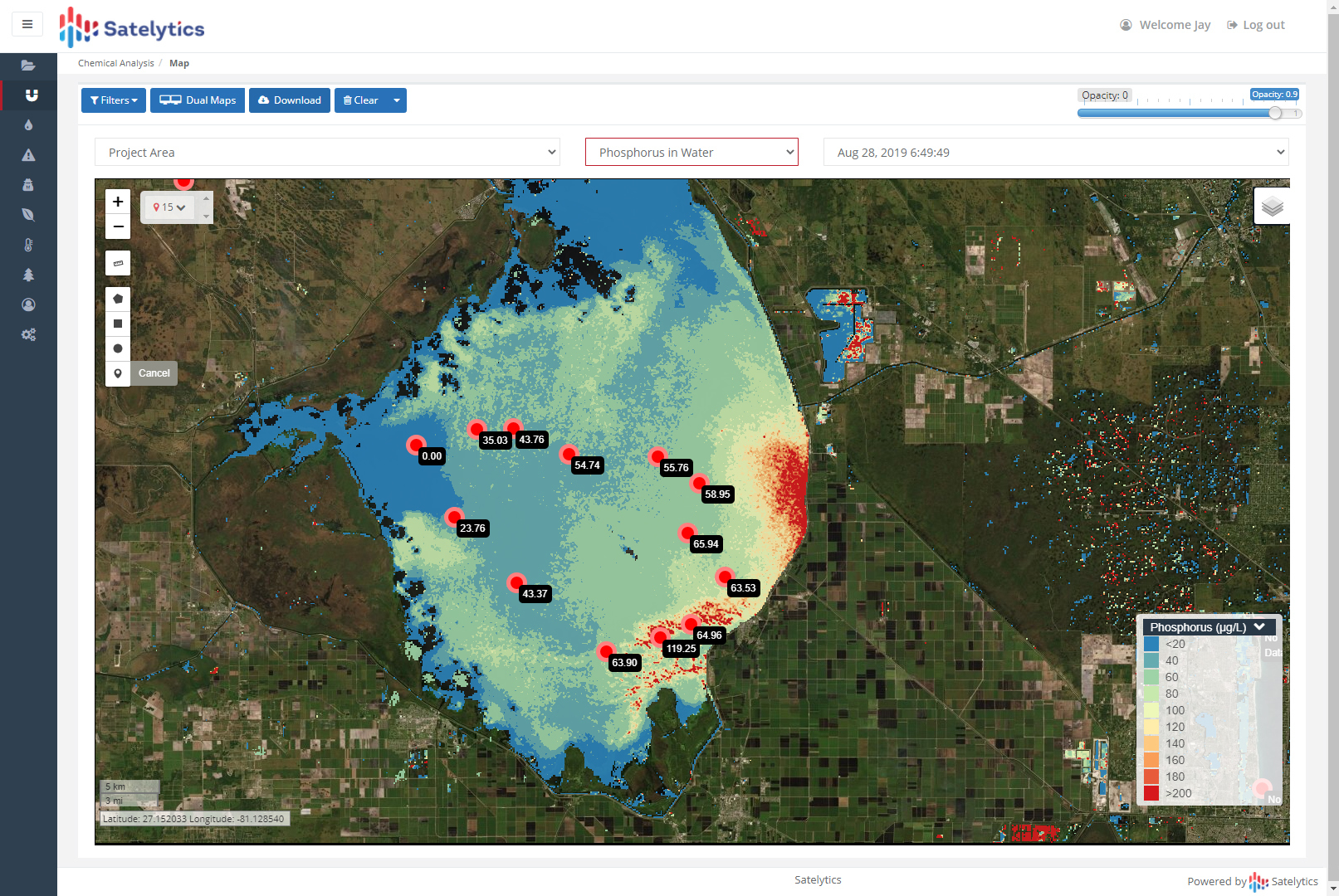
Satelytics can gather imagery and process results for emergency response, in addition to regular monitoring. We can move up* a future capture to respond to an event for no additional program cost. This can be useful for directing field crews, ordering materials, and more — the abilities are endless once you have the data!
*For emergencies and new areas, 24 hours advanced notice is needed to procure satellite imagery.
We use cookies to analyze our web traffic and to enhance your experience. By continuing to view this website, you agree to our use of cookies.
Our Privacy Policy