• General

• General
A recent article highlighted a shortcoming commonly found in the earth observation industry: a well-known optical satellite vendor proudly touting the numerous geospatial analysts they staff and the thousands of images these analysts pour over each day. Their geospatial analysts identify, count, and annotate changes and objects of interest in the imagery gathered for both government and industry projects.
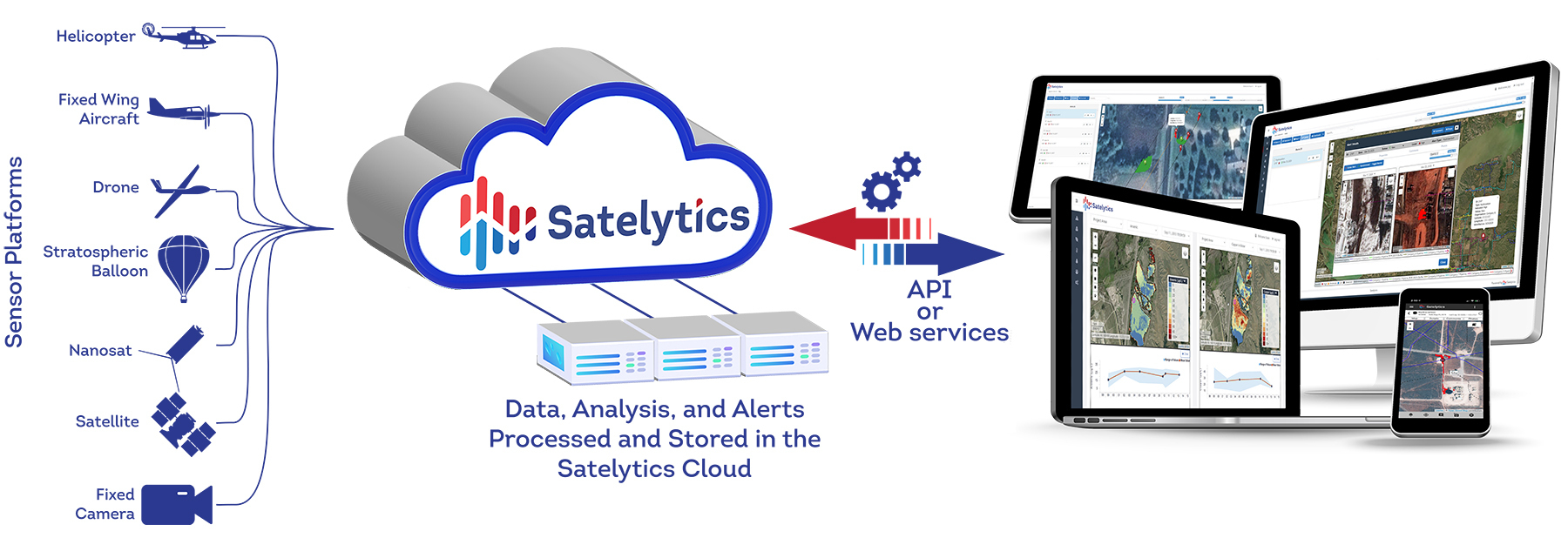
While Satelytics’ shares the same endgame for our industry customers — identifying and quantifying objects and constituents from space — our approach to get there efficiently and accurately is quite different. Satelytics takes a data-driven approach with automated imagery processing, analyzing every pixel and alerting to threats outside our customers’ prescribed operating environments.

Actionable results delivered quickly and directly to end users.
Satelytics’ Constant VigilanceTM algorithms harness the power of artificial intelligence and cloud computing to process millions of pixels gathered. It is impossible for human analysts — no matter how well-trained — to attain this level of granularity and speed. We use high-resolution spatial imagery (30- to 50-centimeter), which allows Satelytics to detect and quantify more with increased accuracy. One cannot identify objects smaller than the pixel size the satellite sensor offers, which is why we utilize the finest resolution.

Why is spatial resolution so important?
Satelytics analyzes the infrared wavelengths of spectral imagery captured for large asset areas, unlocking data outside the visible light spectrum seen by the human eye, “seeing” more than an analyst will ever hope!

Spectral resolution is also important, especially in the infrared spectrum.
Our automated solution allows for rapid turnaround between collecting data and delivering alerts. Satelytics delivers survey results a few hours after satellite overpass, an ever-decreasing processing time. In addition, the frequency at which satellite imagery can be acquired is rapidly increasing.
Satelytics’ customers prioritize accuracy and rapid alerts to get ahead of threats before they become disasters. Don’t rely on people looking at pictures when a next-level solution is available now!