
• General
• General
At the heart of Satelytics’ geospatial analytics are alerts attached to physical locations. Satelytics directs personnel response with accuracy and specificity.
Satelytics alerts are viewable in our web-hosted platform, satelytics.io. This solution allows any number of personnel to log in and view alerts overlaid on a map containing your assets, infrastructure, and buffer zones. Our Constant VigilanceTM algorithms pinpoint threats with specificity and allow users to measure the physical proximity of these threats to assets.
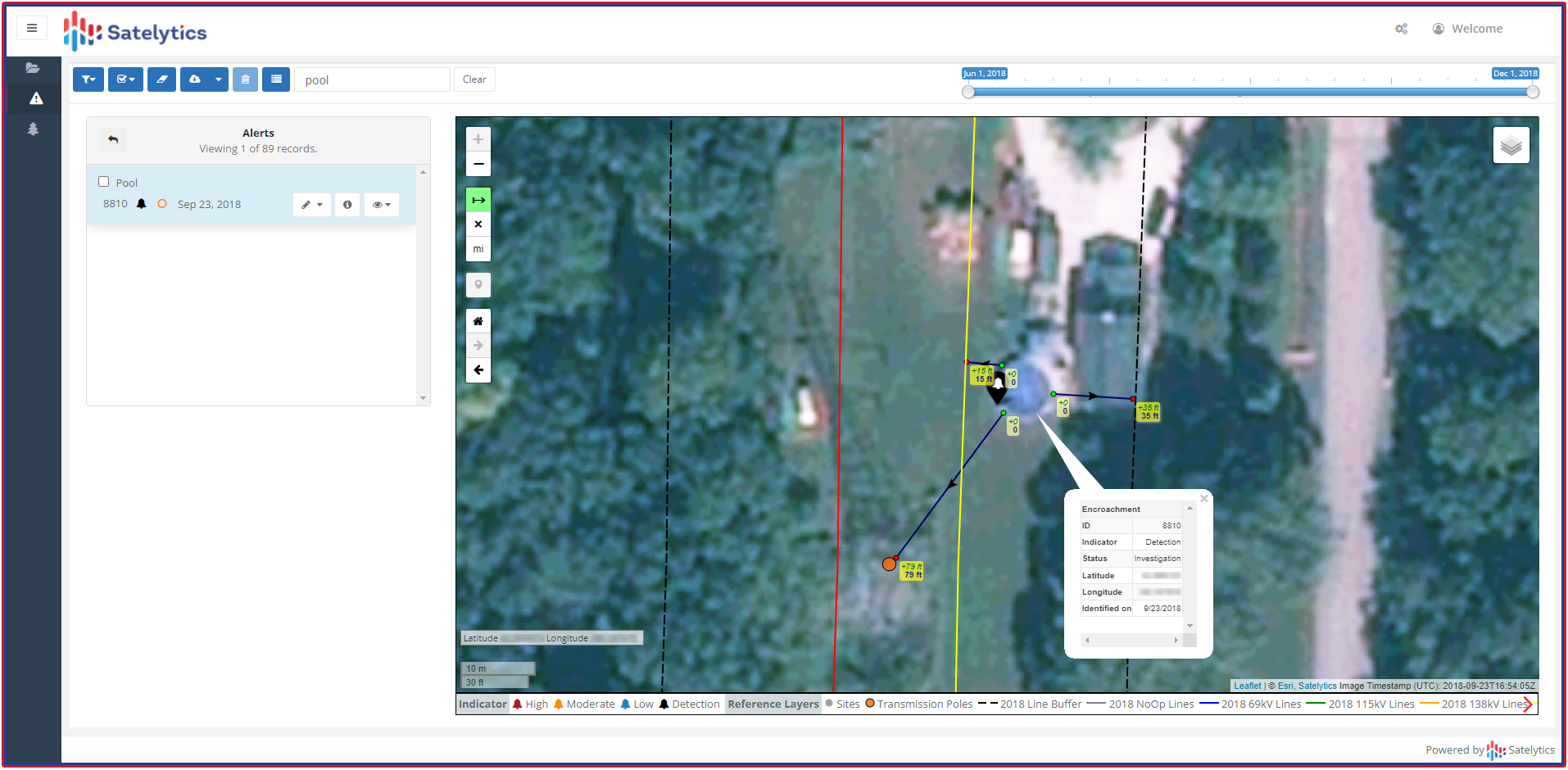
Measure distance between alerted threats and your infrastructure.
Alerts are graded according to each customer’s required scale. For example, alert grading can be related to specific circuits, pipelines, and gathering line segments. Satelytics can also group alerts geographically, by proximity to a structure type, according to high-risk areas, and more. Once the data is acquired and processed, it can be aggregated in any number of ways!
We understand that obtaining the alerts is only half the equation. The other half is the location of this data, making it accessible for your teams to integrate it into their workflows and, in turn, allowing them to remediate incidents in a timely manner. Satelytics is designed so alerts can not only be viewed in our platform, but also passed through via API to your internal software platforms — easy integration of a new data source without having to juggle software platforms. Satelytics is integrated with every major workflow management software platform used by industry, and our Professional Services team is available to provide assistance for a smooth transition.

Satelytics can feed information to most workflow management software tools.
Satelytics’ algorithms analyze every pixel, every time with spatial resolution down to a square foot, allowing our customers to pinpoint threats to exact locations for remediation before they become disasters.
We use cookies to analyze our web traffic and to enhance your experience. By continuing to view this website, you agree to our use of cookies.
Our Privacy Policy