
• General
• General
For maximum benefit to our customers, Satelytics requires accurate asset coordinates. This allows us to trim out any unnecessary data purchases and focus our algorithms on the areas in which you are interested. If the coordinates aren’t accurate, our alerts might send field crews on wild goose chases, checking on infrastructure that isn’t there.
How accurate are the shapefiles for your company’s assets?
Spot-on?
Within a few feet?
Tens or hundreds of meters?
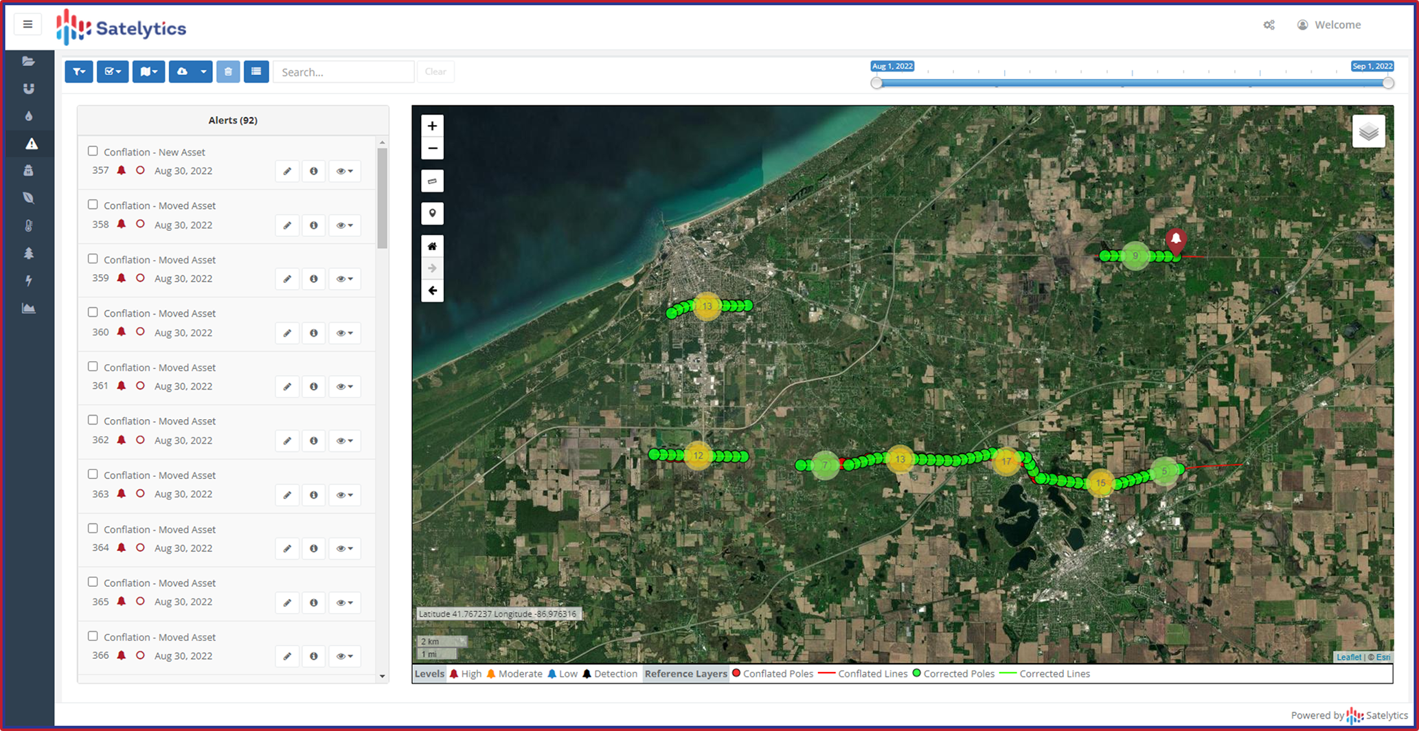
Nearly every Satelytics customer acknowledges a disparity between digital location records and the actual physical location of assets. This could be due to infrastructure built under previous regulation regimes, acquired assets, or improper surveys. However it happens, conflation is an issue for nearly every utility, pipeline operator, and oil & gas company. Satelytics is actively working with utility customers to address conflation issues.
Survey asset areas for conflation issues.

See where your assets are, not where you were told they were.
Satelytics’ algorithms process high-resolution (30- to 50-cm spatial resolution) satellite data. In addition to satellites, our software also processes datasets obtained from UAS, aircraft, and fixed camera sensors. High-resolution imagery is required to identify infrastructure like utility poles, towers, and other smaller assets.

After Satelytics surveys a customer’s asset area, alerts are overlaid on a map, including their asset shapefiles. Our analytics identify specific infrastructure for location comparison to legacy GIS records. Every pixel is analyzed every time with our Constant VigilanceTM algorithms, and each alert includes exact coordinates and a unique identification number for follow-up. We’ll tell you when a discrepancy exists between your GIS location and where we see the asset.
Let Satelytics end your conflation frustration and solve a host of additional business challenges simultaneously!
We use cookies to analyze our web traffic and to enhance your experience. By continuing to view this website, you agree to our use of cookies.
Our Privacy Policy