• General

• General
The adoption of geospatial analytics to enhance asset monitoring is growing rapidly. Geospatial analytics can facilitate advanced asset planning, maintenance and upkeep, and mitigation. This is why the multi-solution analytics provided by Satelytics is the missing ingredient in your company’s monitoring mixing bowl.

Why has the adoption of data analytics expanded so dramatically in recent years? Two reasons:
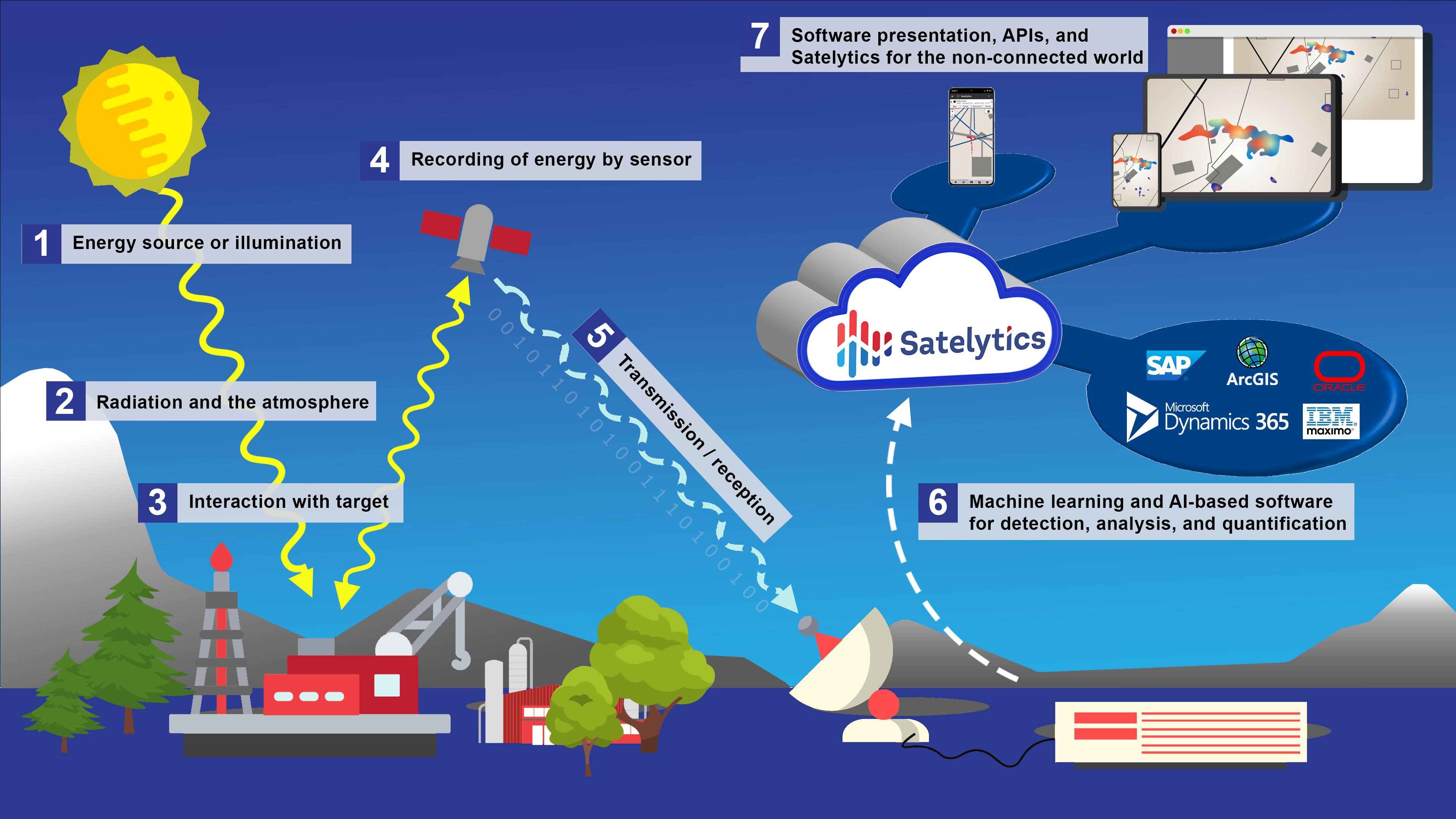
Satelytics provides alerts and measurements primarily from satellite sensors because satellites scan large areas quickly and return the raw data quickly via ground link stations. Commercial satellite sensors also carry out regular calibrations to ensure data quality remains constant in ever-changing environmental conditions. This is an often-overlooked part of data gathering, as every device — whether mounted on the ground, a UAV, or a satellite — experiences drift. This means the turnaround time is only a few hours after satellite overpass, with our customers receiving accurate alerts.

How Satelytics Works
Satelytics’ customers choose us because of the proven accuracy of our 40+ algorithms and to use our analytics as a source of data to benefit their operations.