• Electric & Gas Utilities

• Electric & Gas Utilities
As the window for satellite monitoring of vegetation narrows, it's crucial to gather data before leaves change color, which limits the effectiveness of speciation and health algorithms until spring. While imagery collection may fade from focus temporarily, this is the ideal moment to plan a geospatial analytics survey for your asset areas.
Satelytics offers a comprehensive suite of vegetation algorithms that not only target the removal of specific problematic trees but also enhance your overall tree trimming strategies with a holistic perspective. This provides quality data to inform the development of trim plans and budget allocations for your teams or contractors, focusing efforts on areas requiring immediate attention. This can range from individual circuits or segments to entire T&D zones, with metrics such as:

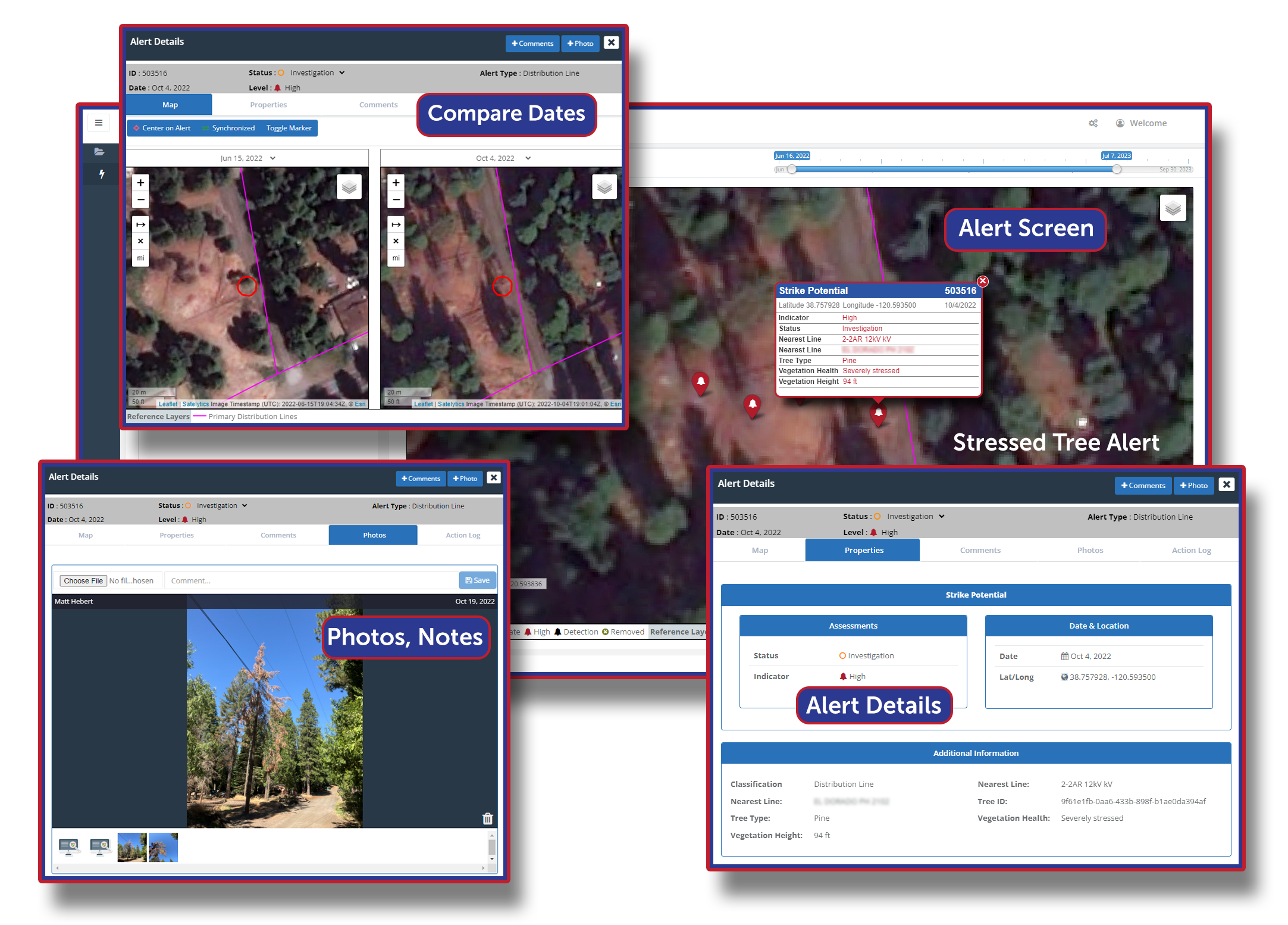
Assess tree height, health, type, and threat potential.
Every tree is cataloged with Satelytics utility vegetation management, enabling rapid identification of problem trees or areas in and along corridors. How is this comprehensive inventory possible? Satelytics analyzes commercial satellite imagery with a spatial resolution of 50 centimeters or better, storing all results in the cloud. We retain all data, allowing you to access a historical archive whenever needed.
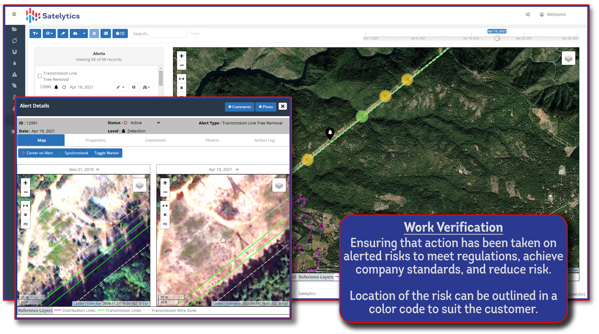
What and where are the challenges your assets face? Satelytics provides solutions to address both questions simultaneously. Post-trimming, our work verification solutions ensure that work has been completed as planned, giving you peace of mind remotely.

Work verification made easy.
Ready to take the guesswork out of vegetation management and make data-driven decisions with confidence? Don't let your assets go unprotected; partner with Satelytics today and unlock the full potential of satellite imagery for your operational needs. Contact us to schedule a demonstration and see how our cutting-edge solutions can transform your vegetation management strategy, optimize resources, and safeguard your infrastructure. With Satelytics, the future of precise and proactive asset management begins now.