• Electric & Gas Utilities

• Electric & Gas Utilities
When hurricane winds subside and the skies clear, utilities face their most critical hours. Every minute of delay in damage assessment triggers an expensive cascade:
The financial reality is staggering. Between 1980 and 2024, the U.S. experienced 403 billion-dollar weather disasters costing $2.92 trillion. Storm recovery expenses have reached crisis levels, with utilities carrying $12.4 billion in weather-related debt as of 2022. Duke Energy alone faced $2.4-2.9 billion in restoration costs from just three 2024 hurricanes, while Florida utilities were approved to collect over $1.1 billion in 2025 for storm-protection projects.
Manual field inspections and helicopter surveys can take days to complete a damage evaluation. After a storm, the costs of delay are enormous. As stated above, inefficiencies that increase overtime and lengthen outages cost utilities millions of dollars. Storm brokers (the expensive middlemen utilities rely on for crew coordination) add markups of 20-30% to recovery costs. On a billion-dollar storm recovery, that's an additional $200-$300 million burden. Therefore, minimizing a utility’s demand for storm brokers by enhancing post-storm intelligence has a significant impact.
Satelytics’ AI-powered algorithms can survey storm damage across entire service territories within hours, not days, providing actionable alerts, prioritized alerts, and quantitative measurements. Rapid assessment capabilities significantly reduce damage assessment times, while also improving resource allocation and field safety.
Modern satellite multispectral imagery offers rich data with a spatial resolution of 30 centimeters. Combined with AI analysis, these systems detect infrastructure damage, vegetation encroachment, flooding zones, unauthorized third-party activity, and access route blockages with surgical precision. Advanced vegetation management programs using satellite intelligence have reduced vegetation-caused outages by 10-20% while cutting management expenses by 15-20%.
Satelytics is built around speed and precision. We constantly strive to decrease the time required to survey large asset areas and bring useful alerts to threats facing customers’ environments and equipment. Our disaster response projects deliver alerts a few hours after satellite overpass. Changes and objects can be detected and identified down to the square foot.

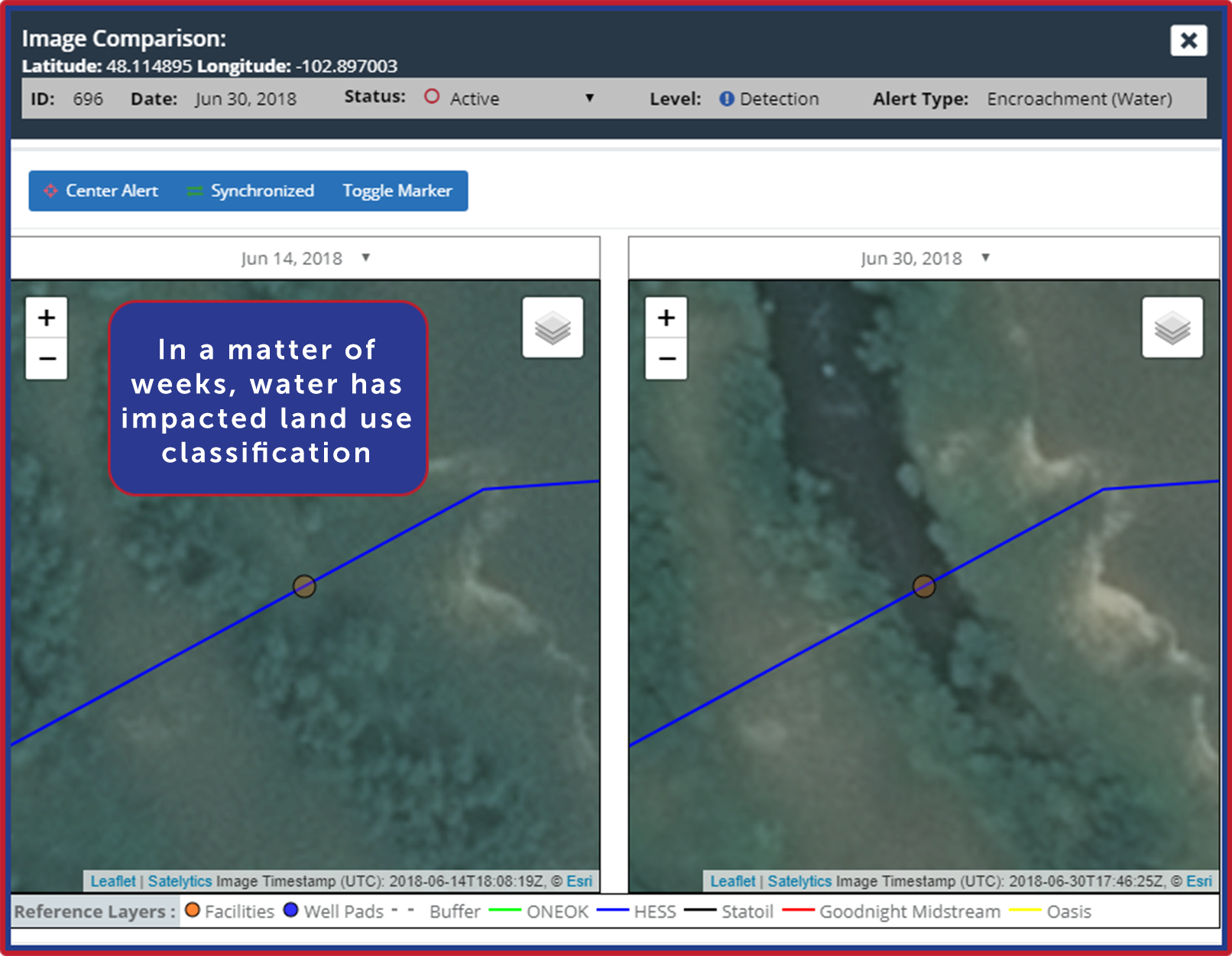
Detect water encroachments and flooding after heavy rains and disasters.

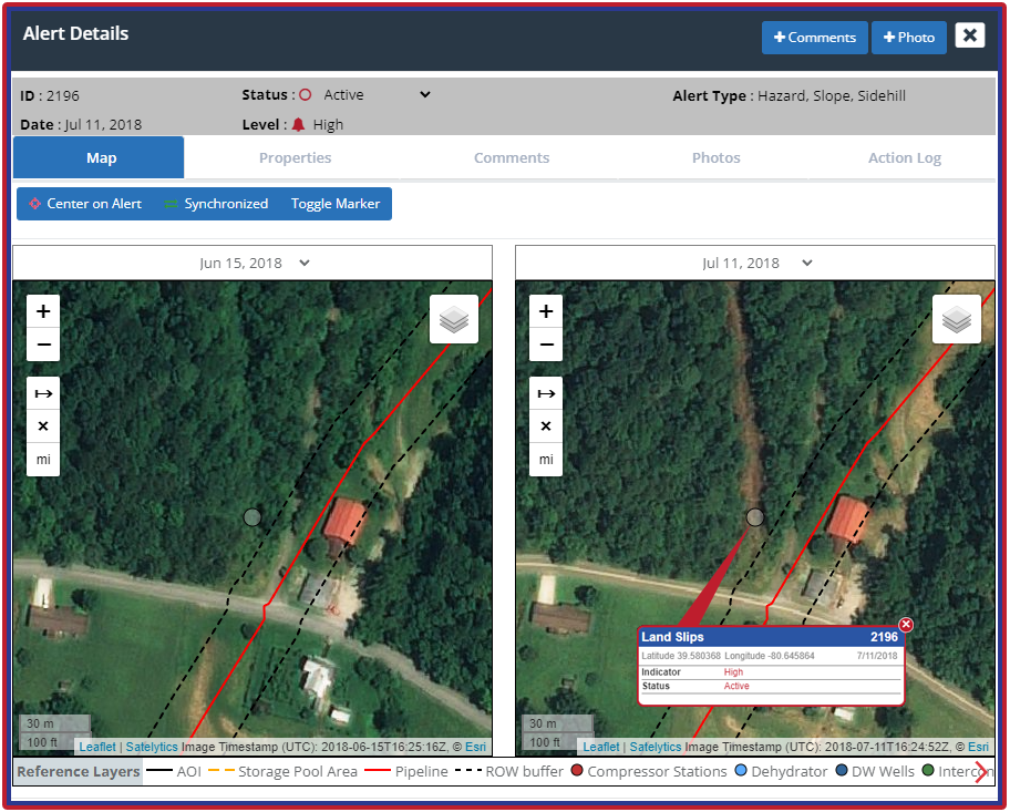
Receive after-storm alerts on infrastructure threats like landslips.
Predictive analytics enable optimal pre-positioning of crucial restoration assets. AI-driven vegetation management achieves greater than 85% accuracy in predicting fuse failures during storms. Utilities using condition-based maintenance instead of rigid cycle trimming have reduced trim areas by hundreds of miles while improving reliability metrics. Utilities have reported a 40% reduction in vegetation-related outages through satellite-enabled monitoring.
The transformation from reactive chaos to proactive precision is measurable. Utilities implementing comprehensive geospatial analytics report 20-50% faster restoration times, improved SAIDI and SAIFI reliability metrics, and substantial cost savings through eliminated inefficiencies. When storms strengthen and budgets tighten, satellite-powered intelligence isn't just an advantage — it's survival.
Contact us today to learn how your company can benefit from harnessing geospatial analytics for greatly improved SAIFI/SAIDI scores and quantifiable, positive impacts on your bottom line.