
• Pipeline
• Pipeline
With the Direct Final Rule (DFR) now lodged in the Federal Register, PHMSA has slammed the door on decades of uncertainty: right-of-way (ROW) patrols can be performed by "imaging via satellite" under §§192.705(c) & 195.412(a). Effective October 9, 2025, pipeline operators no longer need to ask whether satellite evidence will pass audit muster; it is now written, chapter and verse, into the Code of Federal Regulations.
The rule also:
Bottom line: Satellite-based geospatial analytics are no longer a technology pilot. They are a statutory tool. Delaying adoption is no longer about regulatory risk. It is purely a commercial choice.
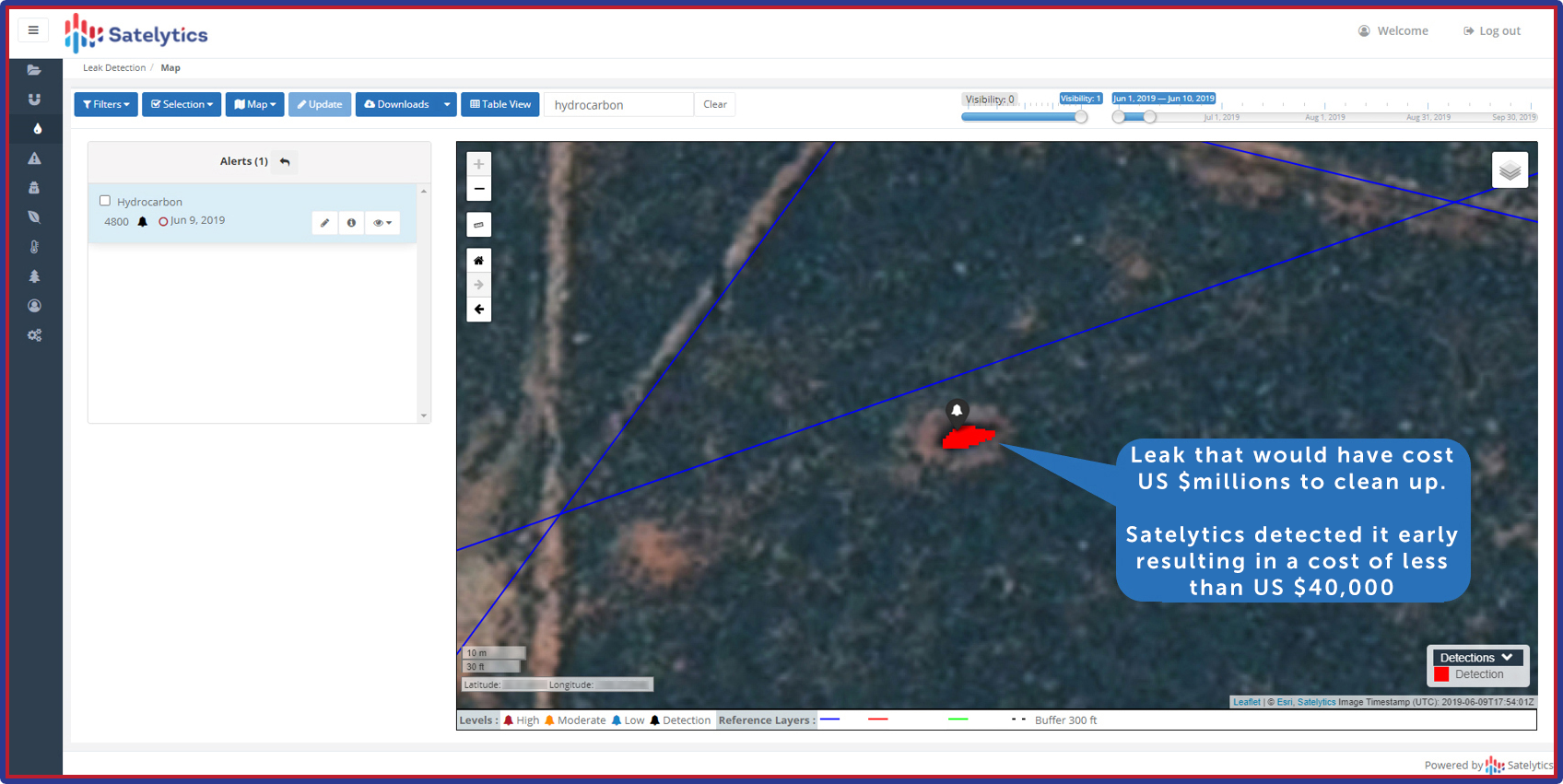
Monitor for liquid leaks, gas leaks, encroachment, land movement, etc.
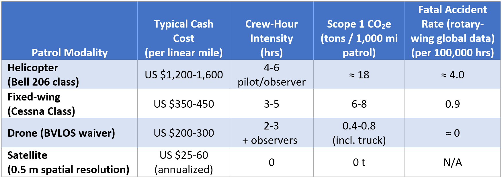
Assumes a 1,000-mile liquids system (26 patrols/yr) and gasoline support vehicles where applicable. CO2 values exclude Scope 2 data center electricity.
Putting numbers together: replacing the mandated 26 helicopter patrols on a 1,000-mile liquids system with weekly 50-cm multispectral satellite-based monitoring yields:
Those are first-order savings. Second-order gains such as automated landslide change detection, encroachment alerts, and methane measurement tend to deliver positive net present value in the very first leak averted, a story most CFOs grasp intuitively.
Publicly available position papers from the rotary-wing lobby stress three pillars: (1) real-time glare, (2) angle of regard, and (3) human judgment on site. Let's stress-test each.
Real-Time Coverage vs. Revisit Frequency Narrative: "Helicopters can respond the same day; satellites are periodic."
Reality: Today's commercial constellations (Maxar Legion and WorldView-3, Airbus Pléiades and Neo) offer daily collections, downlinked within 60 minutes after overpass. In a pure encroachment patrol workflow, you don’t need sub-hour latency — excavation threats develop over days, not minutes. For rupture forensics, image fidelity, not speed, dominates evidentiary value.
Oblique Angle & Vegetation Canopy Narrative: "Low-flying aircraft see under trees."
Reality: VNIR satellites penetrate deciduous leaf-off canopy roughly twice a year.
Hands-on Human Judgment Narrative: "Putting eyes on the ROW lets the pilot land and intervene."
Reality: The over-tasked pilot rarely lands on private land without a chain-of-custody path or sheriff in tow. In practice, pilots radio the control center, which dispatches ground crews (a two-step loop satellites skip entirely). Moreover, 88% of TC Energy's helicopter patrol hours are ferry legs, not on-station observation. That is a lot of risk and fuel for zero inspection value!
Bottom line: operators choosing helicopters shield only PHMSA risk; satellite patrols de-risk four regulators at once.
The DFR does not merely allow satellite patrols; it canonizes them. Every mile still flown with hydrocarbons and rotor blades is a mile the balance sheet, the ESG ledger, and the safety dashboard that will have to defend. Satellites convert that mile into pixels that cost <5 % of a helicopter sweep, emit zero Scope 1 carbon, and never file a workers' compensation claim.
If you are still budgeting for flyovers in FY26, at least run the side-by-side P&L first. Odds are the satellite line wins before you even price the fuel hedge. Talk to us to explore this in depth.
We use cookies to analyze our web traffic and to enhance your experience. By continuing to view this website, you agree to our use of cookies.
Our Privacy Policy