• Pipeline Operators

• Pipeline Operators
One of the most common questions from operators considering satellite monitoring has always been, "Will the regulator accept this for compliance?" With the U.S. Pipeline and Hazardous Materials Safety Administration (PHMSA)'s release of a Direct Final Rule (DFR) on July 1, 2025, the answer is a resounding yes. This groundbreaking rule explicitly permits satellite imaging for routine pipeline right-of-way (ROW) patrols under 49 CFR Part 192 and Part 195, marking a pivotal moment for pipeline safety and operations.
Effective October 9, 2025, the new regulation eliminates any ambiguity about the legitimacy of satellite monitoring for compliance purposes. Here's what you need to know about why this change matters, how it ensures regulatory acceptance, and what it means for the future of pipeline monitoring.
Some hesitate to adopt satellite technology, fearing regulators might view it as supplementary rather than a primary compliance tool. The new rule explicitly addresses these concerns in several ways:

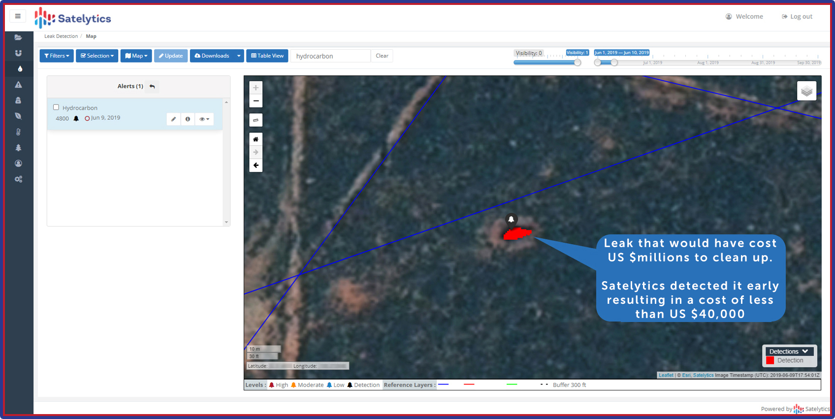
Monitor for liquid leaks, gas leaks, encroachment, land movement, etc.
In addition to regulatory clarity, PHMSA underscores the cost savings and operational benefits of adopting satellite monitoring. Citing “unquantified cost savings” in its justification, the agency highlights lower personnel risk, reduced environmental impact, and decreased reliance on resource-intensive helicopter or fixed-wing patrols.
For Satelytics customers, the efficiency gains align seamlessly with an ongoing push toward innovation in pipeline monitoring. With satellite-imaging constellations offering more frequent revisits and high-resolution image data, operators can streamline ROW oversight while maintaining or exceeding compliance standards. The potential to reduce operational budgets without compromising safety or performance further emphasizes the strategic advantage of satellite technology.
This DFR marks a turning point for pipeline monitoring, offering operators a chance to not only meet compliance requirements but also elevate their operations. By integrating satellite-based monitoring, pipeline operators can achieve long-term benefits such as:
What was once seen as a gamble is now cemented as a trusted compliance strategy, offering operators the opportunity to lead with innovation while preparing for future regulatory shifts. Delaying adoption risks not only higher operational costs but also slower adaptation to emerging standards in leak detection and emissions transparency.
Take this opportunity to review your current patrol methods and ask us how satellite-based solutions can bring efficiency and compliance together like never before.