• Pipeline Operators

• Pipeline Operators
When it comes to pipeline monitoring, a common refrain has been oft-stated: “We are mandated to use airplanes to monitor our pipelines.” While that wasn't strictly true, many operators fell back on old assumptions from decades ago. With the U.S. Pipeline and Hazardous Materials Safety Administration (PHMSA)'s release of a Direct Final Rule (DFR) on July 1, 2025, PHMSA now explicitly permits satellite imaging for routine pipeline right-of-way (ROW) patrols under 49 CFR Part 192 and Part 195, marking a pivotal moment for pipeline safety and operations. Effective October 9, 2025, the new regulation eliminates any ambiguity about the legitimacy of satellite monitoring for compliance purposes.

Monitor ALL pipelines without putting people (or airplanes) in the field.
Airplanes cannot match the speed or scale of satellite monitoring. Aerial surveys often take weeks to collect and analyze data, delaying the identification of potential issues that escalate over time. Moreover, the quality of aerial data is highly variable, influenced by weather conditions and pilot expertise. In most cases, flyovers rely on a pilot visually inspecting pipelines from the cockpit—often without the use of sensors or data analysis—resulting in inconsistent and inaccurate reporting.
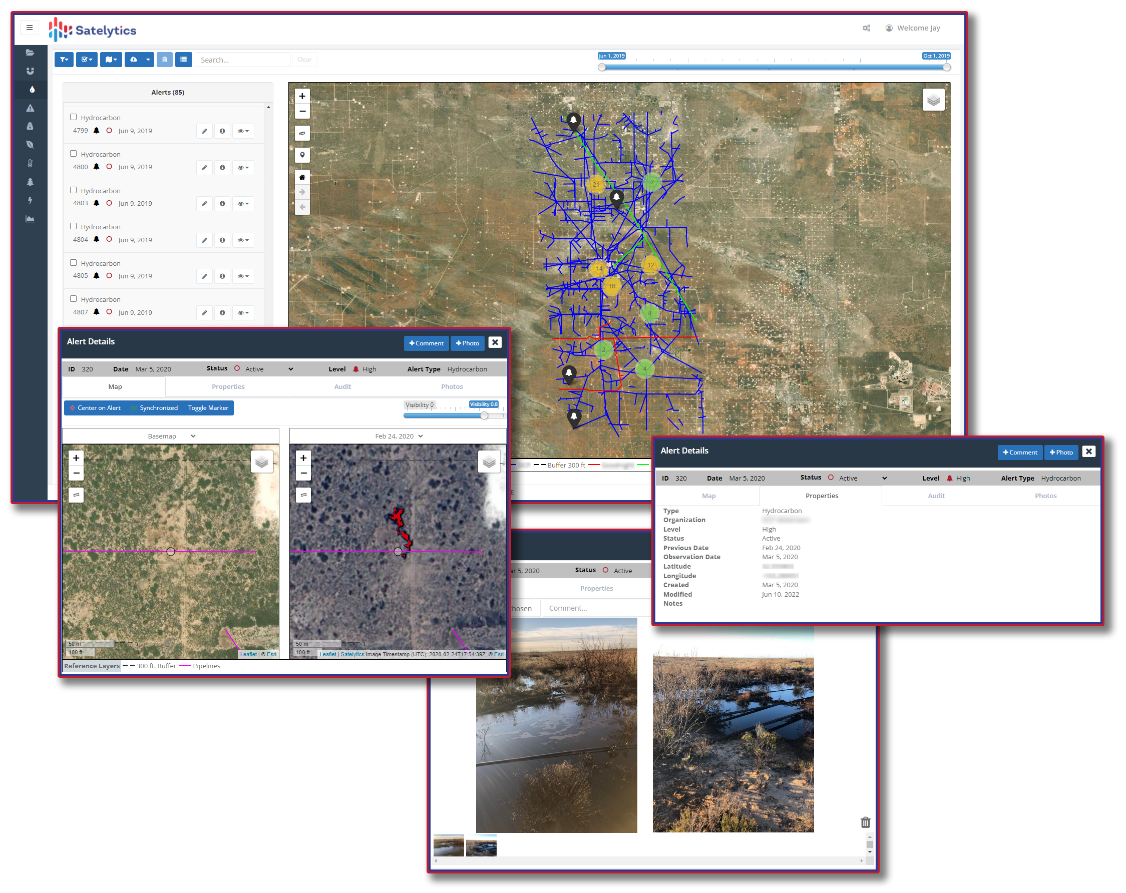
Satelytics replaces these inefficiencies with a smarter, more effective approach. Using satellite data and advanced geospatial analytics, Satelytics delivers precise insights into threats as small as a square foot. This technology can monitor vast pipeline networks while simultaneously capturing granular details. Powered by AI, Satelytics enhances monitoring programs to meet regulatory requirements while significantly reducing the carbon footprint associated with traditional air or ground inspections.
Satelytics proactively monitors for critical issues, including:
The bottom line: Geospatial analytics is redefining pipeline monitoring. It empowers operators to protect assets, meet compliance standards, and safeguard the environment—all while surpassing the limitations of aerial surveys.
Don’t let outdated assumptions hold you back. Reach out to us today for real-world examples of companies already embracing smarter, more effective monitoring solutions.