• General

• General
Generative AI has taken the spotlight in technology, but there's another innovation reshaping industries behind the scenes — geospatial analytics. By combining satellite imagery with cutting-edge analytics, geospatial intelligence unlocks actionable insights from massive datasets, transforming how organizations monitor and protect critical infrastructure. From measuring methane leaks to spotting vegetation encroachment, these advancements are revolutionizing operations with a level of precision and efficiency that was once unimaginable.

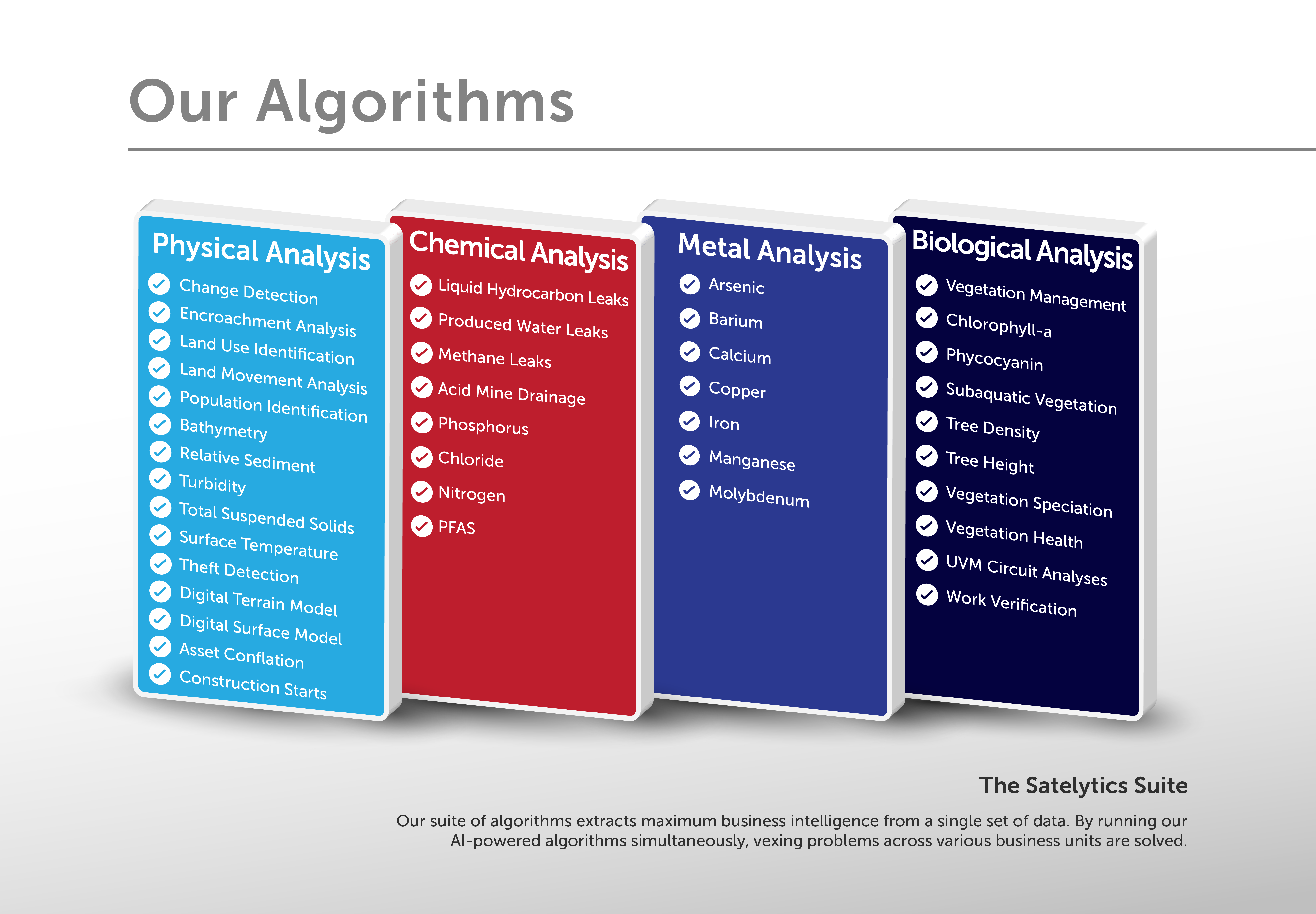
Solve multiple problems by analyzing one set of data.
Traditional infrastructure monitoring methods, such as routine physical inspections, are expensive, time-consuming, and often inefficient. AI-powered geospatial analytics, like Satelytics, offer an alternative that removes these inefficiencies by generating timely actionable alerts that point your team to issues requiring their expertise. Organizations can now monitor pipelines, transmission lines, and other large assets without stepping into the field.
Geospatial analytics identifies risks — including liquid leaks, geohazards, and third-party interference — almost instantaneously. This allows specialists to focus their expertise where it’s truly needed, instead of deploying resources on low-value inspections. For companies managing assets across vast areas, adopting geospatial analytics isn’t just a technological improvement — it’s a significant operational advantage.
To make full use of this powerful technology, it's essential to approach integration methodically. Here’s a three-step plan to build a geospatial analytics program effectively:
1. Define Your Business Challenges
Start by pinpointing the primary issues you need to address. Whether it’s methane detection, vegetation overgrowth, or third-party encroachment, geospatial analytics provides sophisticated algorithms to tackle these challenges with precision. From this foundation, secondary risks can be incorporated seamlessly, expanding the program’s scope without extra cost.
2. Determine the Right Monitoring Frequency
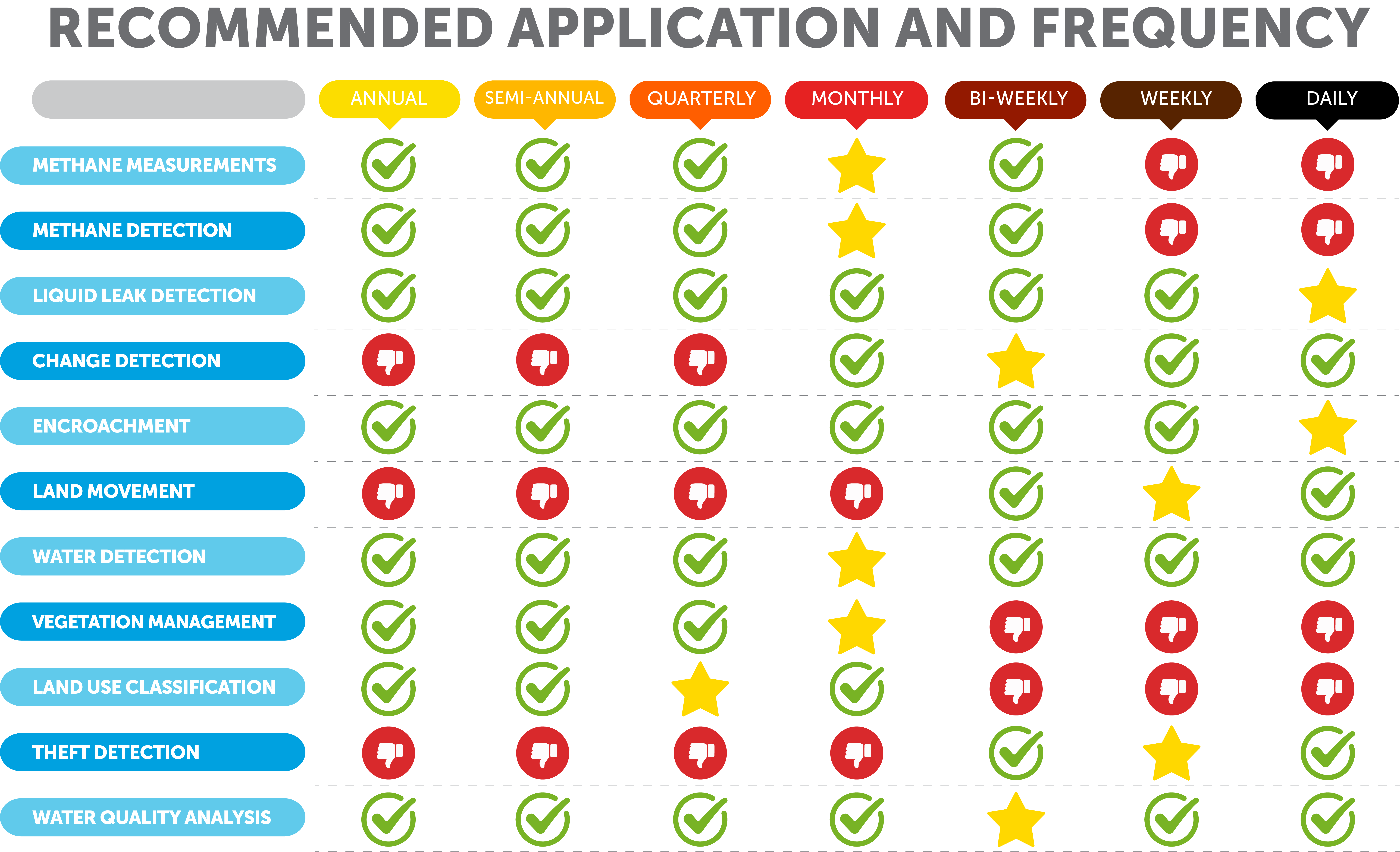
Successful AI-powered infrastructure monitoring hinges on collecting data at the right intervals. Depending on regulatory requirements and risk exposure, frequencies can range from daily to weekly or beyond. With access to imagery from multiple satellite vendors, Satelytics delivers timely insights no matter the revisit schedule, ensuring organizations stay ahead of threats.

3. Start Small, Then Scale
Begin with a focused Proof of Concept (POC) project targeting a high-priority region. This approach not only validates the technology's effectiveness but also refines operational protocols, establishing a strong foundation for future scaling. Measured KPIs during the POC phase help build confidence and ensure long-term success as AI-powered infrastructure monitoring expands across larger territories.
The integration of satellite technology and AI is no longer a distant possibility — it’s a reality, transforming how industries manage risk and assets. Tools like Satelytics simplify operations and mitigate risks, making every day without them a missed opportunity to streamline and safeguard your processes.
Now is the time to harness the power of geospatial analytics. Start small, stay focused, and prepare to revolutionize how you monitor and protect your critical infrastructure. Contact us today to take the first step in transforming your approach to risk management.