• Oil & Gas,Pipeline Operators

• Oil & Gas,Pipeline Operators
You oversee a vast network of pipelines and well sites stretching across thousands of square miles. The job demands constant attention to every inch of that infrastructure for leaks, emissions, and encroachments. Using traditional methods is Mission Impossible, right? This challenge isn't just an operational headache—it's a multimillion-dollar risk waiting to happen.
In December 2024 alone, multiple headlines screamed of massive spills:
"Pipeline Spills 70,000 Gallons of Oil in Wisconsin"
"10,000 Gallons of Produced Water from a Pipeline Leak in Billings County"
Each incident likely ran up a bill in the multimillion-dollar range. But the true cost goes beyond cleanup. There's regulatory scrutiny, landowner disputes, and the ever-present threat of reputational damage. In an industry where public trust is already fragile, these incidents can be catastrophic.
But, geospatial analytics is rapidly becoming the new default for monitoring large-scale infrastructure. It's no longer an interesting experiment—it's a critical tool for operational excellence. Satelytics leads this revolution with a comprehensive suite of solutions that deliver tangible value:
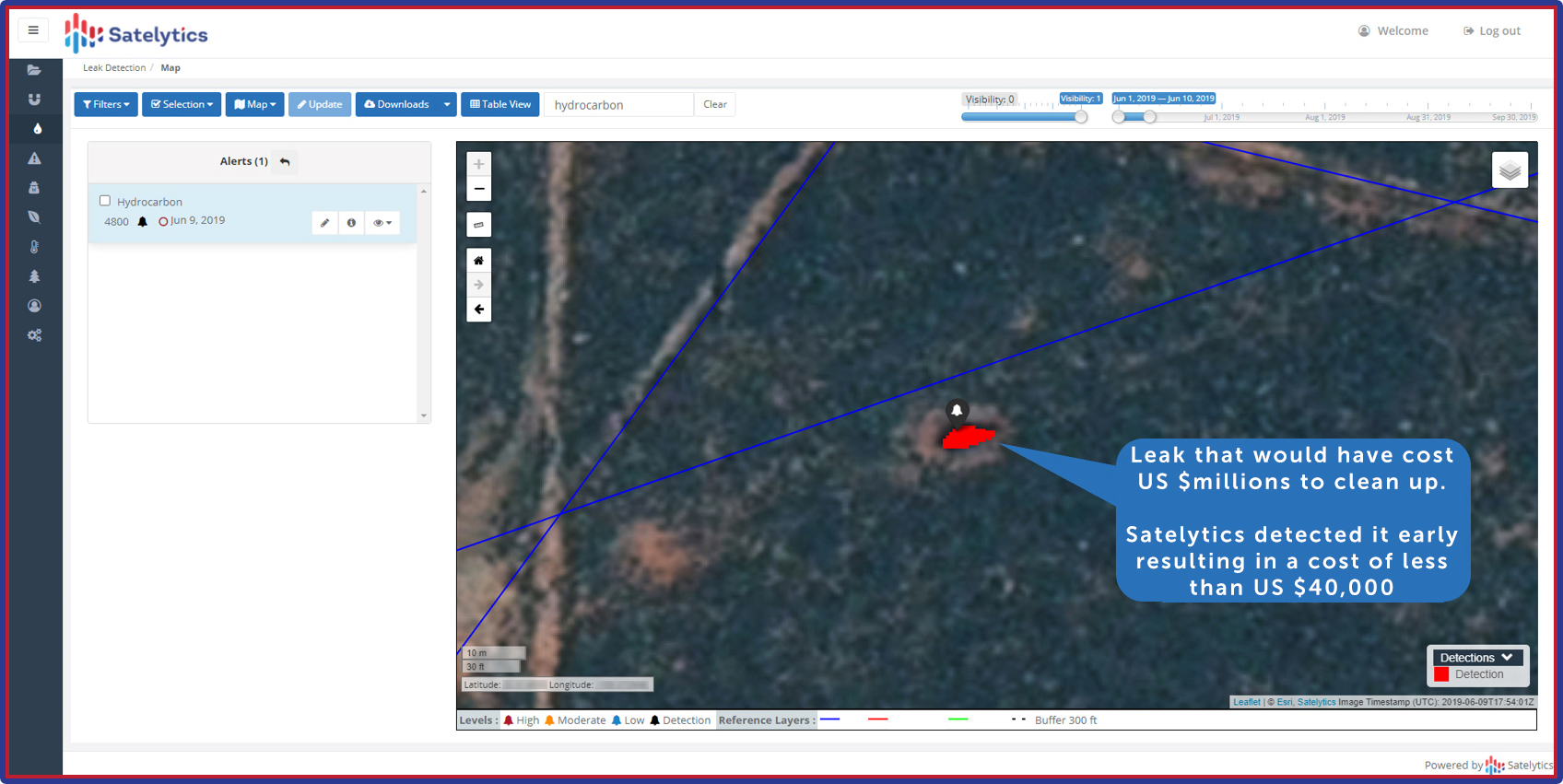
1) Early Leak Detection: Catch Issues Before They Escalate
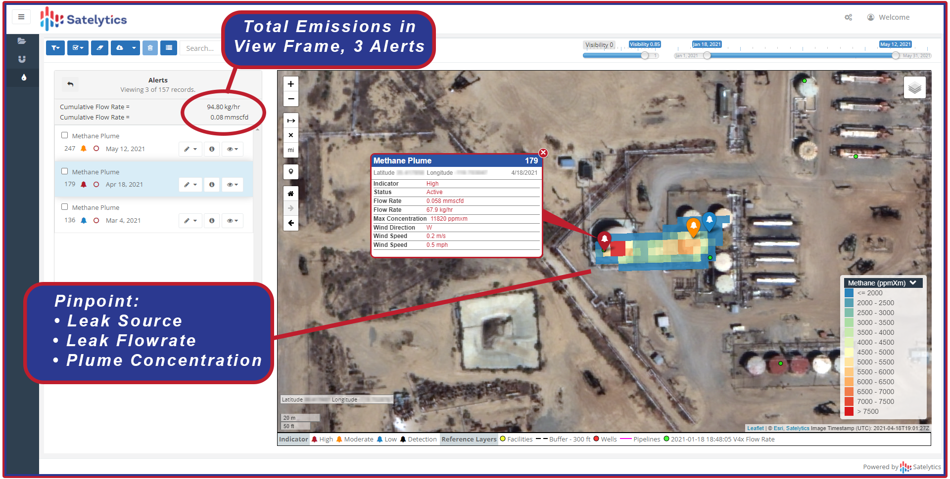
2) Precision Methane Monitoring: Turn Emissions into Savings
3) Proactive Encroachment Management: Safeguard Your Assets
4) Comprehensive Land Movement Analysis: Predict and Prevent

Catch liquid leaks before they yield disaster.

Measure oilfield methane emissions to avoid negative headlines.
The true magic of geospatial analytics lies in its integrated approach. By analyzing a single set of satellite data through multiple analytical prisms, we provide a comprehensive view of operations. This not only maximizes ROI but also reveals interconnected risks and opportunities that siloed solutions miss.
A major North American oil & gas company implemented Satelytics' multilateral geospatial analytics in 2021 with the following results:
Geospatial analytics is transforming how the oil and gas industry manages risk and opportunity. It's not just about avoiding disasters — it's about unlocking hidden value across your entire operation.
In an industry where margins are tight and risks are high, geospatial analytics isn't just an advantage — it's a necessity. The question isn't whether you can afford to implement these solutions. It's whether you can afford not to.
Don't let your next headline be about a preventable disaster. Contact Satelytics today to discover how our cutting-edge geospatial analytics can transform your operations, protect your assets, and drive your business forward.