• General

• General
I heard those words frequently from my dad growing up — focused on my education, sports endeavors, and work ethic. Early morning basketball practice? Always show up. Attend every class, even if I knew the material. Show up to the job and then finish it completely. These lessons have benefited me greatly throughout my life, and I am now passing them down to my children. What does this have to do with Satelytics? Everything!
It means a great deal, I think, to start off on a foundation which one has made for oneself.
Booker T. Washington
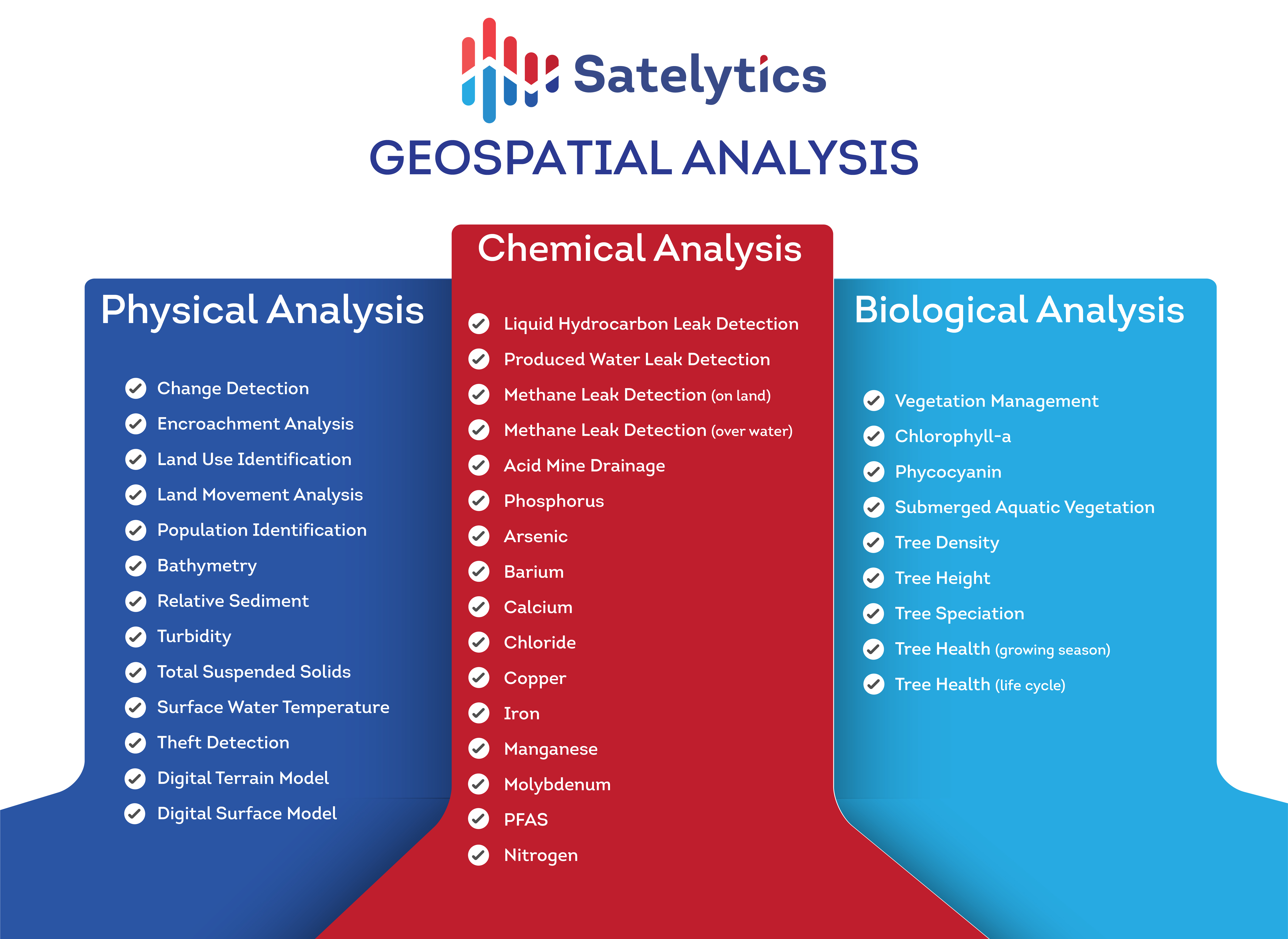
Satelytics was founded on the ability to take one set of water quality measurements from an extremely reliable data source — satellite imagery — to get ahead of threats and reduce consequences. Our scientists took that small idea from the lab to the real world and have since built a suite of more than 36 algorithms — serving not only the water industry — but oil & gas, midstream, and power utilities as well. Our algorithms show up and work to continuously improve their accuracy as they ingest more data. While human activities can be hampered by any number of constraints (as we saw in 2020!), Satelytics' software, coupled with established data sources, works anytime and anywhere.

Satelytics' algorithms show up for work.
Satelytics’ measurements are agnostic to the source. We process data from drones, fixed-wing aircraft, fixed cameras, stratospheric balloons, and, of course, satellites. A vast majority of our current workload utilizes the built-in infrastructure of high-resolution satellite networks. These platforms cover thousands of square kilometers in minutes, often with daily revisit times. This revisit time is expected to decrease to minutes in the coming years as the satellite industry continues its rapid growth.
Once the data is gathered by the sensor, Satelytics’ algorithms show up and go to work processing every pixel, every time. Think about the possibilities associated with being able to monitor every square foot of your reservoir, ROW, natural gas distribution network, city, forest area…and to then receive automated, prioritized, accurate alerts. Satelytics' customers set the thresholds, buffer zones, alarms, and even how they receive the data on our web platform or their internal system.
While our eyes see red-green-blue, Satelytics' algorithms work in the infrared spectrum to detect — and often quantify — constituents of interest. Each algorithm looks for the unique spectral fingerprint of the constituent of interest to differentiate between structure, vegetation, hydrocarbons, phosphorous, methane, and much more.

An arsenal of algorithms to address specific industry challenges.
When a high-priority threat has been identified, response personnel can use Satelytics for the non-connected world out in the field and in remote areas where cell service is lacking.

Satelytics for the non-connected world.
Our software applies science principles, allowing us to do things that are unmatched in the geospatial analytics industry. Our professionals have built these tools that show up and work, and I get to see and hear the success stories from my customers who have signed up to put this cutting-edge tool to work for them.