
• Power Utilities
• Power Utilities
Satelytics’ customers are looking to the skies for data to improve their utility vegetation management (UVM) programs. Our machine learning algorithms analyze high-resolution satellite imagery, capturing information on extensive areas of interest in minutes. Results are available a few hours after satellite overpass — offering a scale unmatched by other remote sensing platforms such as UAS or aircraft.
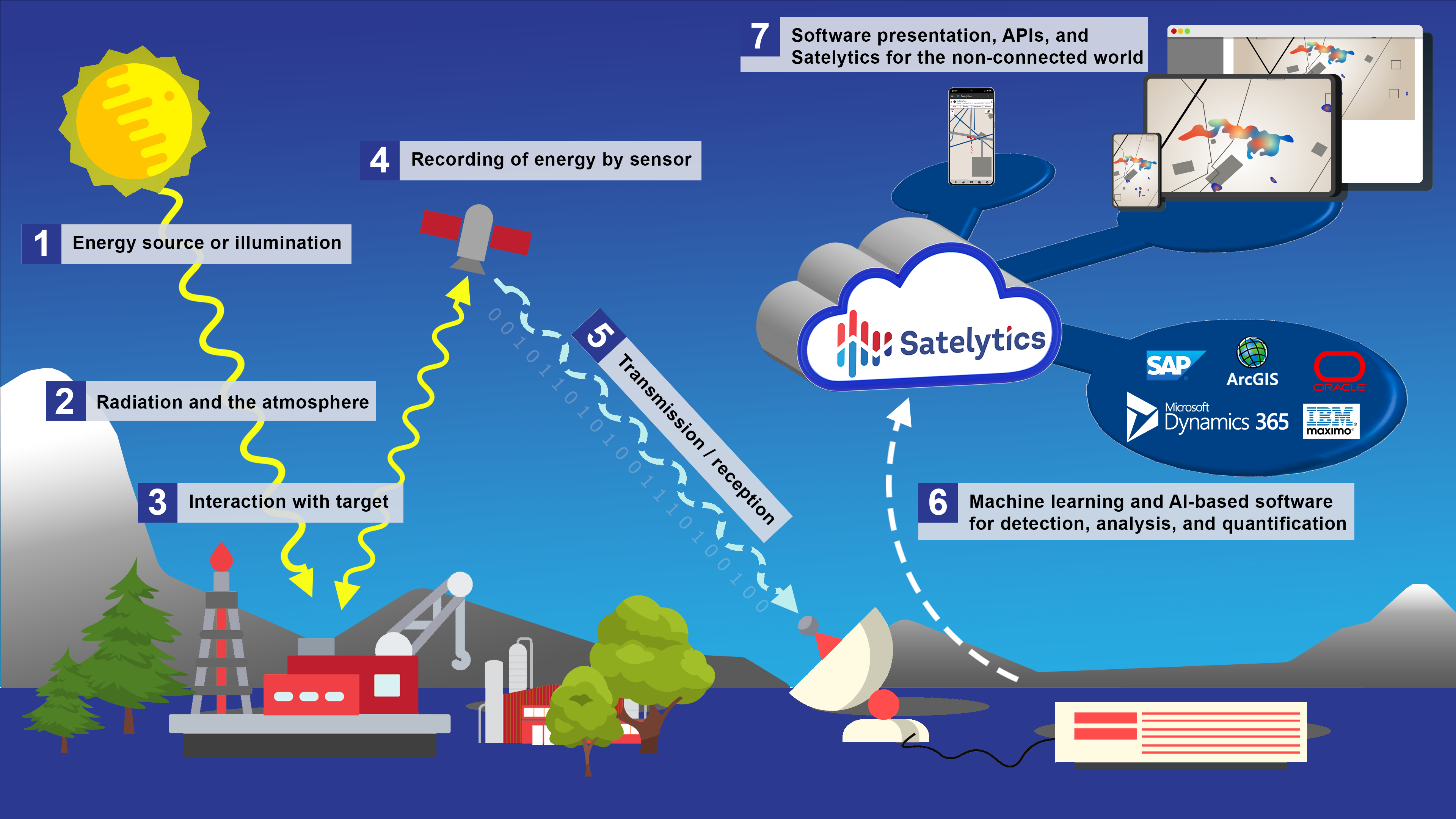
We are using these algorithms to provide utilities and UVM crews height measurements (discussed in part one of this series), speciation, and health assessment. Collectively, these analyses help us identify and alert to strike potential threats. The following are current application examples.
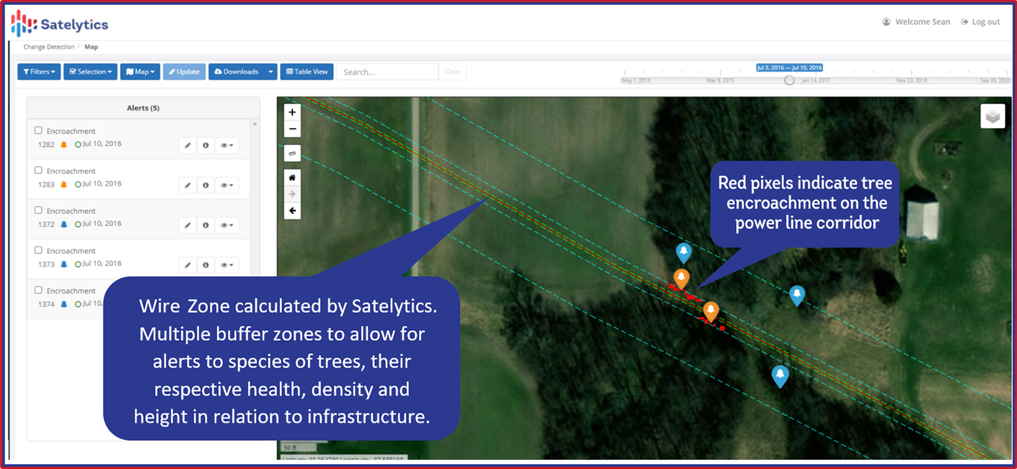
In the last few decades, parts of the United States have experienced infestations of the emerald ash borer beetle. The northern plains, where I live, are no exception. Every summer, the city arborist marks compromised trees around town with orange spray paint, then cuts them down to stem the tide of infestation. We work with utilities to identify ash trees along transmission corridors to reduce encroachments and strike potential on the wire zone.
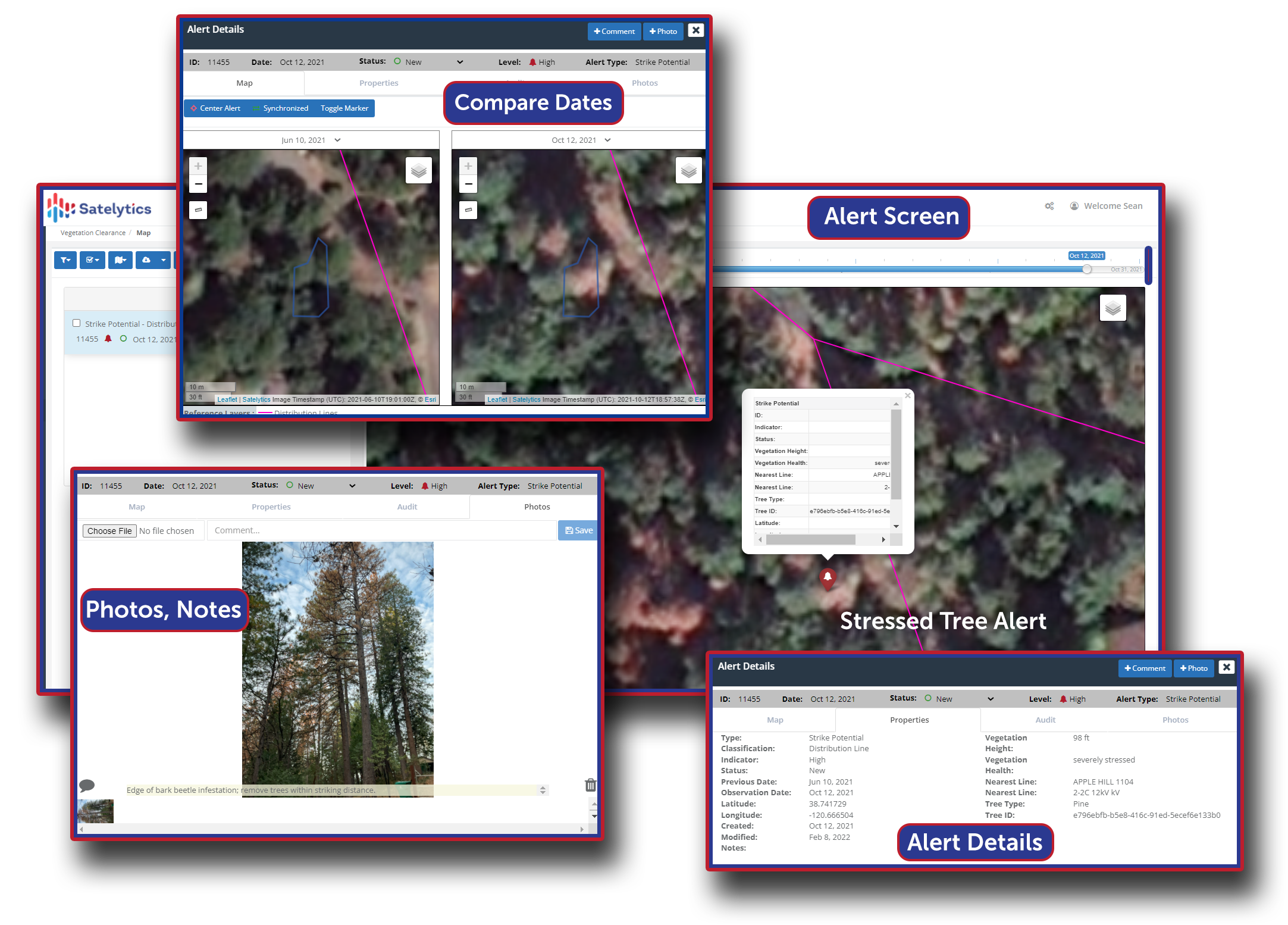
Satelytics is also working with our forestry expert partner, ACRT Services, on a project in the western United States to identify pine trees infected by the mountain pine beetle. As shown in the examples below, we are utilizing high-resolution infrared imagery to detect vegetation stressors like chlorosis and moisture. ACRT has been our expert-on-hand, ensuring the accuracy of the satellite results and advising utilities on best remediation responses.
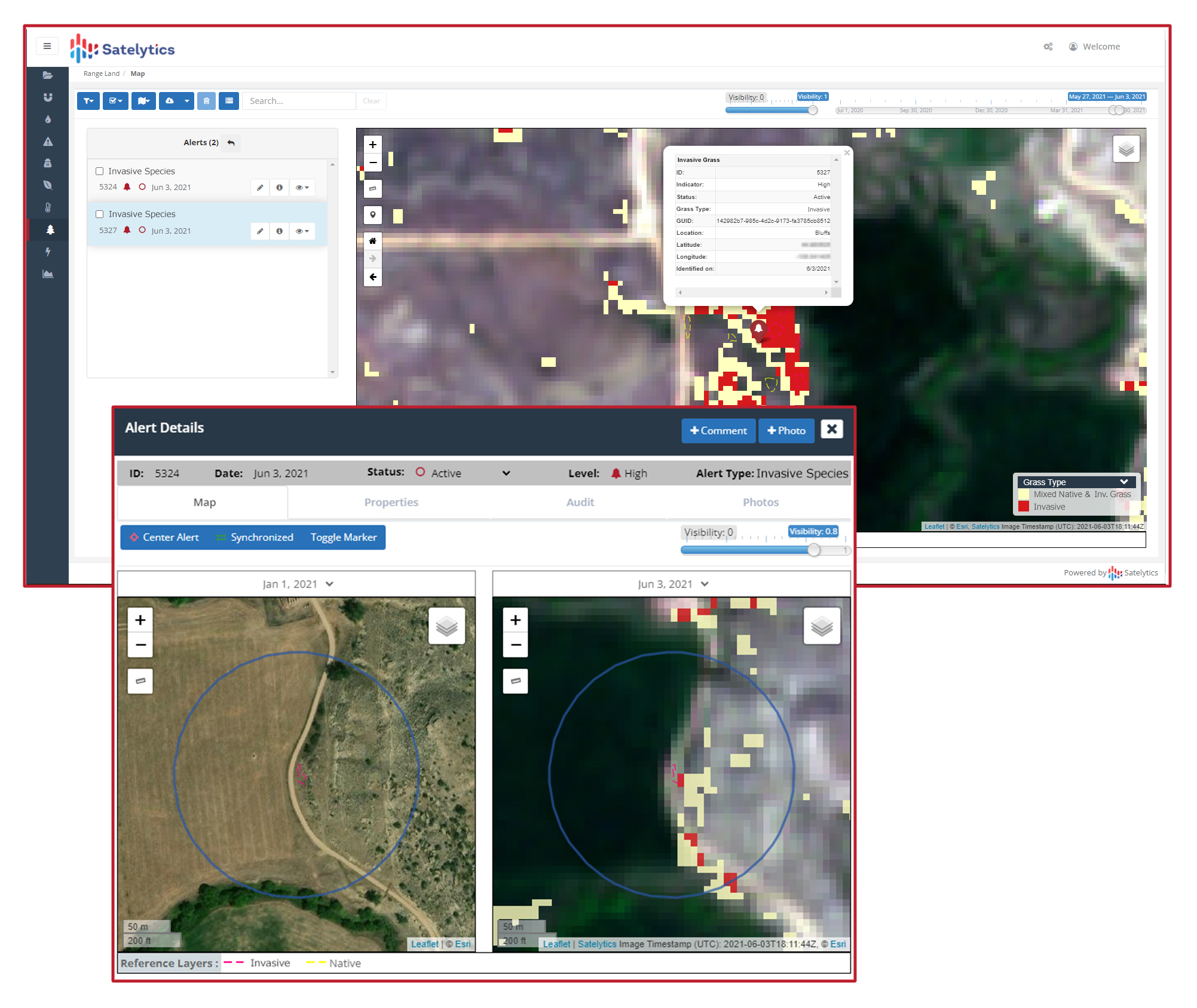
Grasses, brush, and shrubbery can also be identified and monitored, giving you the complete picture of vegetation in the field. Tried and tested, Satelytics provides value TODAY for our electric utility customers.
Incomplete utility vegetation management is costly and does not produce actionable results. Satelytics analyzes high-resolution satellite data with artificial intelligence and cloud computing to return actionable results in a timely manner, providing our customers with data to optimize and protect their operations, wherever and whenever.
We use cookies to analyze our web traffic and to enhance your experience. By continuing to view this website, you agree to our use of cookies.
Our Privacy Policy