• Electric & Gas Utilities,Water & Wastewater

• Electric & Gas Utilities,Water & Wastewater
Satelytics gives water quality experts the tools to identify sources of sediment loading to plan preventative and remediation measures. Part of this suite is our total suspended solids (TSS) and turbidity algorithms, which map and quantify sources of sediment load and their spread. We also measure bathymetry to a depth of 40 feet, tracking natural and human-caused sediment build-up around infrastructure.
How are these algorithms being applied? Watershed managers use TSS and turbidity to track everything from wildfire ash loading into a reservoir to sediment sources from activities surrounding streams and rivers, using this data to direct remediation and compliance efforts. Activities like population growth, agriculture, the draining of wetlands, and deforestation all affect water quality by introducing particulates into watersheds. Customers also use our TSS algorithm immediately after storms and natural disasters — identifying issues triggered by flooded rivers and lakes.

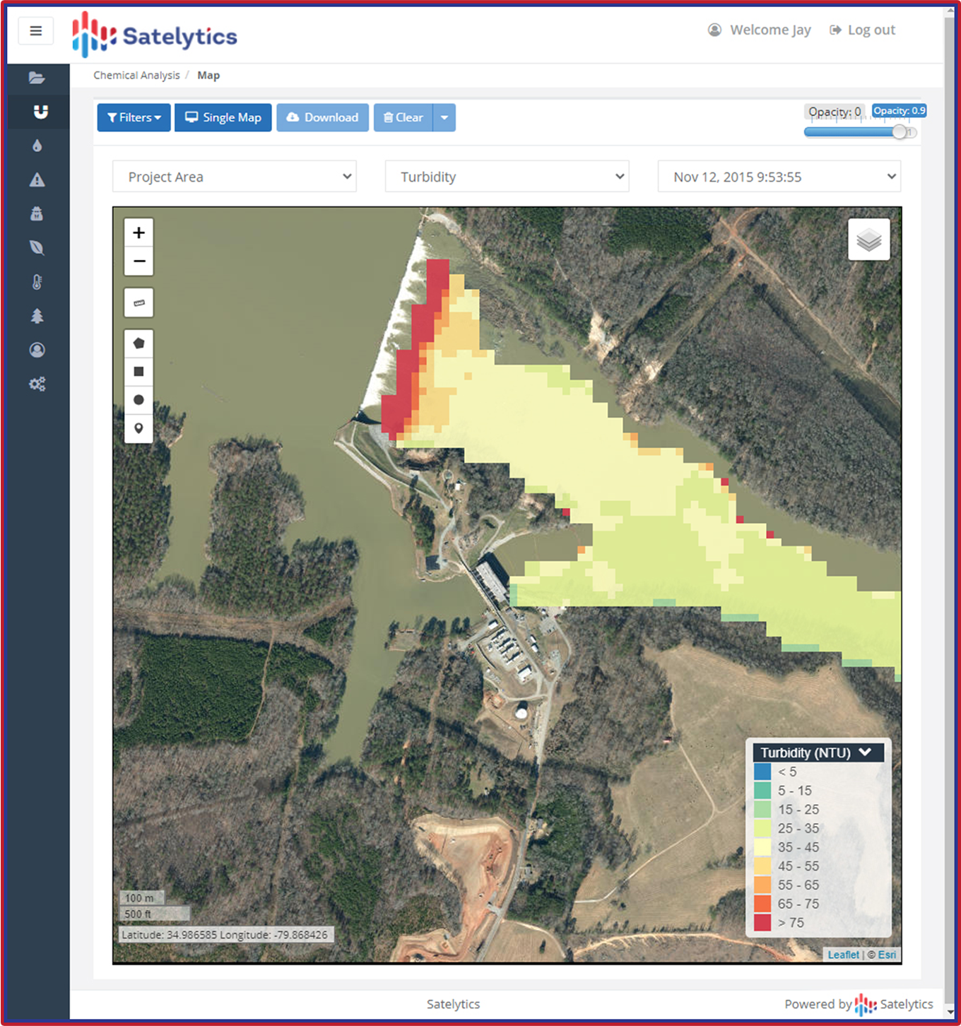
Satelytics measures turbidity in waterbodies and along infrastructure, like this dam.
Our bathymetry algorithm has been used to map the floors of rivers, lakes, estuaries, ocean bays, and more. This data points to areas where dredging is needed and can be utilized to monitor sediment buildup near dams and canals. Contours can be updated regularly and easily with new satellite data analyzed by Satelytics algorithms.

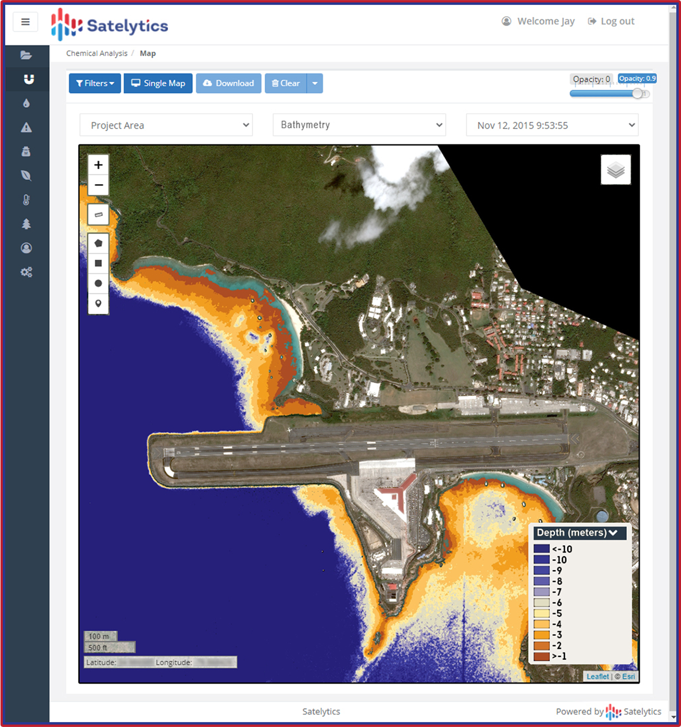
Measure bathymetry along assets and infrastructure.
Additionally, Satelytics can monitor vegetation in stormwater treatment areas and marshlands that absorb nutrients before they contaminate open waterbodies. We also speciate and quantify areas where subaquatic species like hydrilla affect reservoirs and lakes, obstructing waterways and plant cooling water intakes.

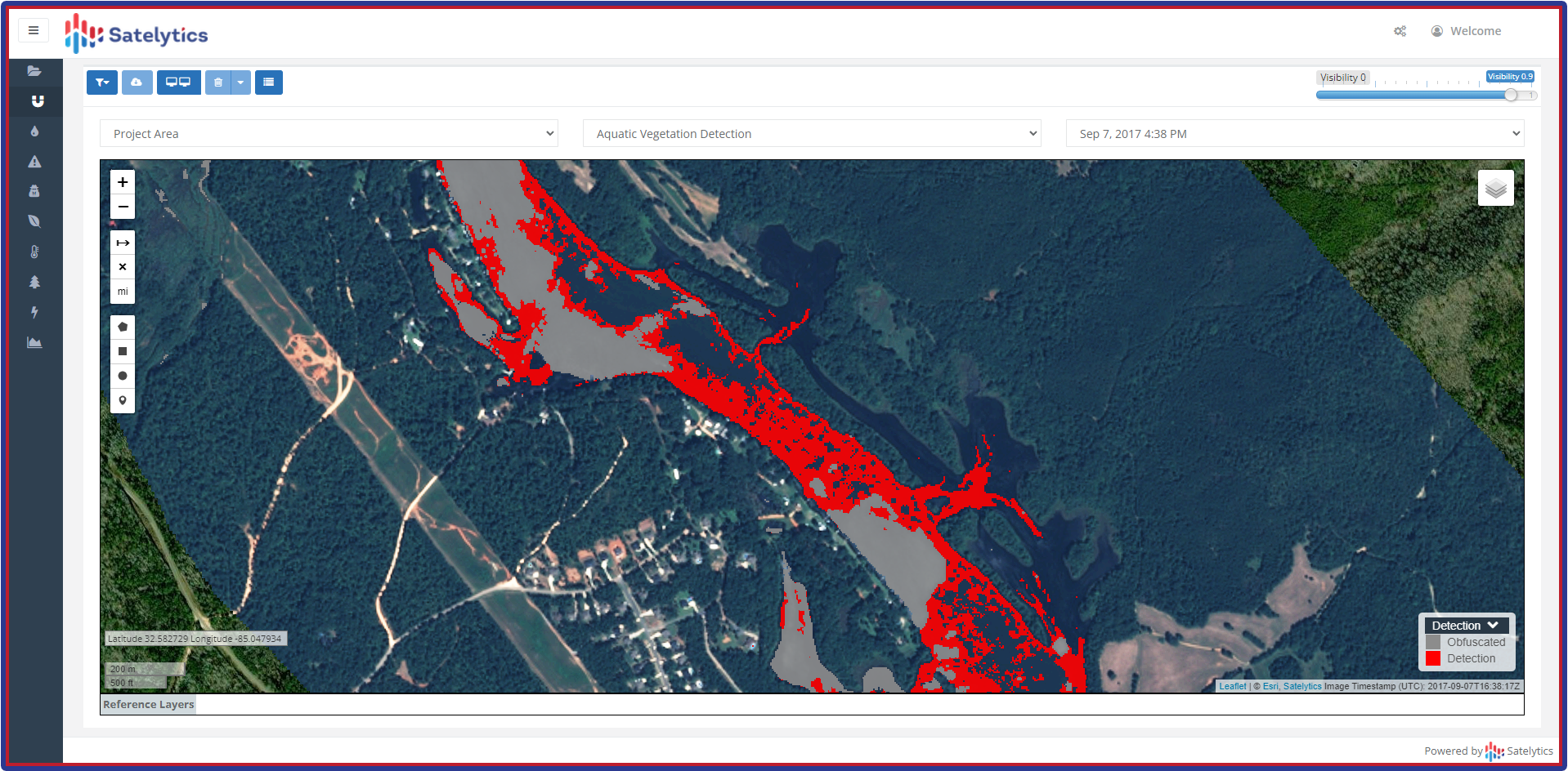
Determine if subaquatic vegetation is clogging assets and waterways.
This is only a fraction of Satelytics’ water quality capabilities used to paint a complete picture of the health and mechanisms at play in watersheds of all sizes across the globe. Forward-thinking water utilities are using our data right now. Call us today for a demonstration with real customer data.