• General

• General
Geospatial analytics, powered by high-resolution satellite imagery and artificial intelligence, has transitioned from a futuristic concept to an essential business tool. What once seemed impossible—remotely monitoring thousands of square miles of assets—is now a practical reality with Satelytics. Companies can now detect and quantify threats to vast infrastructure networks, from encroachments and geohazards to vegetation overgrowth and liquid leaks.
Embarking on a geospatial analytics program is a significant step toward a more efficient, secure, and compliant future. But how do you ensure this powerful data stream is integrated successfully into your existing asset management systems? A well-planned Proof of Concept (POC) is the foundation, but true, long-term success requires more than just technology. It demands a strategic vision, a commitment to transformation that extends beyond the initial contract, and a plan – we outline the latter here.
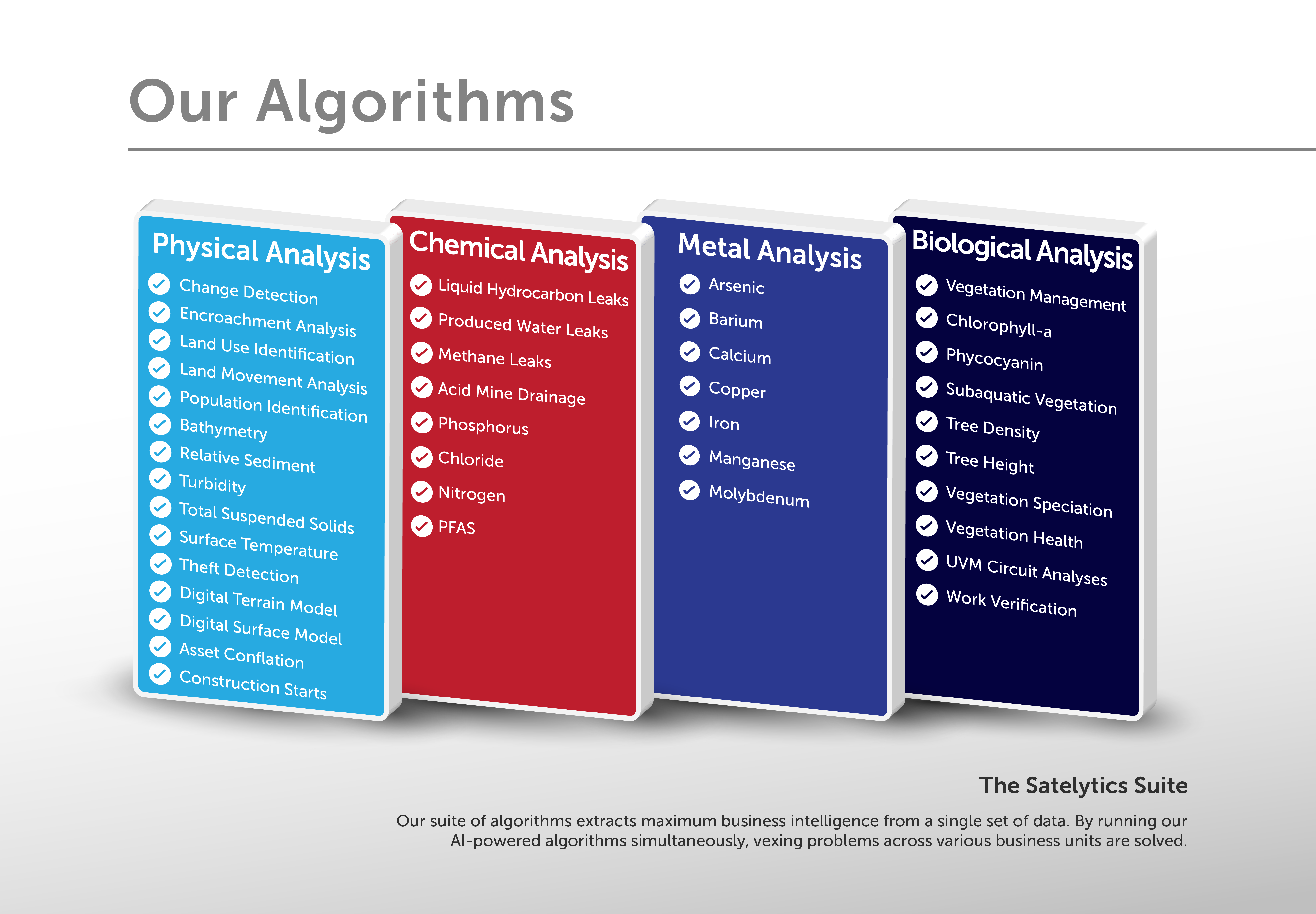
First, identify the most pressing challenges you need to solve. Satelytics’ advanced algorithms can detect a wide range of threats to large energy delivery systems and other critical infrastructure. These include liquid leaks, methane emissions, encroachments from third-party activity, geohazards like land movement, and vegetation management.
While every project begins by addressing a primary challenge, our technology encourages the seamless addition of secondary and tertiary analyses at no extra cost. This multi-faceted capability ensures you gain maximum value from a single data acquisition, turning a targeted solution into a comprehensive monitoring program.

Next, establish the right data collection cadence to mitigate risk effectively. With access to a wide selection of commercial satellite vendors, Satelytics’ algorithms are trained to process data from numerous sources. We can meet even the most demanding revisit schedules.
The ideal monitoring frequency often depends on specific risk profiles and regulatory requirements. By working with our team, you can align the data capture schedule with your operational needs, ensuring timely detection of threats while optimizing costs.
Although satellites cover vast territories and our AI scales effortlessly in the cloud, beginning with a smaller, focused area is crucial. Select a region with known challenges to validate the power of geospatial analytics during your POC. This allows you to test the technology, measure key performance indicators (KPIs), and refine your internal response processes in a controlled environment.
This foundational approach builds confidence and ensures your teams are operationally ready before expanding the program to cover larger asset areas. It’s about starting small to prepare for big, transformative results.
The real work of transformation begins after the POC is complete and you’ve committed to a full-scale program. Technology alone is not a silver bullet. Sustained success depends on two critical organizational factors: a clear corporate commitment to innovation and a robust system for measuring performance.
The move from "business as usual" to a digitally-driven, analytics-based approach requires strong, visible leadership. Without a clearly communicated corporate commitment, internal pockets of resistance can undermine the initiative. Some employees may fear that new AI capabilities will change their roles or even replace them.
Leadership must proactively address these concerns by framing the adoption of geospatial analytics not as a replacement for human expertise, but as an enhancement of it. The truth is quite the opposite of what many fear. Satelytics empowers your teams by focusing their efforts where they matter most. It liberates valuable field personnel from tedious and often fruitless "scouting missions" and directs them to verified areas of concern where their specialized knowledge is indispensable.
This strategic shift elevates your team's role, transforming them from scouts into expert problem-solvers. It allows them to apply their skills to high-value tasks, increasing their impact and demonstrating their worth to the organization. This requires an internal champion who can articulate this vision and ensure every team understands how this new tool amplifies their contribution.
Accountability is the engine of improvement. To maximize the value of your geospatial analytics program, it’s essential to adopt a program scorecard that evaluates performance on both sides of the partnership. This scorecard should not only measure Satelytics’ performance but also provide clear indicators of your own organization's effectiveness in utilizing the data.

Our largest oil and gas customer provides a powerful case study. This industry leader worked jointly with Satelytics to develop an exhaustive scorecard rubric. This tool tracks metrics that show areas of exceptional performance and areas requiring improvement—for both Satelytics and the customer’s internal teams.
By tracking metrics like alert response times, validation accuracy, and risk mitigation success, the customer can build a powerful business case for management. The data demonstrates the tangible value of geospatial analytics, justifying investment and highlighting the program's ROI. More importantly, it provides a clear view of how internal teams are adapting to and leveraging the technology.
Integrating geospatial analytics is more than a technological upgrade; it is a strategic evolution. By following a structured POC process and fostering a post-contract environment of commitment and accountability, you can unlock the full potential of this transformative technology.
Take the first step toward revolutionizing your asset management strategy. Start with a focused project, think about the long-term cultural and procedural changes, and prepare to transform how you monitor and protect your valuable infrastructure.