Satellite Imagery Analysis: The Most Effective Tool for Total Watershed Monitoring
Cyanobacteria (aka blue-green algae) growth has been escalating in freshwater and marine ecosystems around the world over the past decades. Many causes have been cited: excess fertilizer (phosphorus) runoff, warming of water bodies, climatic changes and incidence and intensity of storms and droughts.
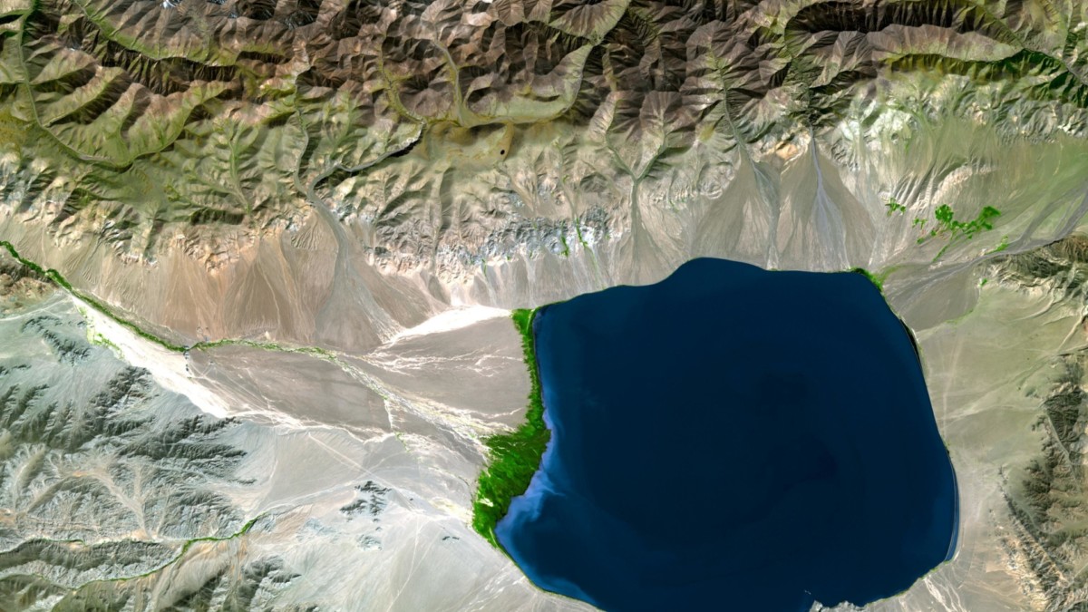
Water managers are faced with the task of solving water body quality problems that often seem to be intractable. Last year a major city, Toledo, Ohio was without potable water for days due to toxins from HAB’s. A key asset in solving the problem is an understanding of the entire watershed—understanding where “hot spots” exist that can be remediated to reduce phosphorus loading.
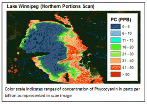
As the earth’s oldest oxygen consuming organisms, these bacteria have become a grave problem. During an algae bloom, there are a host of different algal colonies contained in the “mat,” many of which are harmless. However, a number of algae can be quite toxic, particularly Microcystin. Phycocyanin, a pigment contained in those harmful algae, can be assessed using satellite data and Satelytics' patented algorithm.
Satellite imagery is an effective tool for total watershed monitoring and can be a major contributor to water quality improvements in four significant ways:
- Satellite imagery can be used to determine the location of hot spots;
- Historical satellite imagery (back to 1984) can be used to spot trends;
- Satellite imagery can monitor early emerging blooms and aid in emergent remediation before the bloom becomes lake wide; and
- Satellite imagery can be used to determine the effectiveness of remediation technologies.
The recent US EPA ruling called “Waters of the United States” extends the definition of waters protected by the Clean Water Act to streams, wet lands, etc. These new regulation will further challenge managers going forward. Used correctly, satellite imagery combined with traditional ground sampling can be a significant tool in the water body manager’s tool box for remediating water body quality problems.
