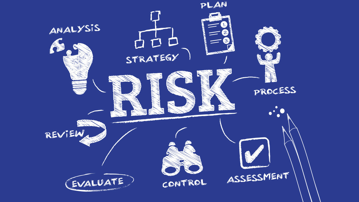
Method in the Madness: Satellite Data Revolutionizes Risk Management for Energy and Water Infrastructure
Business life is full of risks. If you’re in the oil & gas, pipeline, power, and water industries, you should recognize risk analysis challenges. Modern infrastructure operations have more risky parts than the number of outcomes of the NCAA tournament. And by the way, that’s 9.2 quintillion (yes, 18 zeros) different outcomes from that first seed to the final dance.
Dr. Kris Nielsen of Pegasus Global Holdings says “Risk typically is defined as a potential condition, element, event or factor arising during project execution which inhibits or negates the achievement of stated project function, scope, cost, schedule, or quality goals.”
Satelytics was designed from its foundation to assess and rank risk, minimize consequences, and mitigate financial impact for the world’s blue chip leaders in oil & gas, pipeline, power, and water. The challenge with geographically dispersed infrastructure, subject to the elements, is how to gather data on all event possibilities, apply a ranking of priority, and assign resources—people, equipment, and capital. The risk matrix is a most challenging task even with complete data on which to base your statistics.
Satelytics was designed from its foundation to assess and rank risk, minimize consequences, and mitigate financial impact for the world’s blue chip leaders in oil & gas, pipeline, power, and water.
Data, which is the very foundation of the statistical risk analysis—good in some areas, adequate in many—is too often non-existent in others and hopelessly flawed in most. The common thread with the tools and methods available today is that they are based on a small representative data sample set. Ask yourself as a risk professional: how would the risk matrix assessment improve in accuracy if the data being assessed was every pixel and data-point in the area of interest? What if your analysis is looking at water, pipeline, land, vegetation, right of way, facility, or all of them simultaneously?
Satelytics is on the leading edge of software for monitoring asset infrastructure and conditions which might detract from continuity of the operation. Satelytics, at its core, was to designed to eliminate the inaccuracies of the single point analysis in favor of looking at the entire area—every pixel. The engine is a set of algorithms that identify threats from short term to long term: human, geological, operational and those related to mother nature herself.
Every point of data is factored into our calculations providing a spatial visualization of threat locations and distinguishing between operational, human, geological and infrastructure, as well as the severity or quantification of each problem.
Every point of data is factored into our calculations.
Satelytics is by no means the only data a risk or integrity professional would use; however, combined with other datasets, the risk professional’s matrix of assessment, ranking, and prioritization improves in orders of magnitude. The outcome is simply a clearer picture what to do next illustrated with clarity and specificity.
Risk professionals and their colleagues are adopting Satelytics in their calculations effectively creating an operating integrity window where data outside of those parameters alert our clients to action assuring minimal consequence and keeping any disruption or remediation costs to a minimum.
Satelytics will help you identify, evaluate, and eliminate risk
Ranking threats for our customers in oil & gas, pipeline, and power affects a host of the critical business operations inside of those organizations:
- High- and medium-consequence areas (HCA/MCA)
- Health, Safety, and Environment
- Right-of-way management
- Change detection
- Land use and classification
- Water crossing management
- Landslides and sink holes
- Sediment deposition and erosion
- Vegetation management
- Vital data for in permitting
- Vital data for regulatory compliance
- Water quality assessment
- Surface water temperature
- Nutrient loading
- Turbidity
- Harmful algal blooms (HABs)
- Subaquatic vegetation analysis
- Heavy metals on land and in water
- Vital data input for ALL aerial or ground teams
- Identify locations of liquid or gas hydrocarbon leaks
- Critical changes over time (change detection)
Satelytics will help you master the art of risk management
Satelytics has the capacity to monitor any or all operations and infrastructure calculating into the risk matrix events that would cause disruption, have great financial impact, or violate regulations. The data input is absolute: every data-point and pixel is analyzed highlighting with specificity areas that need attention, resources, and action.
Risk allocation in the industries where Satelytics is adopted is like filling out your NCAA bracket: it’s putting predictable ratings on the elements and events that threaten to disrupt continuity of business operations.
How Satelytics Works
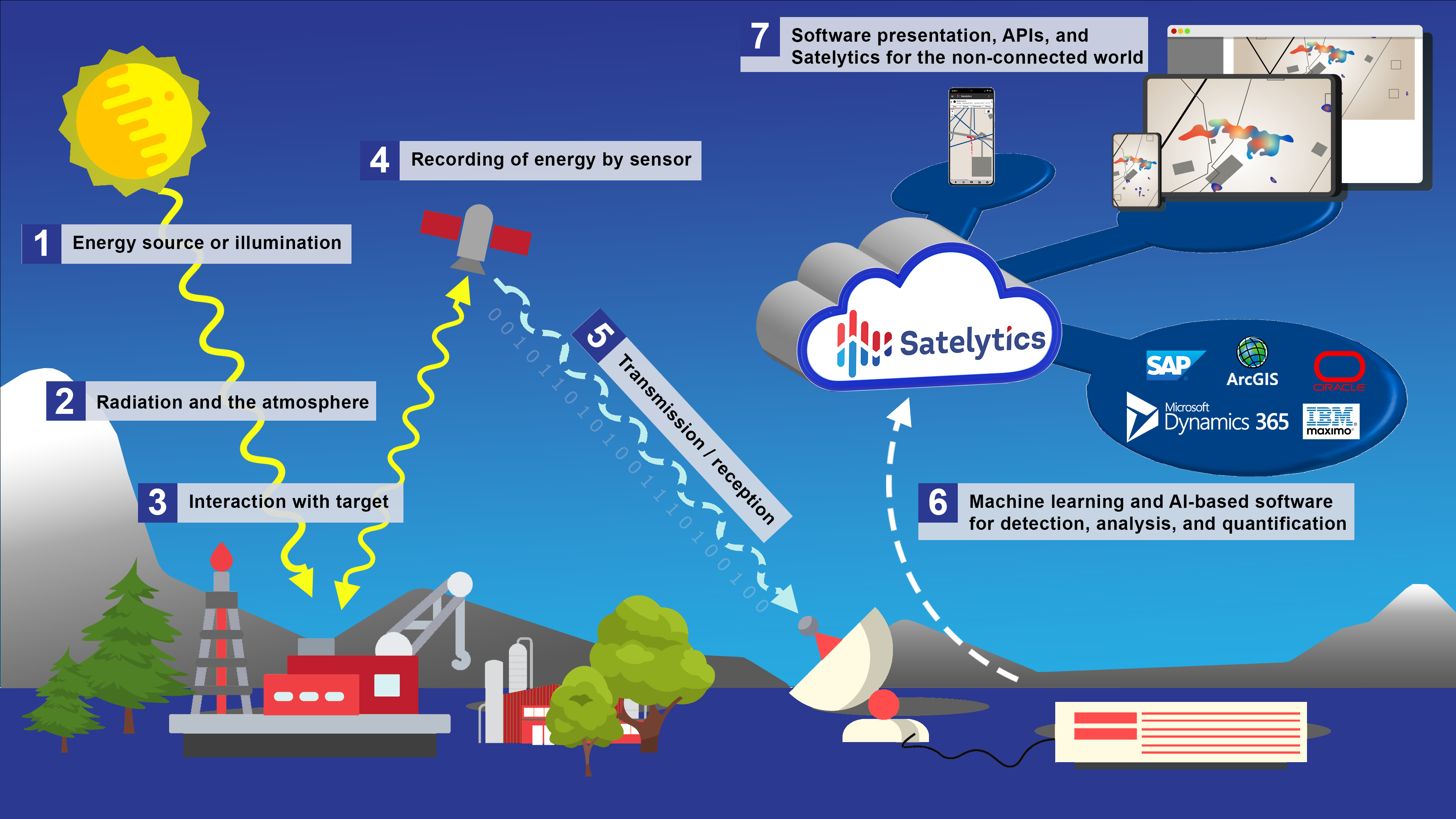
Using finely tuned, proprietary algorithms and the power of the cloud, Satelytics processes volumes of aerial imagery from a variety of sources and collates this data into web accessible dashboards and maps as well as alerts to mobile devices or even to other software via a rich API.
