Press Release
Our AI Can See and Predict Your Problems
Toledo, OH – March 5, 2020. Keeping you right of ways (ROW) and delivery assets clear is a huge cost for utilities. In states where wildfires are common, vegetation management practices are increasingly being reviewed to keep power and gas lines up and running for customers. Traditional vegetation management means sending crews on a regular schedule to perform tree trimming, brush removal, or other practice, into the field or as a response to a customer report.
The topic is becoming so important that in California a federal judge is intervening with a utility to require a certain number of vegetation management workers be employed. In California, utilities are required to work with the California Department of Forestry and Fire Protection on their vegetation practices.
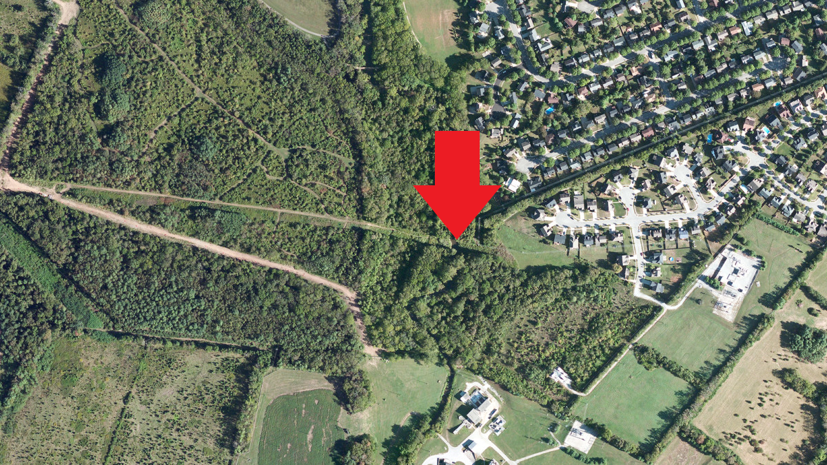
Satelytics can measure vegetation encroachment.
But what if utilities could assign vegetation management crews directly to the area needed, eliminating scheduled inspections altogether? Is there a tool that takes the human aspect of inspection out of the mix increasing productivity and safety? Satelytics’ Constant Vigilance algorithms can measure and inspect vegetation and ROWs using imagery obtained from satellite or other aerial platform and send alerts in a matter of hours to ground teams so they can focus directly on trouble areas. Our software uses artificial intelligence to recognize and alert you to changes along your infrastructure.
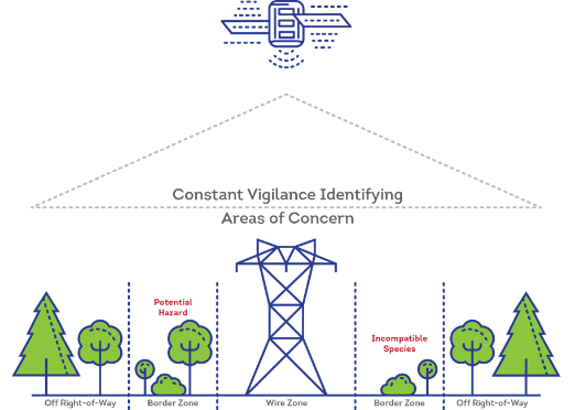
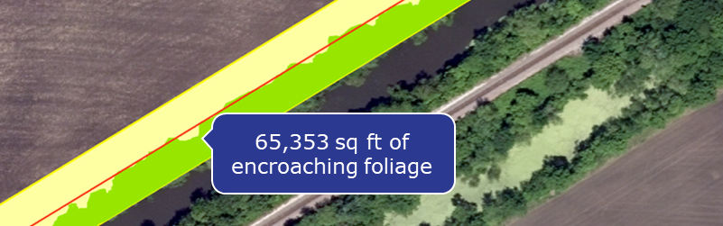
Constant Vigilance watches over your ROW.
The Constant Vigilance alerts are distributed to your teams via text or email, including latitude/longitude coordinates where the maintenance is needed. An investment in Satelytics software can save your company money and promote safety by taking inspection crews off the road. Our technology can even identify tree species that may have a higher consequence in your ROW. We also work with our customers to monitor growth of vegetation in areas where remediation efforts have occurred or in response to extreme weather events.
If your company would like a demonstration of Satelytics’ vegetation management tools please reach out to us today!
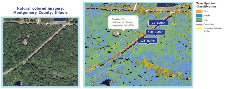
Satelytics can speciate trees in your high consequence area.
Satelytics Inc., www.satelytics.com is a cloud-based geospatial analytics software suite. Multi or hyper-spectral imagery is gathered from satellites, UAV, planes, and fixed cameras, and processed to provide both alerts and qualitative results for our customers. Data can be gathered on up to a daily basis and results sent to customers in hours. This includes the specific problem, location, magnitude, and even qualitative information, which minimize cost, impact, and operational disruption for our clients.
For more information, contact David Dunham, ddunham@satelytics.com, (o) (419) 728 0060 extension #101, (c) (701) 213 0294.
