Press Release
Wildfire Burn Scar Analysis Can Predict Infrastructure Damage
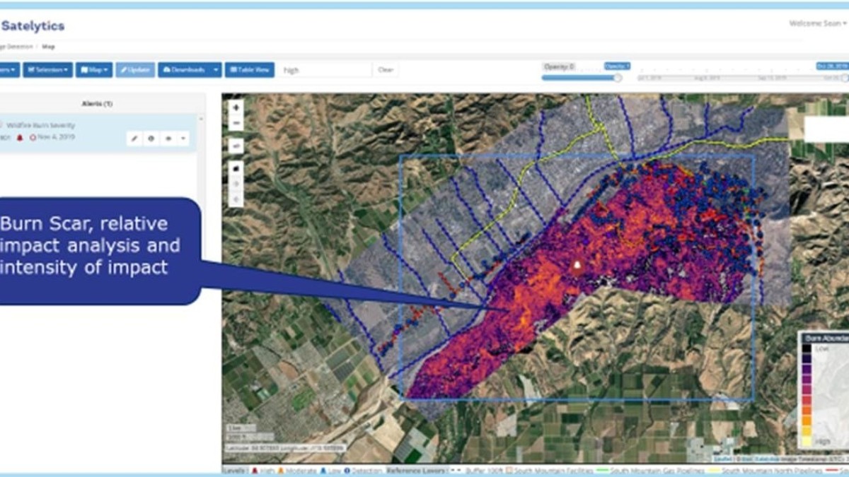
Toledo, OH – February 12, 2020 – Satelytics Inc., working with one of its industry clients, has developed a burn scar analysis algorithm that when overlaid with the owner’s assets can alert companies to compromised locations and high consequence areas.
The consequence of wildfires is not just a present-day issue but also a potential future area for landslides and erosion once vegetation has been damaged. Soil exposed to the elements is likely to cause damage to buried infrastructure below. Industry has reported remediation costs averaging $90,000 per landslip incident. Monitoring with Satelytics and its artificial intelligence software platform can save companies hundreds of thousands of dollars in remediation costs.
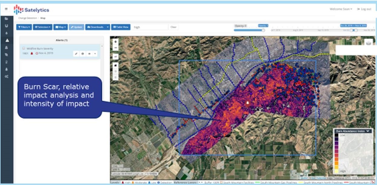
Satelytics wildfire burn scar analysis for industry client.
A parallel to the burn scar vegetation problem is snow melt and runoff in other colder regions. Satelytics is working with clients to monitor these areas as well.
Satelytics Inc., www.satelytics.com is a cloud-based geospatial analytics software suite. Multi or hyper-spectral imagery is gathered from satellites, UAV, planes, and fixed cameras, and processed to provide both alerts and qualitative results for our customers. Data can be gathered on up to a daily basis and results sent to customers in hours. This includes the specific problem, location, magnitude, and even qualitative information, which minimize cost, impact, and operational disruption for our clients.
For more information, contact David Dunham, ddunham@satelytics.com, (o) (419) 728 0060 extension #101, (c) (701) 213 0294.
