
• General
• General
I started mowing lawns for my neighbors when I was 12. It was typical kid stuff — just trying to make a few bucks. After a few months and perfecting my ability, I picked up a few more yards and found I enjoyed leaving every blade of grass looking perfect for the homeowners. Over the next ten years, that little lawnmowing “business” grew and paid for my college with money to spare! While mowing was a large portion of Dunham’s Lawn Service revenue, I decided that to make the grass look perfect, I would have to do something about the pesky dandelions that proliferate during North Dakota summers. I began applying herbicide, which removed the yellow-speckled appearance and left a nice green yard.
We take it for granted, but our eyes and mind are powerful tools that can discern height, health, concentration, and speciation of plants, grasses, weeds, or trees. We can sense that a blade of grass is green and skinny, while a dandelion is yellow and round. Our eyes and mind recognize color, shape, and texture.
Two things limit us in this seemingly simple task. The first is our ability to learn and identify new objects. I wouldn’t be able to identify the dominant weed species for a lawn in South America until someone educated me. The second is our ability to see acutely over long distances. I can glance at my yard and determine if the weeds need attention, but I can’t glance at the entire park across from my home and determine if it all needs dandelion treatment or just a portion. It is too large of an area.
Satelytics algorithms address both these human deficiencies with artificial intelligence and cloud computing. We build and train our models to detect the unique spectral signature of vegetation found in data from commercial satellite sensors. The spectral signature of an oak tree is different from that of a pine tree. Grasses native to the Midwest have a signature unique from grasses native to ranchlands in the Southwest. Invasive species as small as a dinner plate can be identified using the highest resolution data sets and prior knowledge of a plant’s spectral signature. When this is applied over large asset areas, enormous data sets emerge that can be quickly analyzed with cloud computing, revealing measurable outputs for our customers' unique projects.
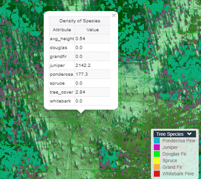
Speciation achieved via interpretation of unique spectral signatures.
Use Cases
For our electric utility customers, tree speciation and strike potential in the wire zone are common. Location and concentration of ash trees are important for one customer in the northeast as they proactively harvest to stay ahead of ash beetle infestations.
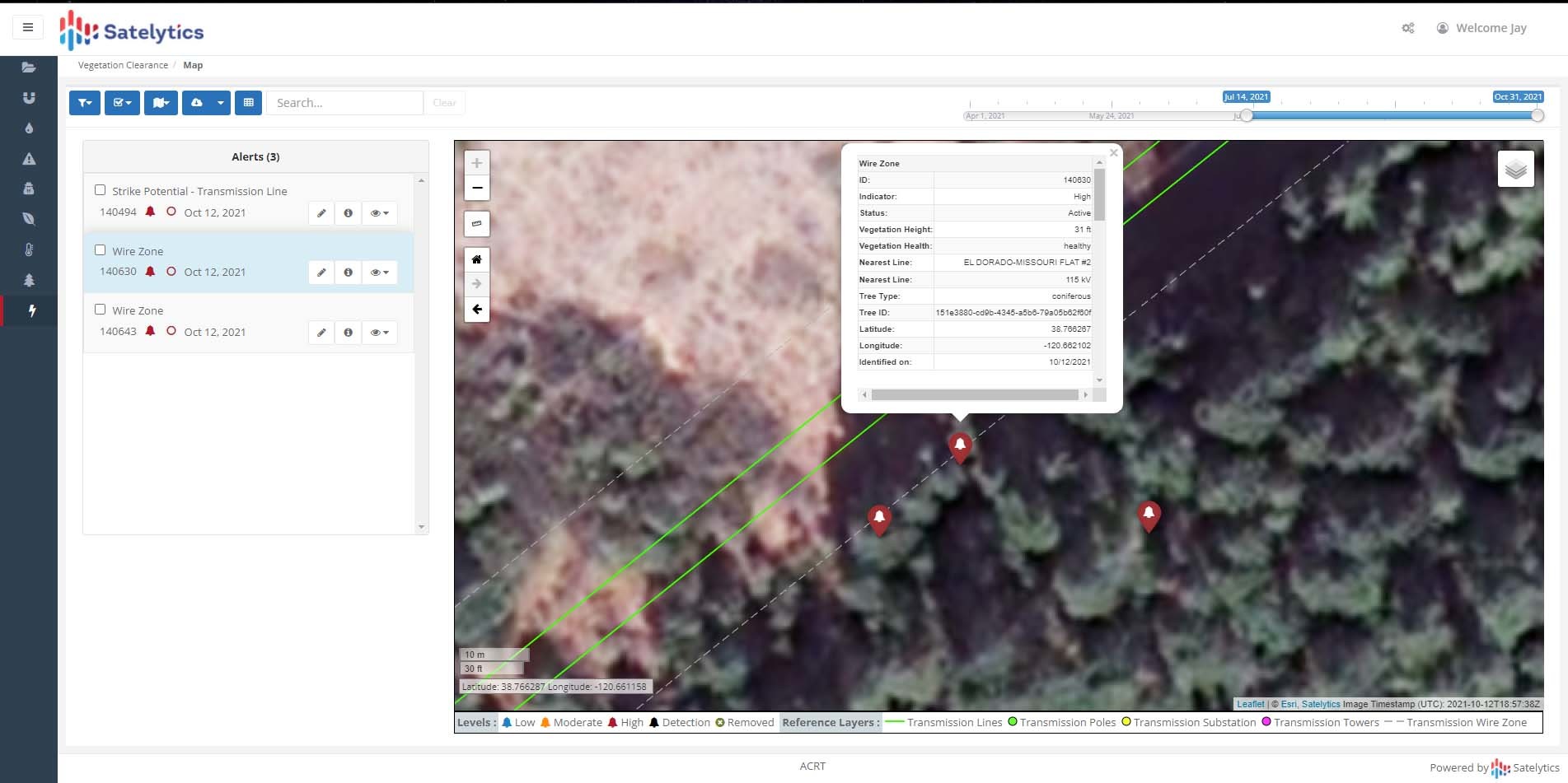
Tree speciation and strike potential in the wire zone.
For underground utilities and midstream customers, our Constant Vigilance algorithms monitor loss of cover or revegetation after construction and remediation projects. We have even been tasked by an oil and gas customer with monitoring grasslands for the flowering season, which is associated with the hatch of a protected butterfly species. And through it all, AI is capable of learning new species with new backgrounds unique to different locations worldwide.
Satelytics is a software company focused on AI for solving pressing challenges. Our resolve is to partner with subject experts like ACRT Services, the largest independent vegetation management consultant, specializing in the electric, gas, and water utility industry. In business for nearly 40 years, ACRT Services creates innovative solutions for clients nationwide. ACRT Services and our other strategic partners help us speak the language of our clients and focus our expertise on world-class solutions, setting new industry trends and unparalleled levels of service. We offer a suite of 40+ proven algorithms that address a myriad of challenges your industry faces.
Just like with our human minds, the opportunities to learn are endless. Apply our geospatial analytics to your unique vegetation challenge today.
We use cookies to analyze our web traffic and to enhance your experience. By continuing to view this website, you agree to our use of cookies.
Our Privacy Policy