• Power Utilities
• Power Utilities
A prospective customer came to us for a vegetation solution to bolster their right-of-way (ROW) program. But after a preliminary analysis, we found their GIS asset record did not match the ROW locations on the ground, a case of conflation. It’s hard to accurately measure and assess vegetation along a ROW if digital asset records aren’t accurate themselves.
Conflation is a common issue in the energy industry. The most common cause of conflation is asset acquisition: adding new shapefiles to the current ones without confirming ground surveys. Many gathering systems and transmission corridors dating from the mid-twentieth century can be lost to vegetation growth over the years. In other cases, it’s simply that mistakes were made when infrastructure was geo-tagged after installation.
Ensure accuracy with conflation analysis across entire asset territories.
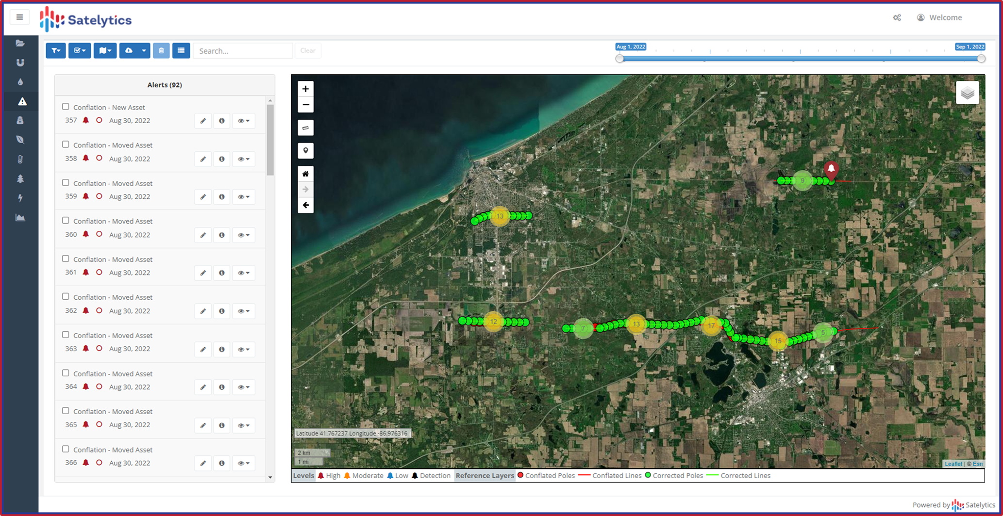
Satelytics uses high-resolution (30-50cm) imagery to identify above-ground assets like power poles and the ROWs that border them. Each piece of infrastructure and surrounding ROWs are identified with coordinates of their exact locations. Our science professionals then work with customer GIS teams to adjust their records so any future projects are as accurate as possible.
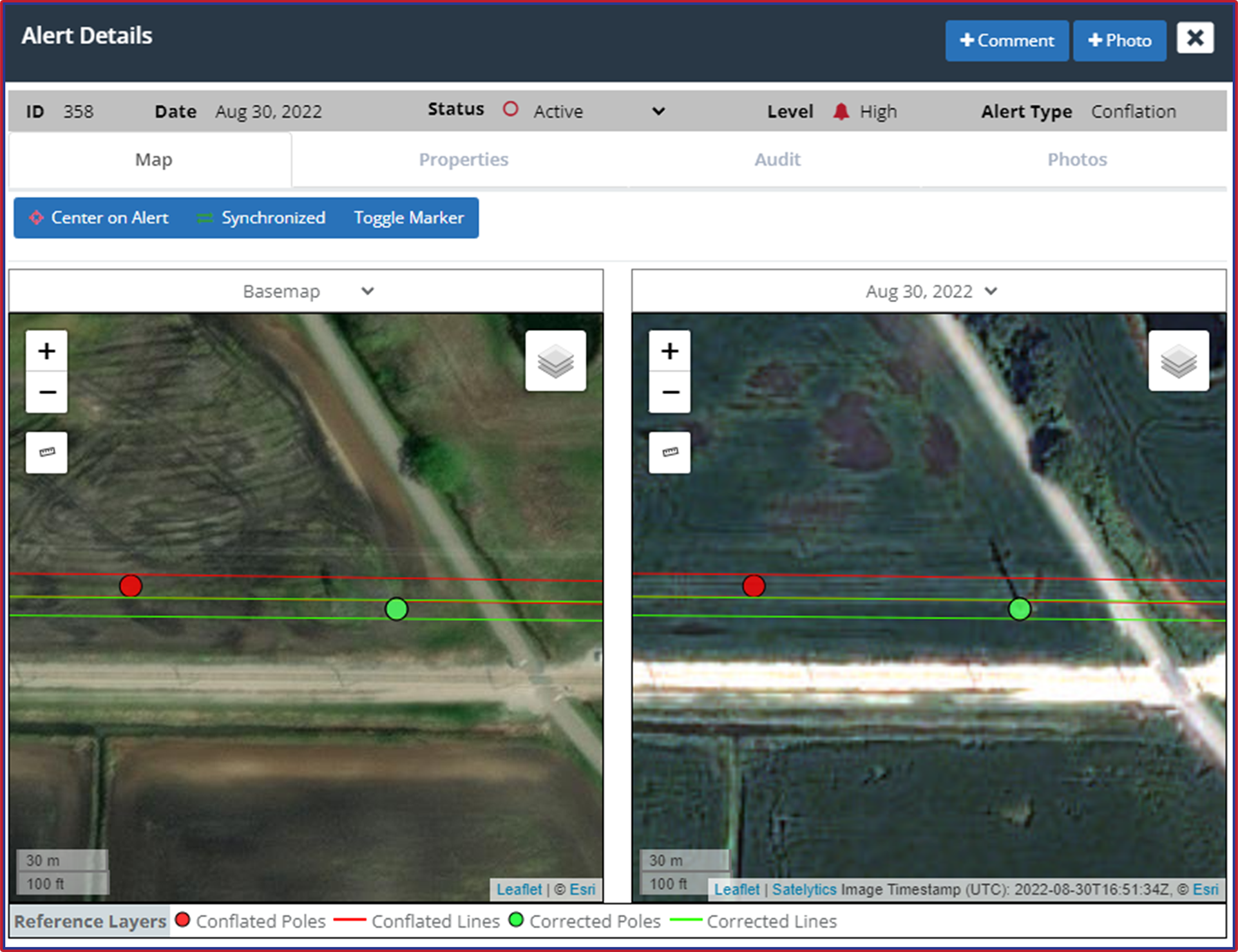
Satelytics alerts to individual poles where the location does not match that recorded in GIS.
Once conflation issues are addressed, we can unleash our suite of vegetation algorithms, designed alongside our partners, ACRT Services, to address the challenges facing our customers’ assets. These measurements include tree, brush, and grass speciation; tree height; and vegetation health. We also alert to strike potential, identifying encroaching trees that could fall onto powerlines or other assets.
The possibilities don’t end there, but the first part of any geospatial project is making sure digital asset records match what is in the field. For the best results, start your Satelytics project with conflation detection. See how accurate asset locations can make a difference in your monitoring program by scheduling a demonstration.
We use cookies to analyze our web traffic and to enhance your experience. By continuing to view this website, you agree to our use of cookies.
Our Privacy Policy