Detecting Natural Pipeline Threats and Changes Using Satellite Data and Satelytics
While there are many concerns over manmade threats to pipeline infrastructure including construction, digging, heavy machinery, etc., nature can strike anywhere along the over 3 million miles of pipeline running throughout the United States. Natural threats can include landslides caused by rainfall and erosion, water crossing erosion, and cyclical watershed patterns.
Pipelines traverse some of the most remote and rugged terrain where natural threats are difficult to vet, let alone find. Leaks caused by exposure, land movements, and erosion start relatively small, but build up over months amounting to millions of dollars in lost product, remediation costs, and regulatory consequences, not to mention contamination of the environment and the local water table.
With increasing scrutiny from both the general public and regulatory agencies, pipeline operators are more motivated than ever to seek out, track, and catalog the multitude of encroaching natural changes and threats along their thousands of miles of pipeline. Responding proactively to threats mitigates any potential risk and protects the long-term integrity of the pipeline.
Finding natural threats along these vast lengths of pipeline can be a daunting task, and energy transmission companies often rely on manual inspection from field crews or aerial surveyors. In situations where satellite imagery is used, it can take multiple employees months or even years to comb over terabytes of satellite data looking for potential threats in a process that is expensive, labor intensive, and error prone.
Automatic Change Detection
Satelytics uses the power of the cloud, proprietary algorithms, and autonomous software to turn tedium into a simple, repeatable process. Satelytics is able to monitor an ongoing stream of satellite data covering thousands of miles of pipeline and synthesize that massive data into simple visualizations and actionable alerts. What used to take our clients armies of people and many months can now be done be done in days.
Satelytics allows pipeline and right-of-way operators to more thoroughly and accurately identify threats and allows them to minimize associated risks and consequences.
Satelytics builds a base set of data to identify the various concern areas near or within the pipeline right-of-way including anthropogenic threats and natural threats. When new data is gathered over the length of pipeline, Satelytics compares the two sets of data using our proprietary algorithms to isolate changes that may pose a threat to energy infrastructure.
Individual changes are documented with maps and charts via the Satelytics portal, or sent to any third-party software via our API (Application Programming Interface) that allows for seamless passing of data between software applications. Alerts can also be sent to mobile devices or work order software giving up-to-the-minute data to field crews.
Below are examples of natural changes of various threat levels detected automatically by Satelytics using satellite imagery.
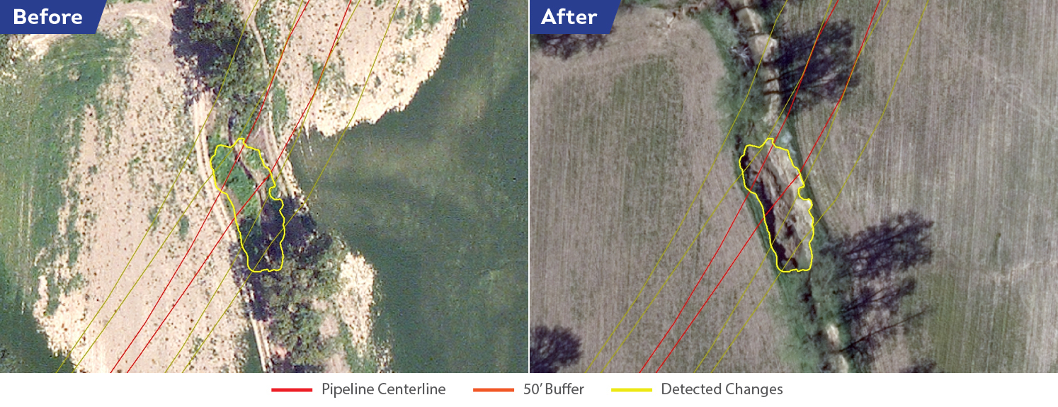
Landslides can have numerous causes including shifting fault lines and precipitation. Landslides can expose pipelines to corrosive elements and even cause pipelines to break.
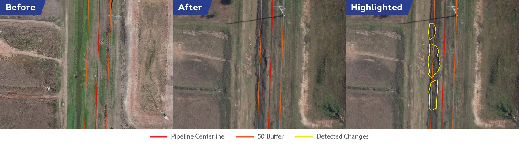
River banks and water crossings often shift as water and precipitation patterns change. Water crossings represent some of the most critical threats to pipeline due to their shifting nature and the potential for pipeline breakages to contaminate water supplies.
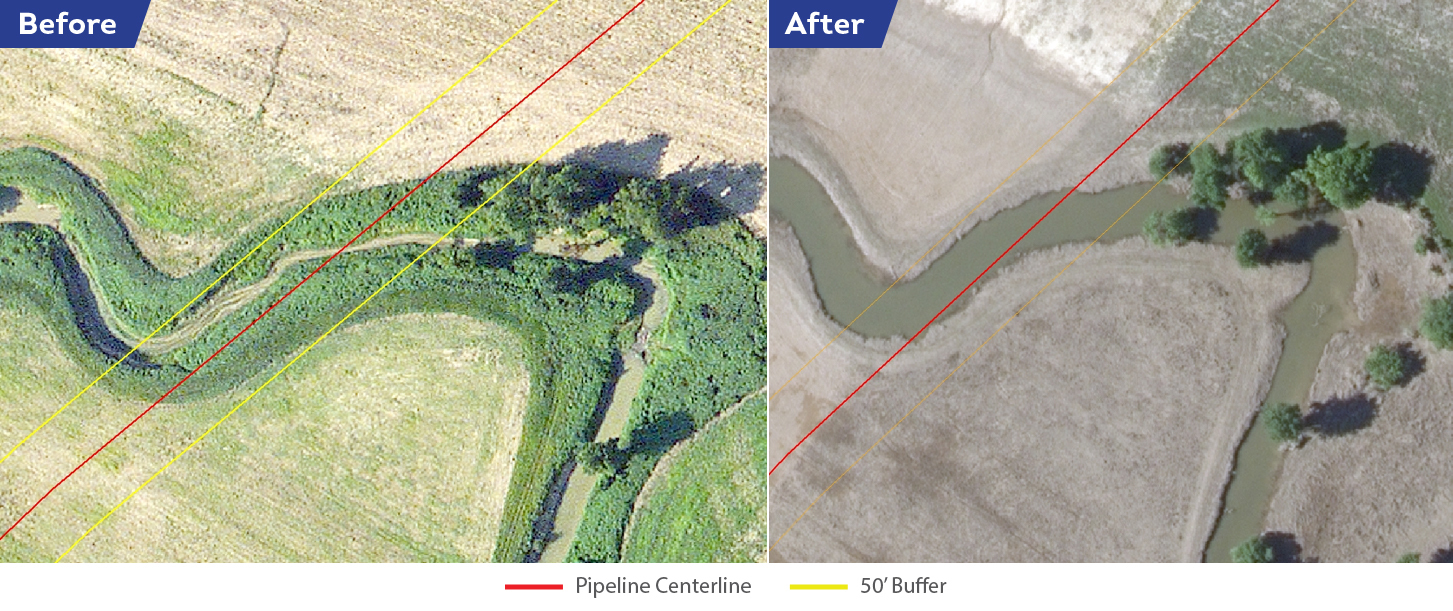
Another water crossing where the bank has eroded significantly. Whereas current surveying methods rely on aircraft pilot or field crew judgments, Satelytics allows for a clear side-by-side comparison of the dates.
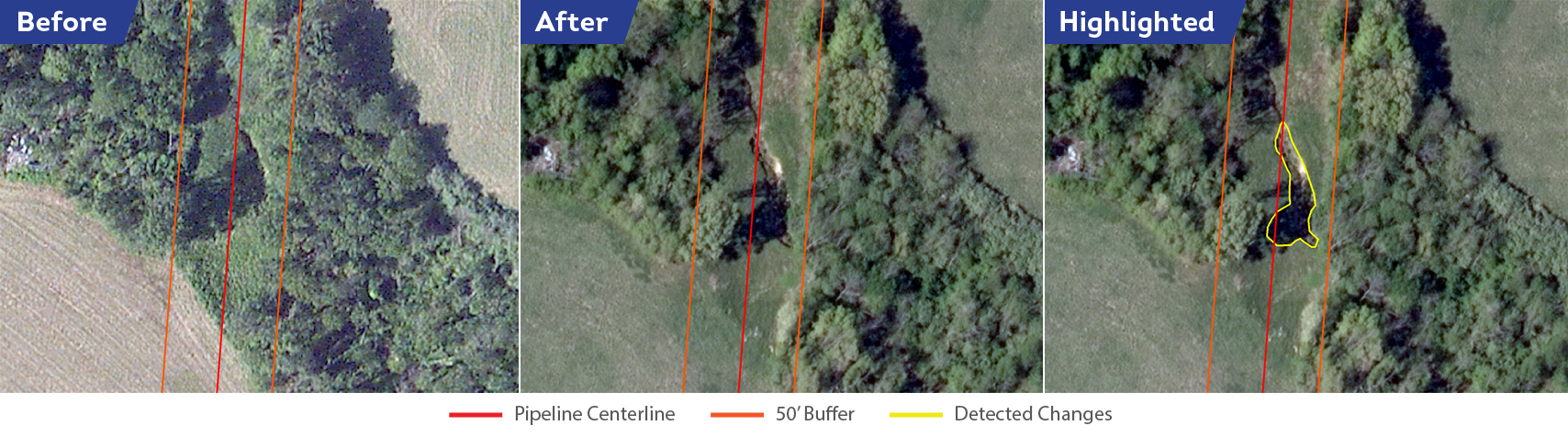
Significant stream bank collapses happen when water flows more quickly through a waterway and erodes the bank in a very short amount of time. These substantial land movements can unearth pipelines, damaging them or exposing them to corrosive elements. These are easily detected by Satelytics and clearly visible in side-by-side imagery.
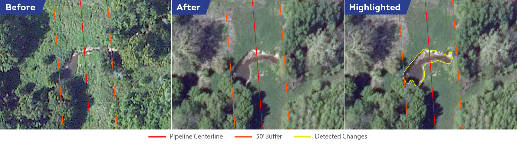
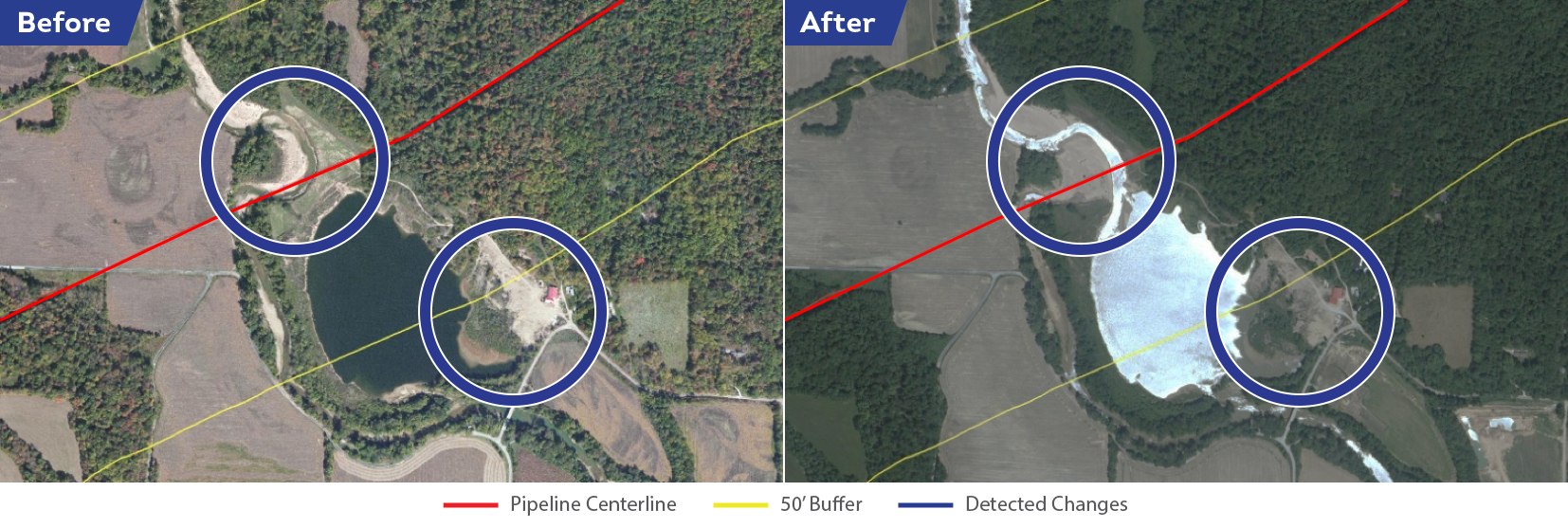
River widening can be seasonal or affected by upstream precipitation or human activity. When rivers widen, stream beds can erode and threaten to expose the pipeline to corrosive natural elements.
Narrowing and waterway changes are fairly often occurrences as well. Changes such as narrowing can increase the speed of water flowing through the waterway and deepen the riverbed or erode the river banks.
Satelytics has the amazing ability to distill terabytes of satellite data into action. With the advent of nano-satellites and satellite constellations, more frequent revisit times will increase Satelytics' capabilities to monitor pipeline and other oil & gas infrastructure. Processing this tremendous amount of data will only become more critical as pipeline operations scale and threats multiply.
